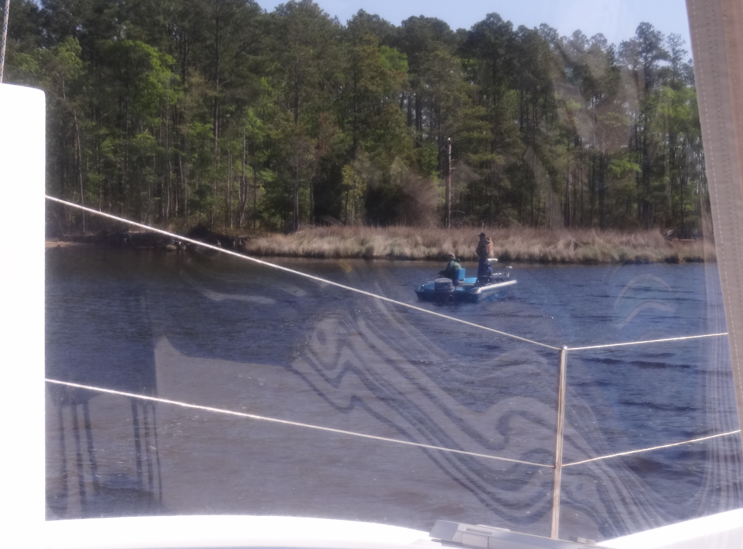
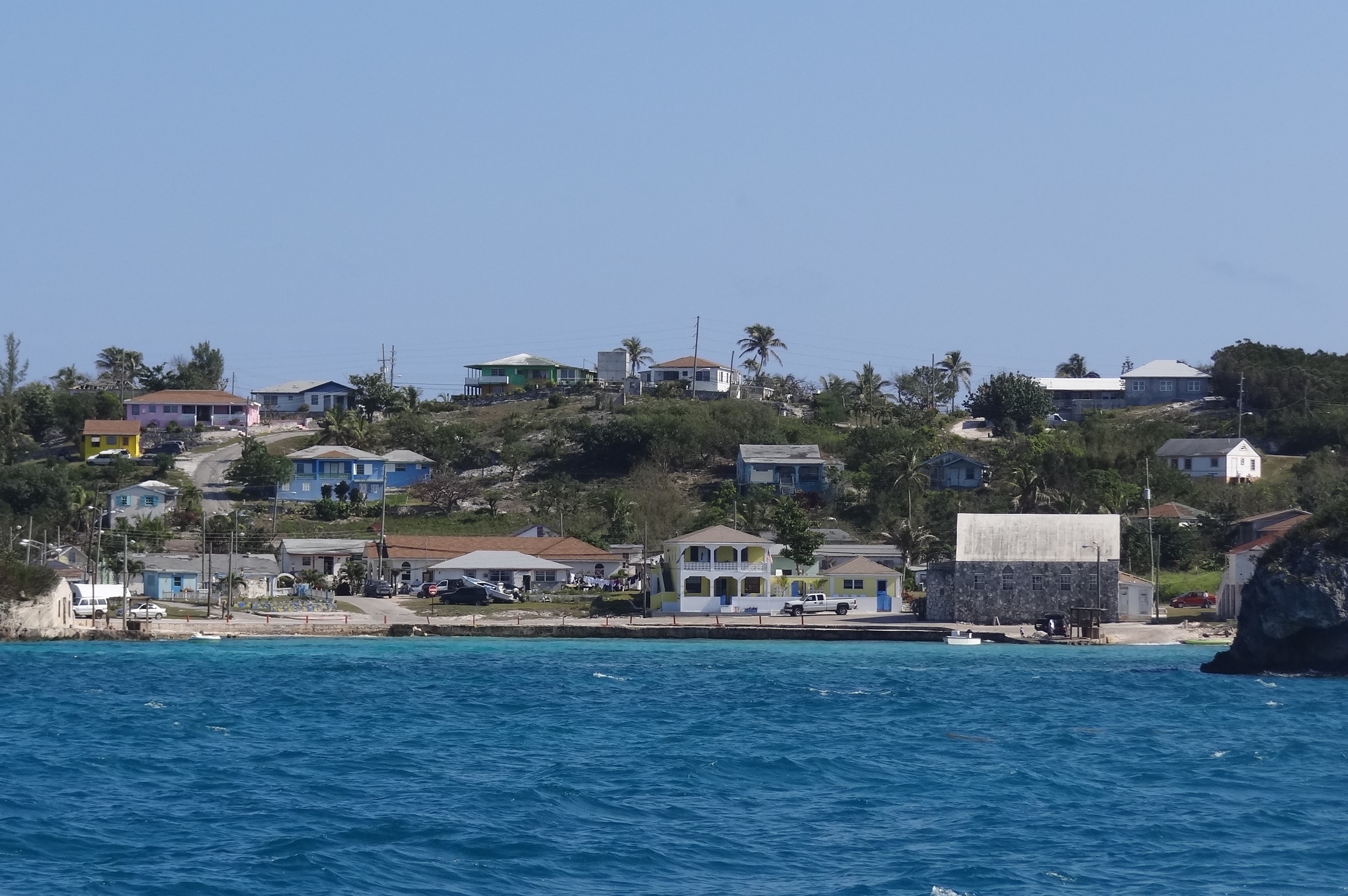
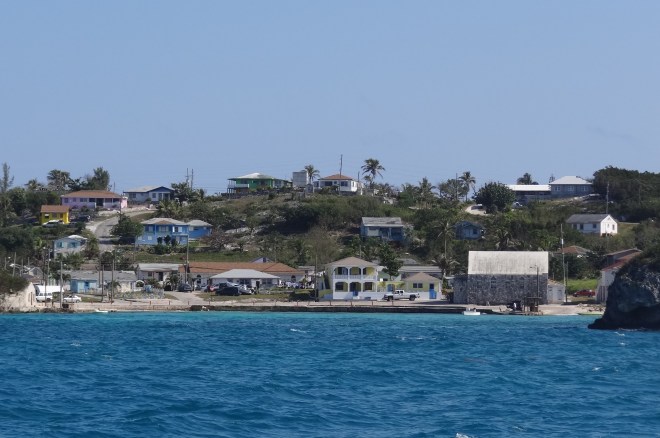
Rock Sound was to be our home for a few days and as usual we left earlier than planned. The Explorer Chartbook we have is not the latest edition; however, thanks to One White Tree, at least we have one. This simply means that much of the information about a settlement is out-of-date and likely as not, what was once available, no longer is. Checking info in ActiveCaptain helps, but one still has to check things out and not assume much.
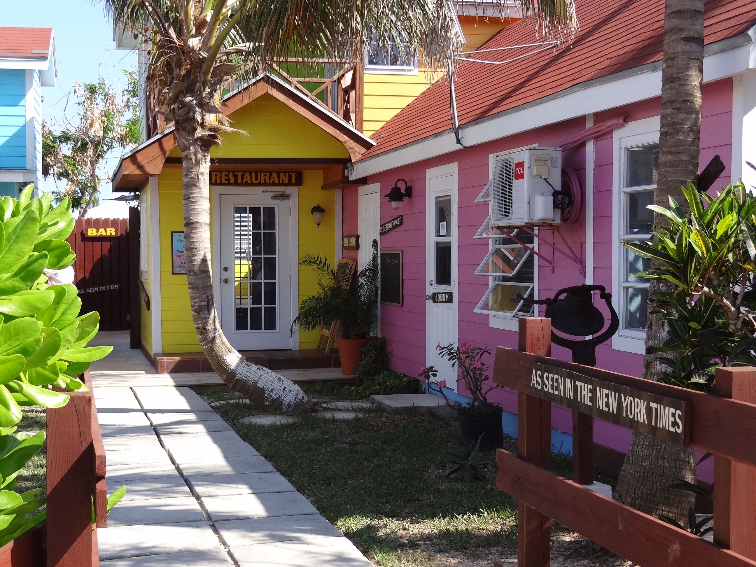
Dingle Motors is the visitor info center, filling station, mini mart, wifi source and hardware shop all in one easy stop about a block north of the dinghy/fisherman’s dock. One fantastic change for the better was the new Laundromat in town; just a few blocks north, then turn right, bear right at the fork and voila!

Laundromat in Rock Sound- a great place
3T’s is clean, clean with 5 washers and 3 dryers. At $3/load this was the best price I’ve found in the Bahamas. The owner (I never got her name) has 3 grown children, all well established on other islands and you could tell she was reasonably well-educated and spoke to us slowly enough so we could understand her. Bahamians speak quickly, often pronouncing words in such a way that they are difficult to understand, but taken in context, you get the idea. When they speak to one another, forget attempting to glean more than a vague gist of the conversation.
Dinner was pizza on the grill, made with home-made dough (thanks to Russ) and I am sorry to say that no photo exists. We used 1/3 can of diced tomatoes, leftover sausage slices, garlic, basil, oregano, shred mozz and olive oil. First, shape the dough (grapefruit size) to fit your grill and grill it for a few minutes on one side. Remove, flip it, add toppings and place back on grill, close cover and grill a few minutes more. Gosh, it was really good. Fresh dough is paramount to success here!
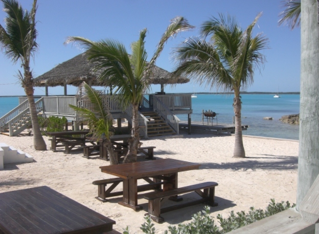
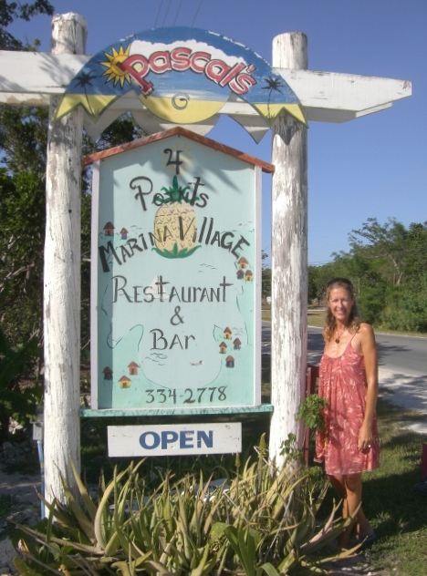
Lunch at Pascal’s was on the list, where we could enjoy outdoor dining with a view of the harbor. A song was playing that I’d tried unsuccessfully to find on iTunes so I asked the waitress for the name; she was no help, but the woman at the next table told us about Shazam. It’s an app that hears a song and identifies it for you. Does a slew of related things too, but you can discover that for yourself. Once we are in Abaco with constant wifi, Shazam will get added to our iPhone apps.

View of the harbor from Pascals

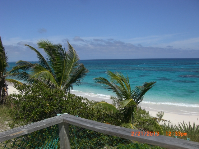
Very warm day, requiring a sundress
We got to talking with the woman and her husband. They are on vacation and really enjoying the laid-back island experience. We talked some about our cruising life and that our next stop that day was the market just up the road. They offered us a ride, which we took, if only to experience being in a car with the steering wheel on the right.
Just our luck, the market closes at 2pm on Wed to bring in stock from the freight boat. Guess that means Thursday fresh produce would be available; always a plus.
Having hands-free meant stocking up at the liquor store we passed on the way back, would be a productive activity. They stocked the Lazo Sauvignon Blanc we like at the same great 20% off a case (or any 12 bottles) we found in George Town, so we took that deal. Very drinkable white wine at $5.72/btle; a better deal we have never found in the States.
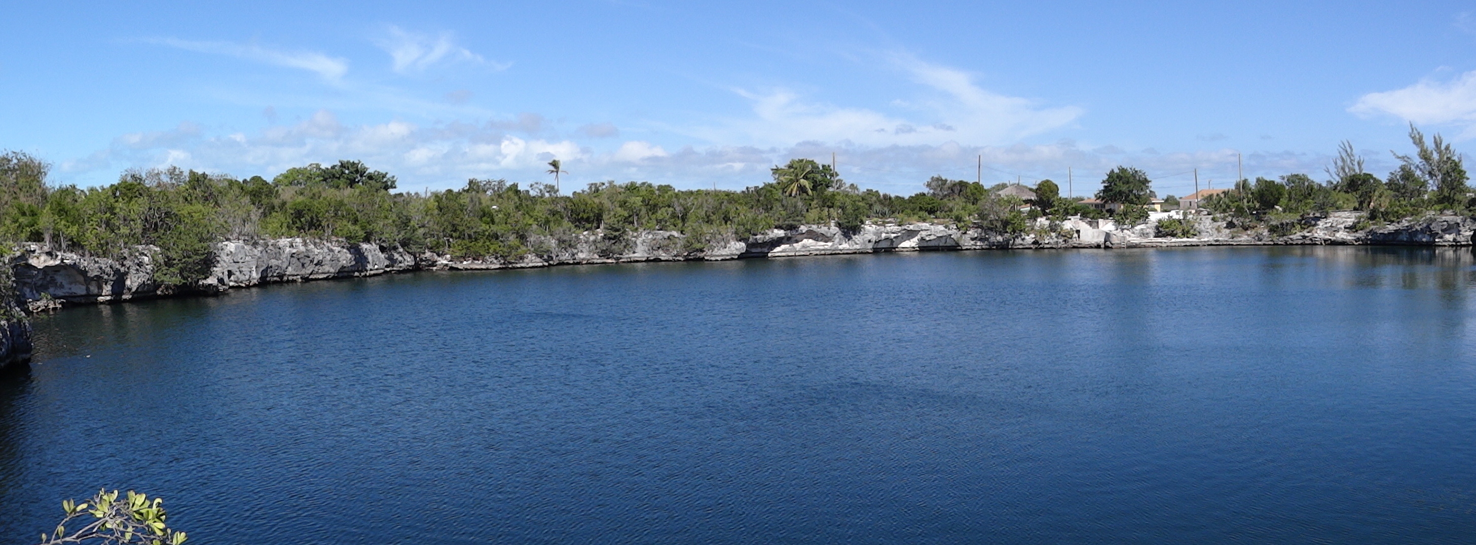
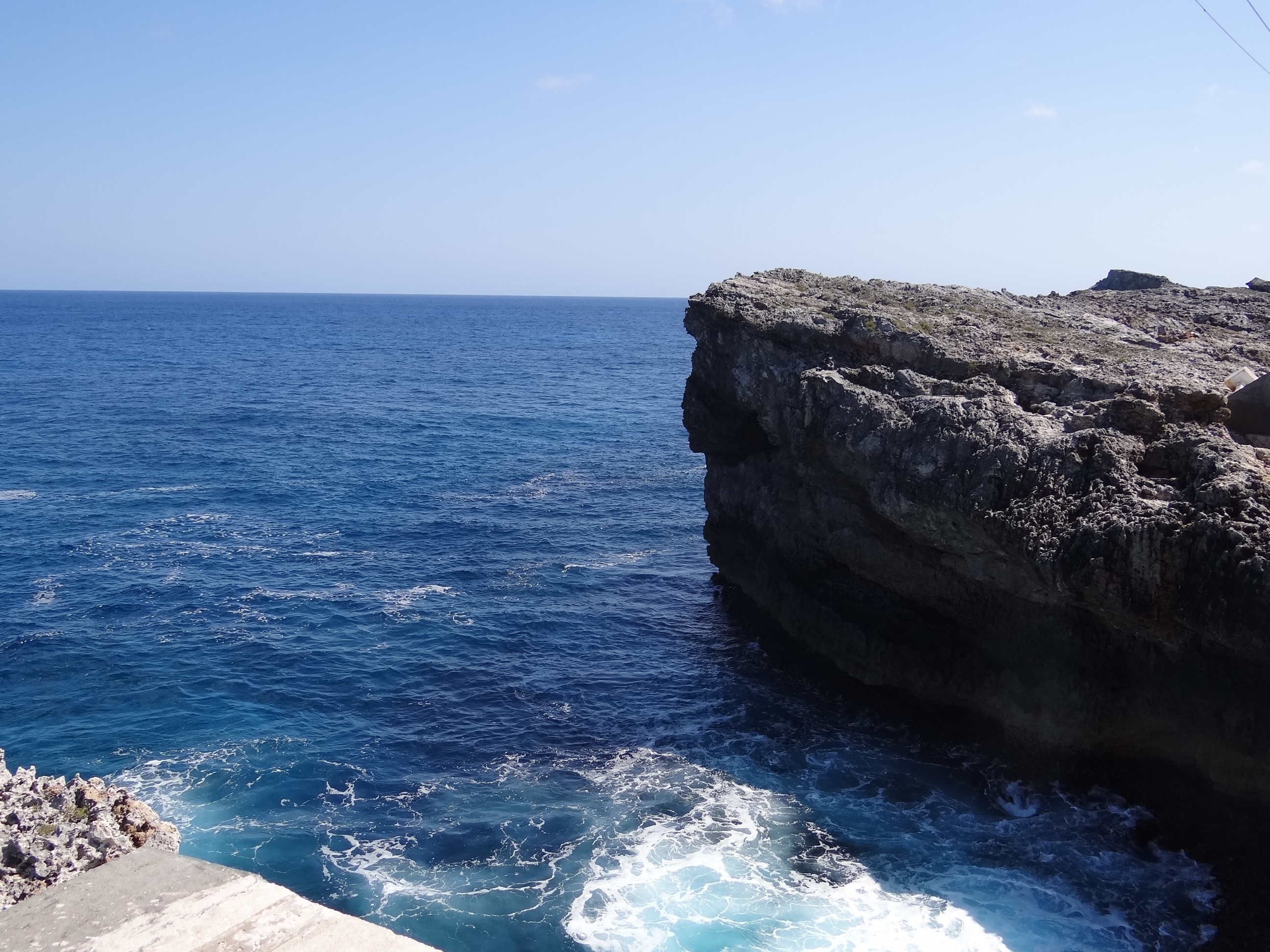
Rock Sound boasts a large ocean hole situated just out of the town’s center and provides a local scenic park where fish perform for bread crumbs.

A panoramic view of the ocean hole in Rock Sound
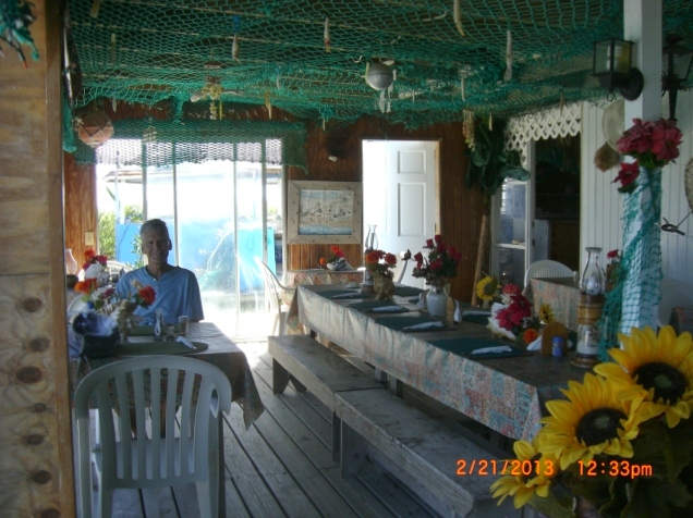
Another day, another lunch; this time on the Nort’ Side at Rosie’s, overlooking the beach and Atlantic Ocean. Rosie was born and raised in Freeport and has called Eleuthera home for many years. She will pick you up and drive you to her home and restaurant which is nearly 2 miles from the dinghy dock- in case you were about to admonish us for not walking! Rosie served up a terrific dinner-sized meal and her rum punch was huge. Her always made fresh coleslaw was simple and delicious- lime juice the secret ingredient. (note to self). Our stuffed-pig selves then walked down the wooden steps to the long stretch of beach below to walk off a few calories and beach comb for whatever (ok, sea beans).
The view from Rosie’s at Nort’ Side

Porch dining at Rosie’s; more diners came later
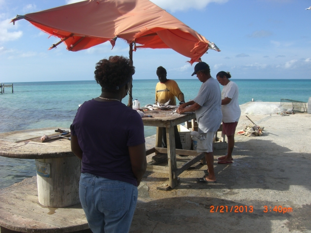
Now, if this wasn’t enough good stuff packed into one day, when Rosie drove us back she said she was headed to the fish docks and would we like to take the ride up to Tarpum Bay, a six-mile trip up the highway. How could we pass up the opportunity to obtain fresh fish; our own attempts being fruitless.

Our fish selection is filleted- that’s Rosie in foreground
School had just ended and we came upon a uniformed school boy hitching a ride- and we had room for one, perfect. Apparently, the school bus had broken down and the kids had to fend for themselves. Not a huge deal if one lives in Rock Sound, but the kids from Tarpum Bay have a long trip so are at the mercy of others. The boy’s friends who were walking in a larger group up ahead will no doubt find rides with the many vehicles heading their way.
That evening we joined Jim and Laurie on s/v Magpie2, a Leopard 40 catamaran. Seems like 1 out 6 new women I meet are named Lori/Laurie- this is good as I just might remember their name when we meet up again! Natives of Maine, they knew of Maine Cats and both had careers as forest service biologists. Being a small world, we discovered that they were the boat going into Cat Island’s Hawksbill Marina last Friday; the day we diverted from Cat.
That evening and for the next 24 hours (stopping to sleep) we had wifi which cost $10 for 24 hrs. We packed in as much as we could, Skyped Benj (first time in a long while), updated blog, paid bills, moved money around, emails and checked blogs we follow, including Lily’s new one.
On Saturday we pulled out of Rock Sound (one load of laundry never got done) and sailed up to Alabaster Bay which sits roughly 6 miles north of Governors Harbor; a 31 mile trip from Rock Sound. Sailing in the lee of Eleuthera is easy, much the same as in the Exumas and sailing is eco-friendly as well as wallet friendly. Plus, you can do galley chores such as baking without getting seasick. A quick side-step here: we left FL with 84 gals of diesel and right now have 58 gals which looks really great at first blush but we have to add to that the 50 gals we’ve purchased a jug at a time since mid-December. I’ll bet that at least half of the 50 gals was used by the generator which gets called into use the more we sail. Still, that works out to .86 gals per day for every day we’ve been in the Bahamas. Let’s see, the price of diesel is near $6/gal- ouch. In comparison, Patti of s/v Lutra says she’s used 23 gals since leaving Miami- or roughly .31 gals per day. Moving on to more pleasant activities then…. We anchored in the crescent beach lined bay and plotted our Atlantic beach attack for the next morning.

Ortolan resting happily in Alabaster Bay
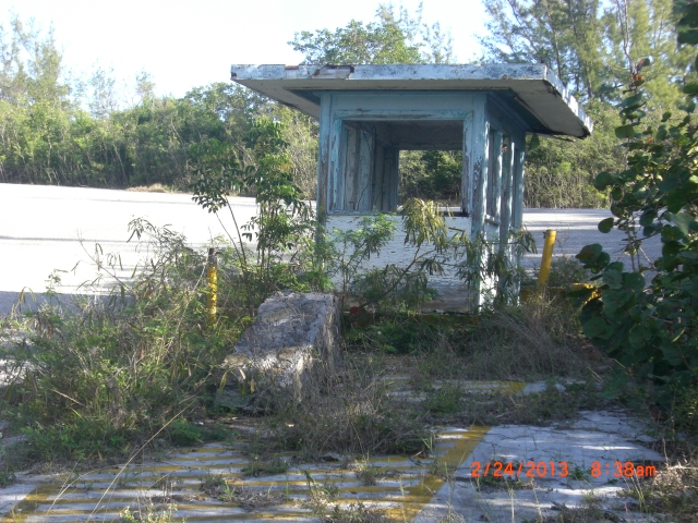
Skinny- that is the key word here. No, not me, the land. Across from us on the ocean side waits a pink sand beach and it appears to be walkable at ¾ mile. The trick is finding a path or road. A former U.S. Navy Base as well as the main road lies between us and the beach. Russ recalls Fred on m/v Northstar saying that you can walk through the base and get to the beach. The chart shows a path from our beach to the main road; but it was not to be found so we took the long way past the resort which was for sale and walked around some sort of pond/swamp thing to the main road.

The guard station has seen better days

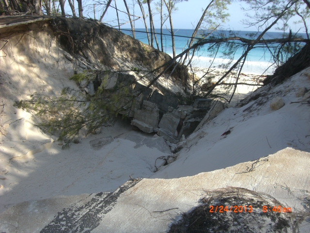
Multi-storm damage at the base by the beach bluffs
Fifteen minutes later we were “on the beach.” Is the sand actually pink you ask? Looking at it, not really. Comparing it to other sand, yes you can see a faint pink tinge to the sand. The beach was long, curved and quite lovely, strewn with a minimum of seaweed and trash. For those in the know this means I’m not going to find many sea beans. Quite true, but I did have one trick up my sleeve and it worked well enough so that the trek was not simply a way to exercise. 🙂 Sea glass and shells: virtually non-existent here. Go figure.
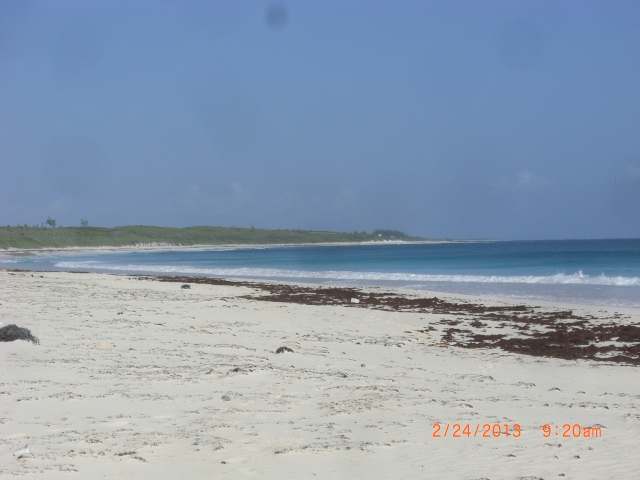
The pink sand beach stretches for over a mile.
Tuesday was looking to be the day to sail up to Abaco, and that gave us one more day to spend in Eleuthera. If we opted not to take this window, then the wait to go again would be at least two weeks- uhn uh.
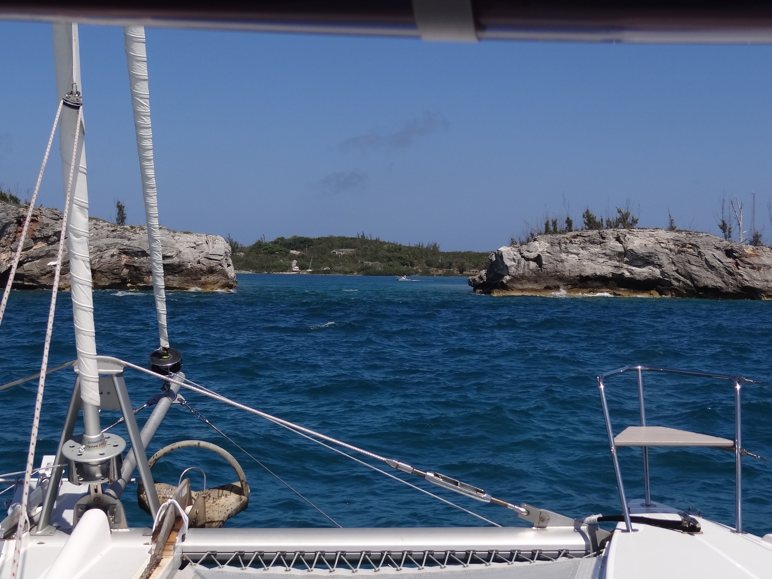
So after our morning beach jaunt we headed out, sailing once more, to Hatchet Bay/Alice Town an easy 12 miles north. The pond has a single opening giving it 360 degree protection and if you aren’t scared off by the rocky cliff bordered narrow opening, inside you will find 10 fairly new free govt moorings. Another cat was headed that way and as we got closer we saw it was Magpie2; they were motor-sailing and WE were sailing at 6kts. Stopping to drop the main allowed them to brave the entrance first 🙂

Getting aligned to enter Hatchet Bay Pond
The balls do not have any tackle, just an eye on the top of the ball. We figured out two ways to handle, but an even better third method presented itself in the form of: man in dinghy helps attach bridle with clip to mooring ball. Sweet and easy. Jim stopped over and we made plans for a combined dinner aboard Ortolan; a feast for sure.
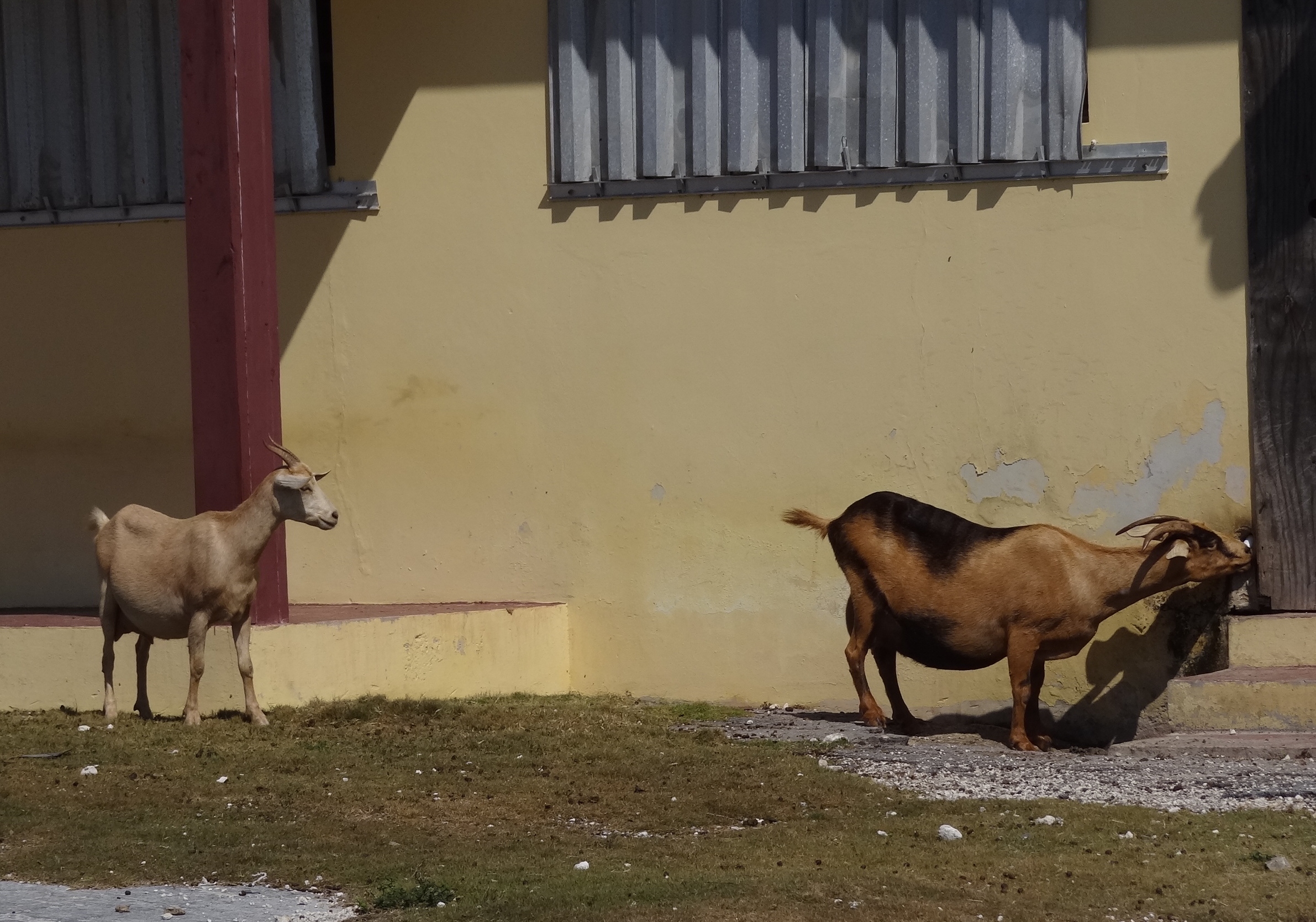
Ate a quick lunch and in to town we went. Checked out the poultry farm ruins and on the way saw several goat families. This group has found a source of water from the drain pipe of- the A/C unit perhaps?

Drinking water is scarce for these guys; get it where you can
The famous Twin Brothers (of Potter’s Cay New Providence) has a fancy location here and between them and The Front Porch which overlooks the pond, you’ve got too excellent dining options.

Enjoy the best conch salad in the Bahamas- now two locations to serve you!
Magpie2 arrived with everything- including knives- they needed for their part of dinner. We enjoyed a fine feast with white and red wine, but the best part, for me anyway, was when Laurie pulled out a Ziploc with several large pieces of fresh coconut. We got good tips on where to find them (recently falls are what you want) and that you want them brown and plenty of liquid inside. Magpie2 will be staying in Eleuthera a while longer before heading to Abaco while we are making our move much sooner.
The next day, Monday Feb 25, was the last scenic day on our whirlwind tour of Eleuthera. Gregory Town, with its tiny harbor Pitman Cove, presents a virtually hidden harbor opening that blends so well with the surrounding rocky cliffs that we couldn’t see it until we were nose-even with the opening. This wasn’t a stop, just a sail-by.
Looking in at Gregory Town at Pitman Cove.
The Glass Window was our final stop and we anchored about one-half mile away in a small bay for an hour-ish while we went to shore. The wind was just enough to sail and at 10-13kts out of the SE that meant swells would be rocking us around a bit during the dinghy ride to shore. Found a bit of sandy beach, tossed out a bow anchor and used the same line to tie our stern toward shore. This would keep the boat into the waves and easier to retrieve.

Hey there lonely girl…. we will return.
Much of the shore is what is termed “ironshore” and boy those sharp points on the swiss cheese style rocks are not for bare feet. The climb up to the main road was quick and once on the bridge Russ took the camera because exposed heights are not my friend.
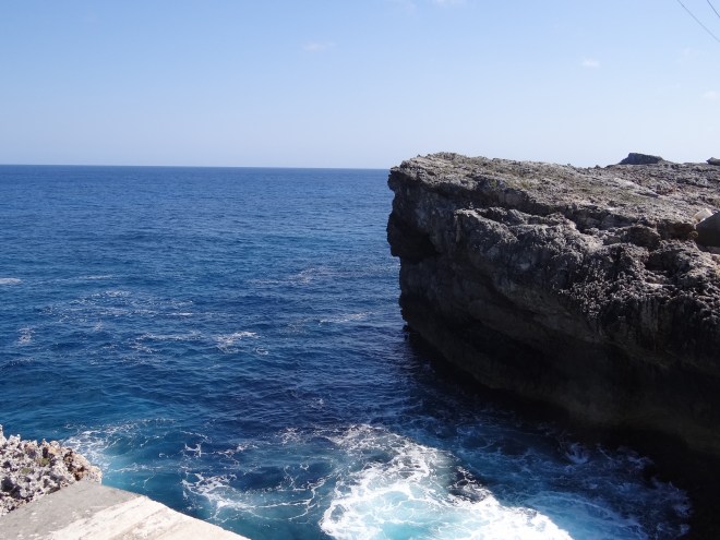
The present bridge is man-made bridge #2 over dual waters. At one time, the road passed over a natural bridge which formed a window between the turquoise blue of the banks and the deep blue of the Atlantic. We read that people have lost their lives when a wave washed them off the bridge during a storm; not too smart being there.
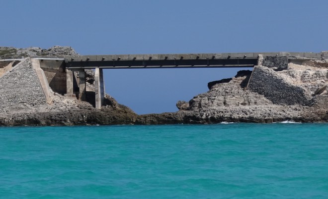
Looking through the Glass Window
Waves on Atlantic side are expert at crashing.
Fred on m/v Northstar described a natural formation called the Queen’s Bath that was somewhere near the Glass Window; take a path and look for the cement pillar things. We tried mightily, but no luck on that one. Even asked someone; but they were more clueless than we.
The weather was cooperating wonderfully and we had high hopes for a brisk sail into Little Harbor, Abaco and perhaps catch a few fish along the way. Since we were returning to the site of our ONLY catch this season, we could hope couldn’t we?
First though, we’ll finish off our final Eleuthera day.
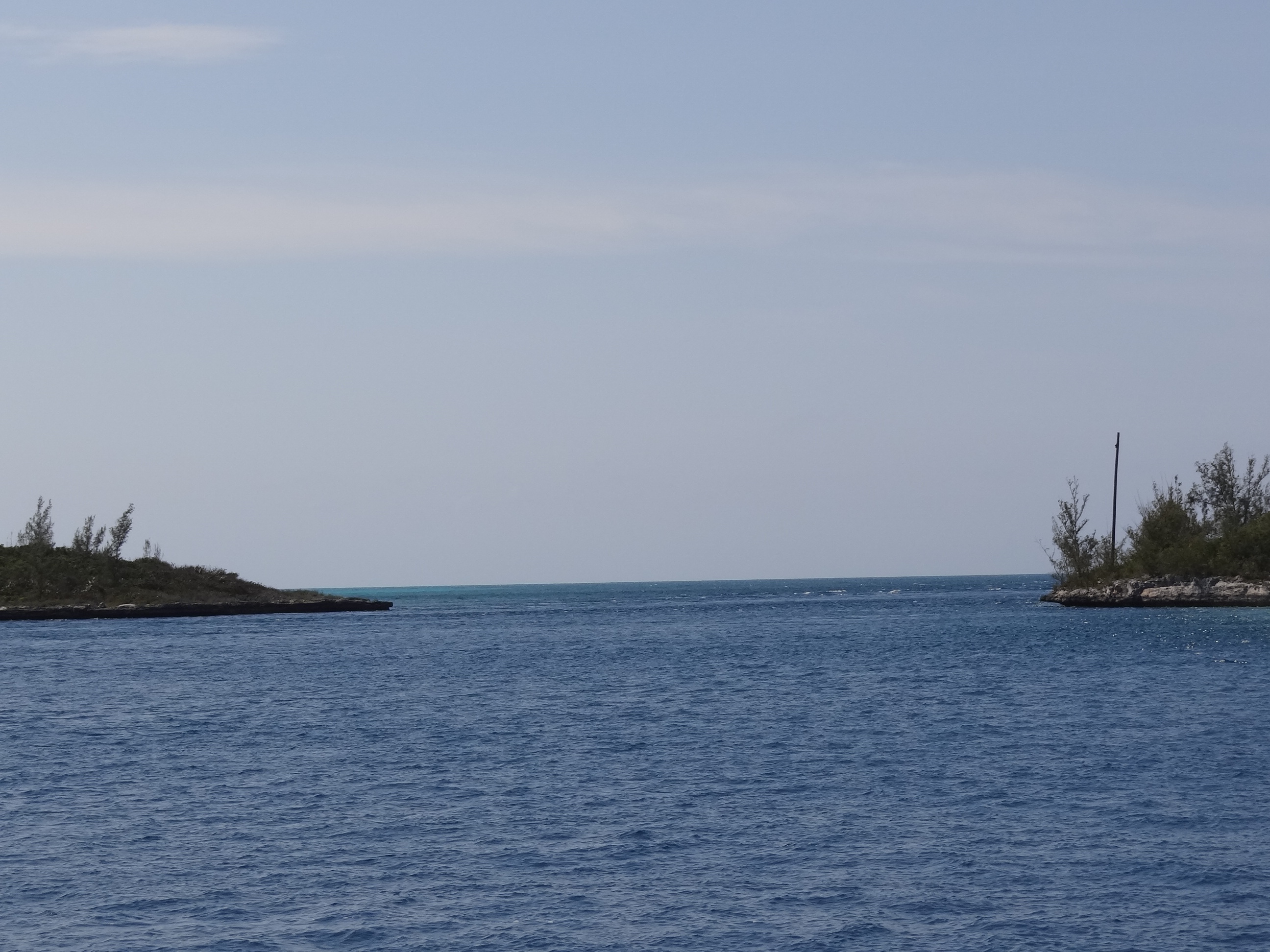
Waved good-bye through the window as we hoisted those useful white sheets and made way to Current Island and the cut we‘d need to pass through to get to Egg Island. This cut through Current, creating Current Island, is best approached by going parallel to land and then turning (when headed north). Plenty wide and deep in the cut, we could see how it might show its nasty side when the wind and seas are up. Ideally you want to be going with the current and for this location, an ebb tide is going north, or in our case, with us. As long as we arrived by 2:30- 3pm the current should be with us, yet near slack. I’d hate to go through at full raging current as we hit 10kts sailing through.

Current Cut looking benign and very lovely today
Last year we anchored in the protected harbor at Royal Island. Not much for scenery, but then we hadn’t arrived with any daylight remaining. In order to save time on Tues, we anchored in the lee of Egg Island, a small piece of land next to and west of Royal.
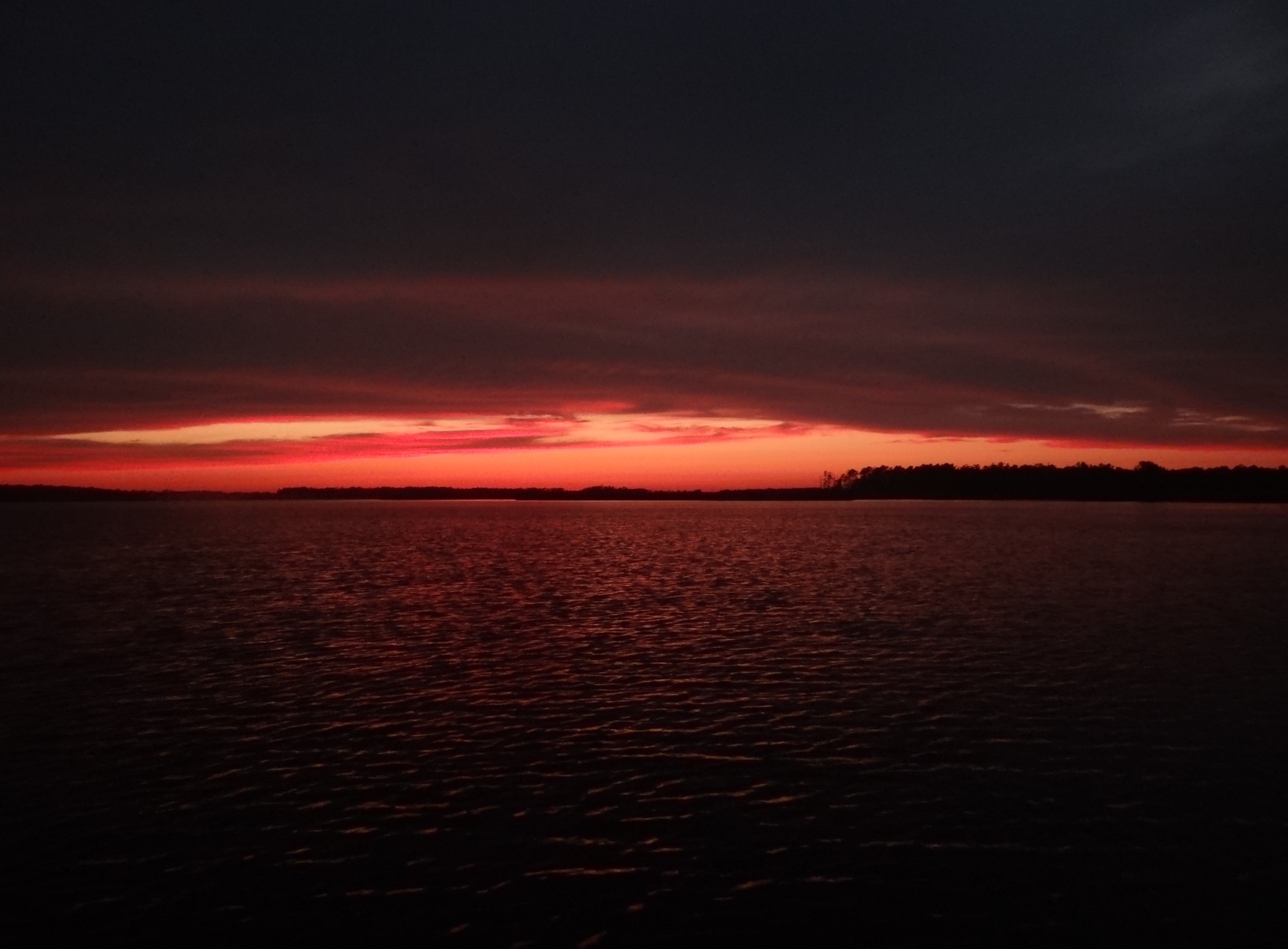
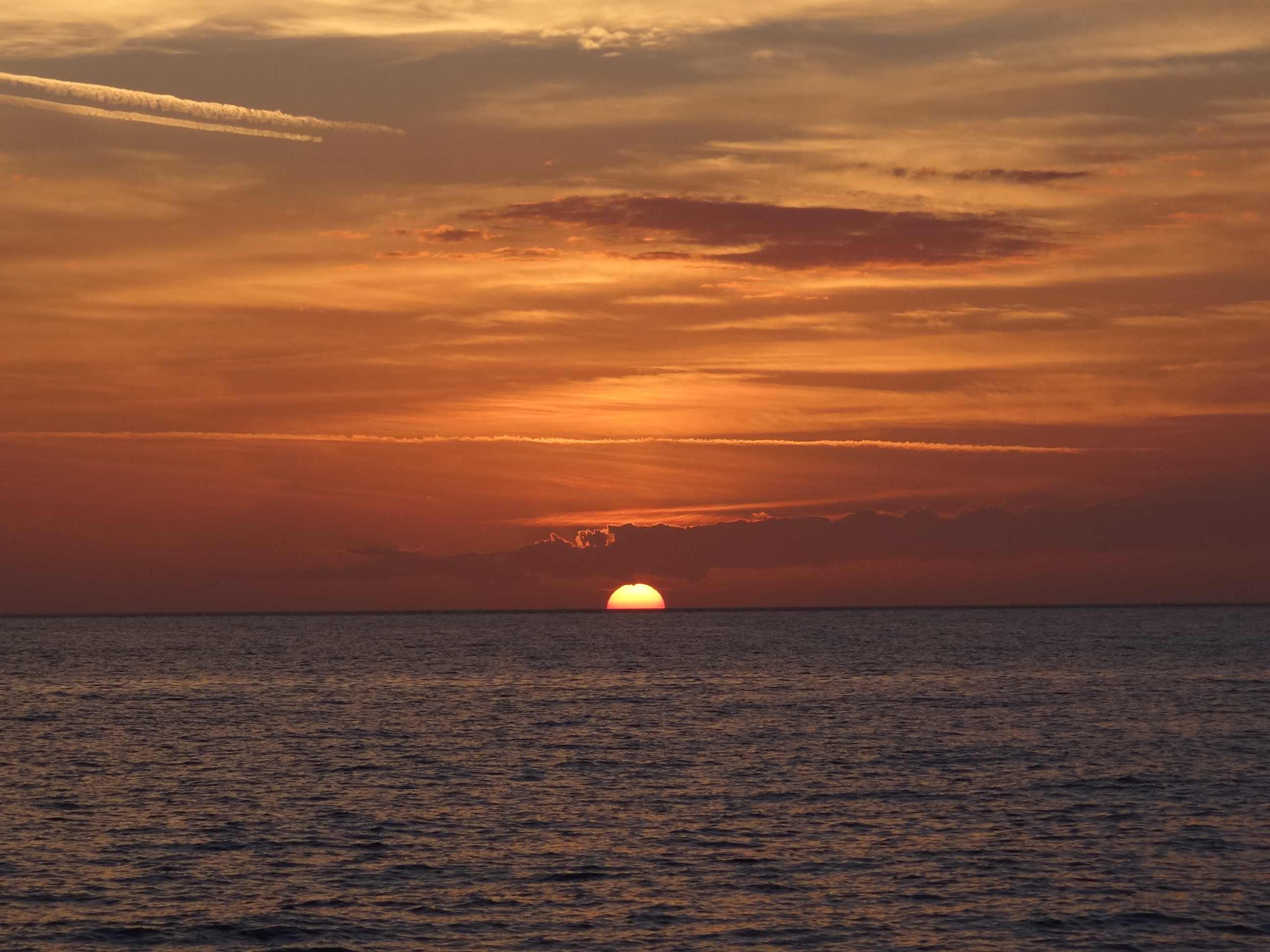
The chart didn’t show much except good depths, which was accurate and also much of the area was coral with a few large sand areas. I did my job and made sure Russ released the anchor so that it would land in the middle of the sand. It did and held well, but it was an uneasy feeling at first being anchored over coral heads; very low and plenty of water over them, but still odd. The sunset was brilliant.

Red sky at night a sailor’s delight.

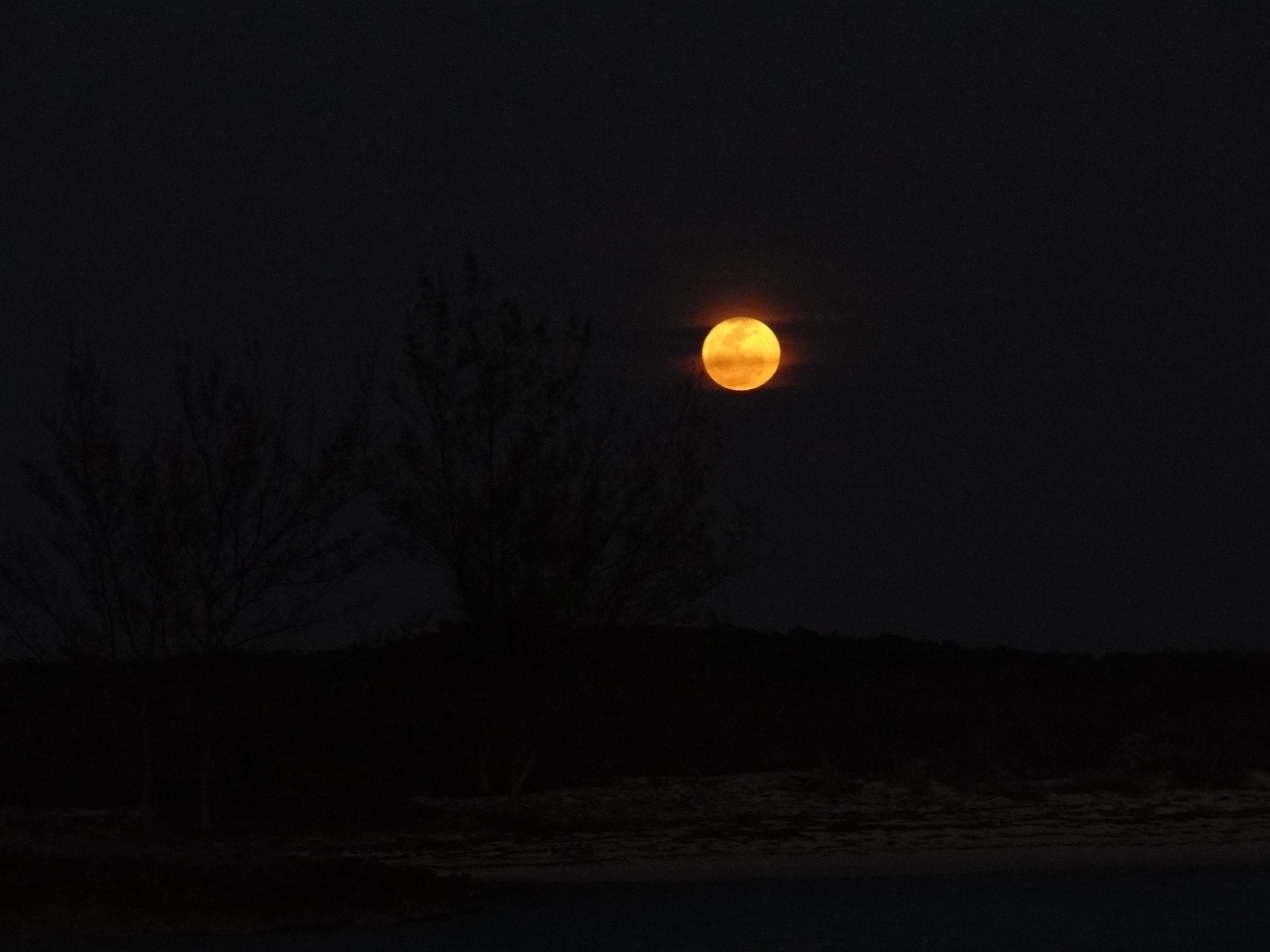
A full moon rose 5 mins after the sun set
Russ made an unusual adjustment to the bridle (oops- sorry no photo), moving the stbd side end over to the port cleat in an attempt to keep us pointed into the swells. It worked well, until during the night the wind picked up (mind you, for the last 3 nights the wind had been down) and someone dragged me out of bed at 4am to re-adjust the anchor bridle back to “normal”. This is not as simple as it sounds what with all the stays and lines we have at the bow. No problems though and I’m not sure either of us slept much until the 6am alarm sounded. Ugh.
Rather than keep you on pins and needles, I’ll spill the beans and say. “No fish were caught during our 10-hour, 61nm, mostly sailing trip into Little Harbor, Abaco, even with a detour to hit the contour lines.” Bummer and I was tired to boot; Russ too. Saw our cat friend s/v Polar Pacer on AIS about 8nm out and yes, they too were headed into Little Harbor and a good meal at Pete’s Pub. Sounded good to me and we had a chance to catch up with them and hear the story of the 5ft bull Mahi caught in Exuma Sound the day they left George Town. Oh well; next year.