Thanks to the extra wine I try to consume on a regular basis, I’m able to find the positive in most tough situations. If nothing else, that sure sounds good I think. Carolina Beach is 12nm south of Wrightsville Beach and seems to be the anchorage less stopped at by cruisers. That includes us, as this stop would be our first. About a year ago the town put in 10 mooring balls at $20 per night. Pricey when compared to Florida and no services except a well protected area. Just before the mooring balls remains space to anchor and that we did as the winds were to be next to nothing Tues night and Wed.

Carolina Beach- looking north from the anchorage toward the ICW
First, a few words about the bridge. For a myriad of reasons the number of sailing vessels drops off considerably after Florida. Each day they became scarcer, dropping like flies with each state. Naturally we hoped to not be the only tall mast dealing with the Snows Cut bridge, but it wasn’t looking good. Then a mast appears behind us as we begin to head up the Cape Fear River, and they pass us because we are going slow with the current against us and trying to arrive no earlier than 5:30. Looks promising.

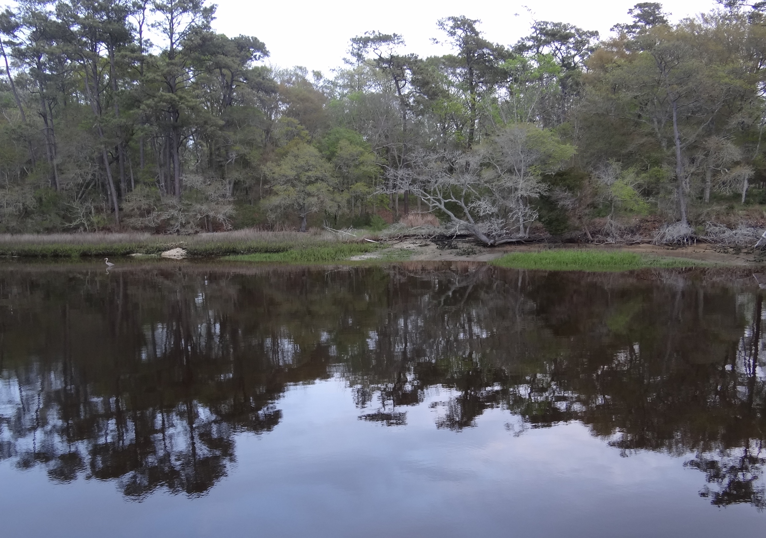
Looking back as we head up the Cape Fear River
Another mast comes along, this one also has AIS and they call the first vessel. #1 says they only need 61ft and will go right through but will report back. #2 calls us and we learn they need 63ft to our 62 1/2ft. “Hey,” says Russ, “you go first!” The tricky part of this is figuring out the tide. Between the tide station on the river side and the one on the Atlantic side; which one should be used? Wouldn’t things be easier if tide info was provided right at the bridge? Oh, but what fun would that be? Boat #2 says he got info from a marina that using the “other” side for tide info, that is the Atlantic side, is best. We discussed and agreed the more conservative approach would be to average the two since the river tide was an hour later. We ended up anchoring for over an hour to pass under close to low tide and boat #2 did the same, only they upped anchor before we did. Oh that clever Captain Russ. Judging space between the mast top including all the gizmos up there is not so easy. I watched with our trusty spyglass and thought boat #2 had a solid foot to spare and Russ thought we had at least that much. I know that installing a height board to show the temporary height clearance for the bridge would ruin the fun, but geeze. Another boat passed by while we anchored , but they were stopping at the State Park marina a stone’s throw before the bridge and would go under at the morning’s first low. We will not even delve into whether or not a jump outside was an option to get past this nonsense.
A front was forecast to arrive late Friday and we debated staying here or getting up to Beaufort Thursday and anchoring in another creek on Friday. A potential motor-sail from Wrightsville Beach to Beaufort could be had Thursday, saving us from 3 scheduled bridges and all that goes with it. Such dilemma, but moving ahead won out and so we spent ¾ day enjoying Carolina Beach before heading up to Wrightsville for dinner and staging to jump outside.
All the way down in the corner are floating docks for dinghies and boats under 26ft. We were the only dinghy. This time of year is not quite in season and many shops are only open Friday- Sunday. We started getting very excited at the mention of Britts Doughnuts located near the boardwalk. ActiveCaptain reviews mentioned it and when Russ checked Yelp and Travelocity, wow did this place sound like the makers of a doughnut to die for. A business started in 1939- surely they’ve perfected that one doughnut which sounds like a cross between Krispy Kreme and a French cruller. Then we discovered that their hours were really odd, but who cares? Open on Wed they were not.
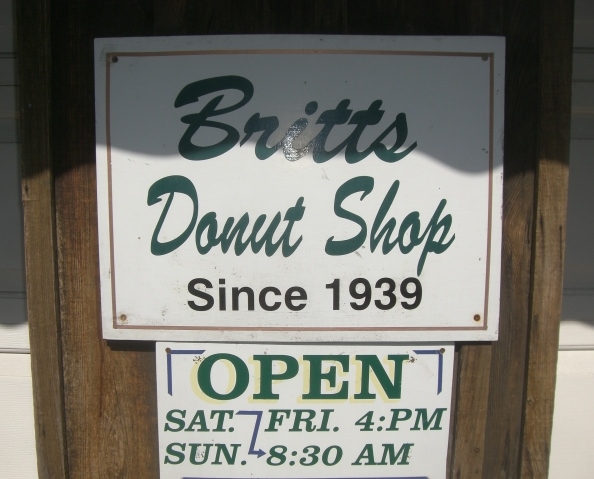
Britts- not open for us 😦
Instead we headed for Kate’s Pancake House and the most cheerful service this side of the Atlantic, not to mention a dozen different toppings for your pancakes or waffles, cream cheese stuffed and cinnamon roll French toast, omelets and more. Neither of us ate lunch.
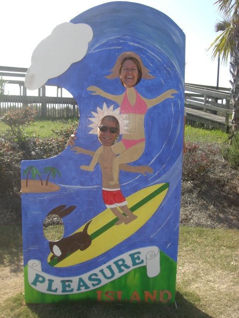
Surfin’ at Carolina Beach
I took advantage of the beautiful, no wind 73 degree day and read for a bit on the tramps, knowing this was the last time for lord knows how long. We checked out the beach, boardwalk and added to our provisions at the local market.
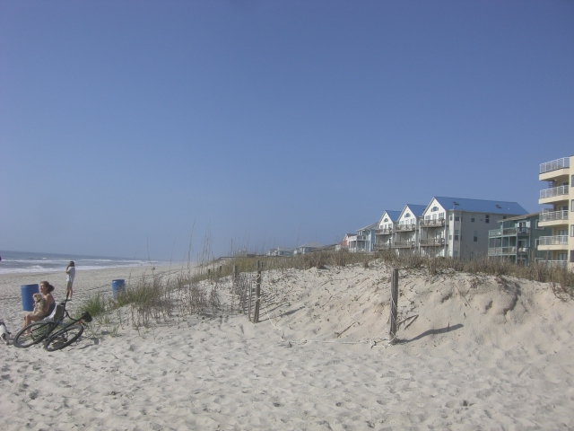
The beach! Carolina Beach, looking south.
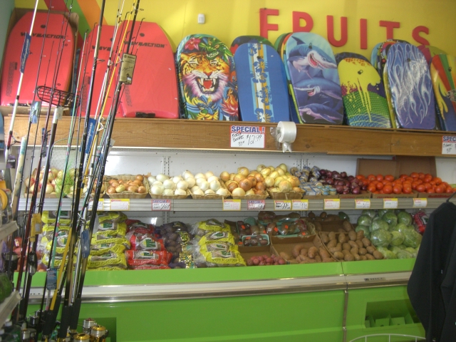
You know you’re in a beach town when..
Around 3pm we left for Wrightsville and dinner at a Baja Mex place recommended by another cruiser last year. Compared to Carolina, Wrightsville sports a younger crowd, not that we saw many folk at Carolina (but you can tell) and not quite the cross between Ft Myers Beach and Cape Cod of Carolina Beach, but a bit more going on there.

Wrightsville Beach- setting for “Message in a Bottle”