
We met a boat in Charleston; one of their first statements was, “Marilyn hates the ICW.” True that; their Q flag was flying as they entered the harbor, a sure sign of Bahamas being their last port. If Ortolan drew more than 5ft we’d wouldn’t be so keen on the ICW either. Fortunately we only draw 3ft, but mostly Russ behaves like we need more.
Have I mentioned bridges lately? No doubt I’m due to whine about them again.
Snows Cut connects the Cape Fear River, north of Southport, NC, to the ICW at Carolina Beach. A fixed bridge spans the cut for vehicle convenience and boater annoyance. A couple of weeks ago we checked the Coast Guard’s Local Notice to Mariners, an extensive (but not exhaustive) listing of stuff to take note of, such as missing channel markers, dredging projects and bridge construction/repairs. One cannot go along the ICW fat, dumb and happy… and remain that way. If so, kudos to you! By the time we’re done checking weather, notices, ActiveCaptain, more weather, I’ve got a headache. Maybe I need more wine.
So we see that the span is being re-painted from Dec 2012 until April 30, 2013, with clearance reduced 4ft. Um, perhaps we could dawdle more. Years ago the old paint would have been removed and the new paint applied. Environmental regs require that the area be curtained off and a big vacuum used as the old paint is sandblasted off as well as remove new paint fumes. A corrugated platform is hung under the span and pieces of canvas are used to cover the span, forming a cocoon. This is what causes the clearance reduction, meaning that at normal high tide 61ft is available and 65ft at low. We need approximately 62 ½’. Hang on I’m getting to the scenic stuff. Not trusting the accuracy of the info and knowing that we have a mast top air tube that doesn’t bend, we wanted to pass under closer to low tide, which was either going to be around 6:30 am or 6:30 pm. We opted for evening low tide and could stop for the night at Carolina Beach, just a mile away.
Based on that schedule, we opted to begin our bad bridge day 40 nm away at Calabash Creek.
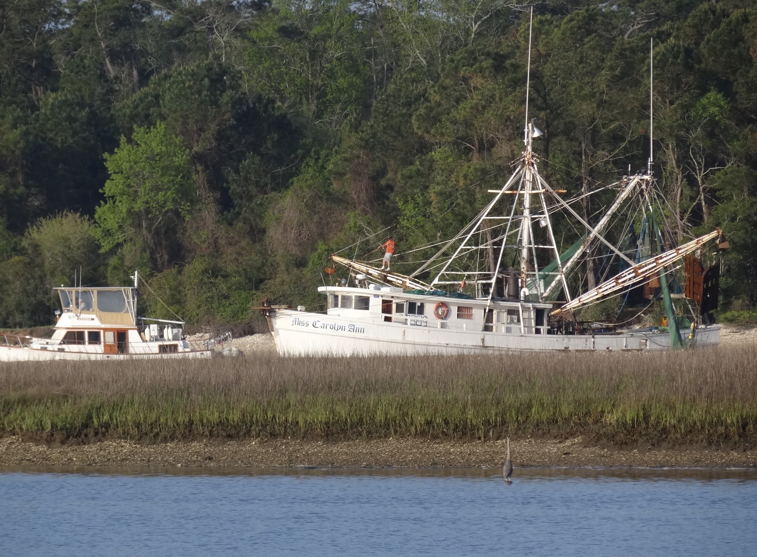
A trawler squeezes past a shrimper preparing to head out the inlet.
Really the end of Calabash River just off the ICW where on the other side it continues out to the Little River Inlet; a stone’s throw to the North Carolina border. The creek offered tree-lined North to East protection with marsh on the opposite shore. One m/v and s/v already anchored, but I think we got the best spot in between them. Low tide was showing the mud along the shore where happy egrets and a heron made their dinner selections. Spied an osprey, heard but didn’t see a woodpecker and as you may have already guessed, played Sally Shutterbug. Oh, plus we talked with Benj almost an hour; life is good.
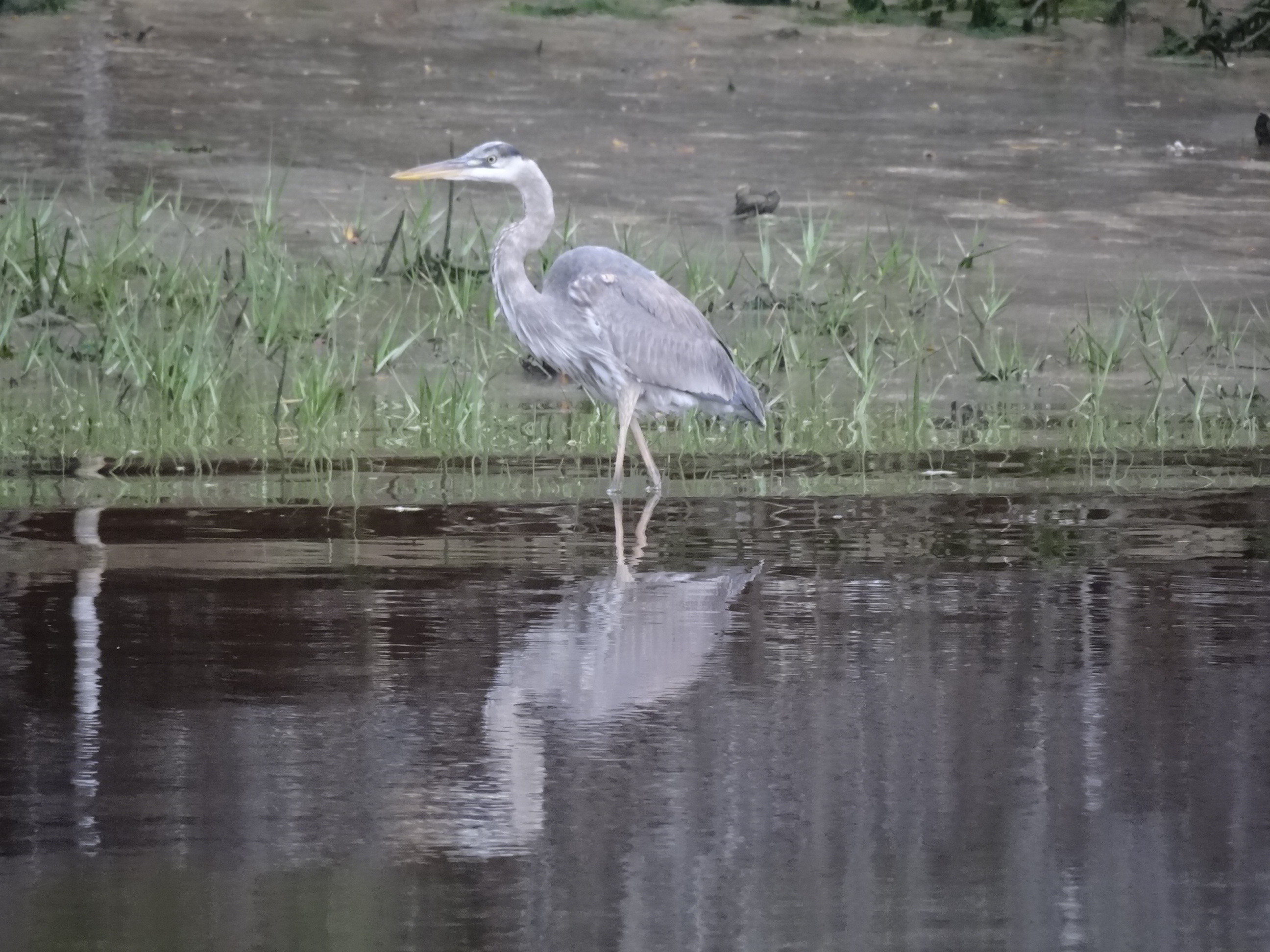
Reflecting or ready to strike?
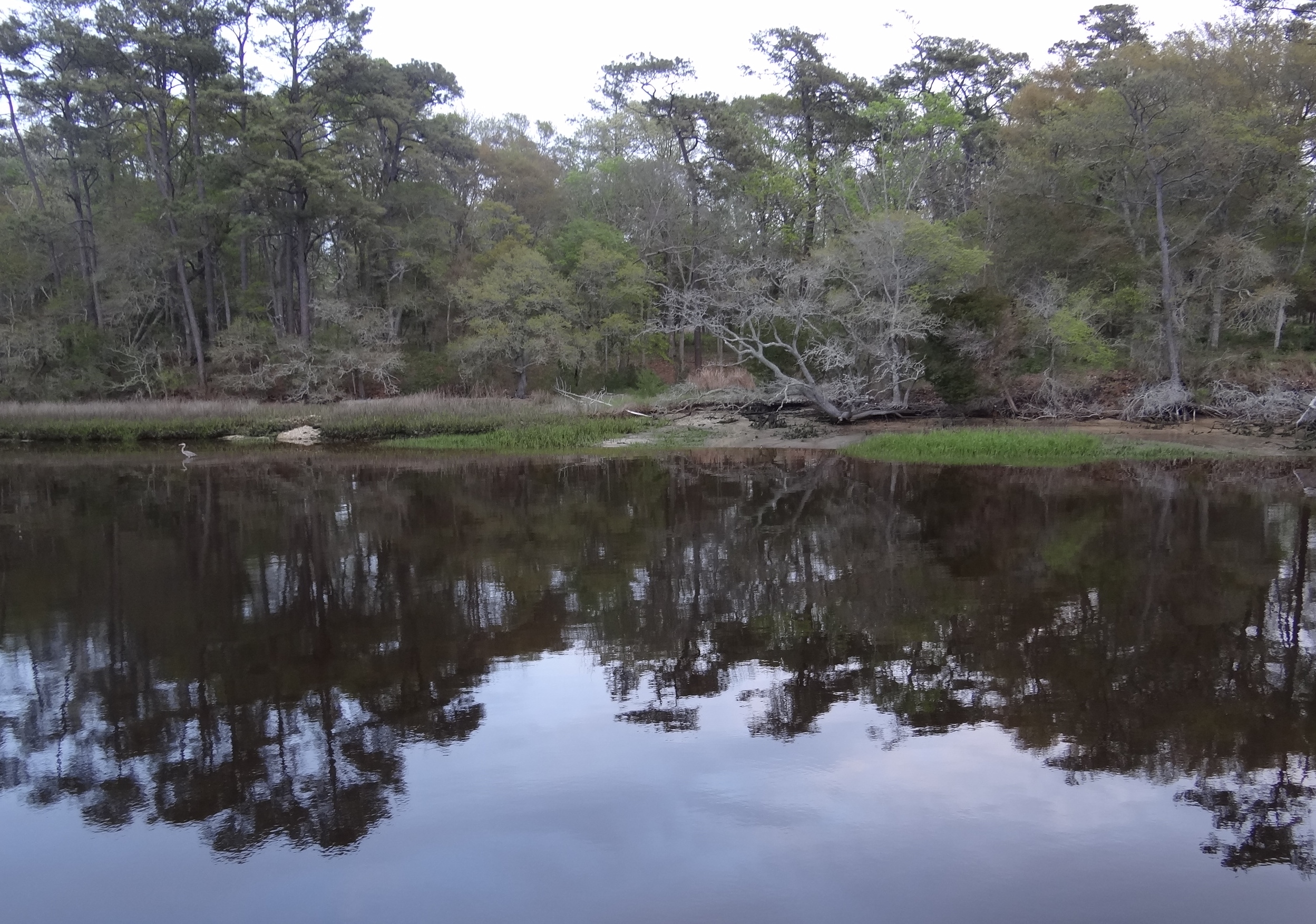
Our evening shore side view at Calabash Creek
