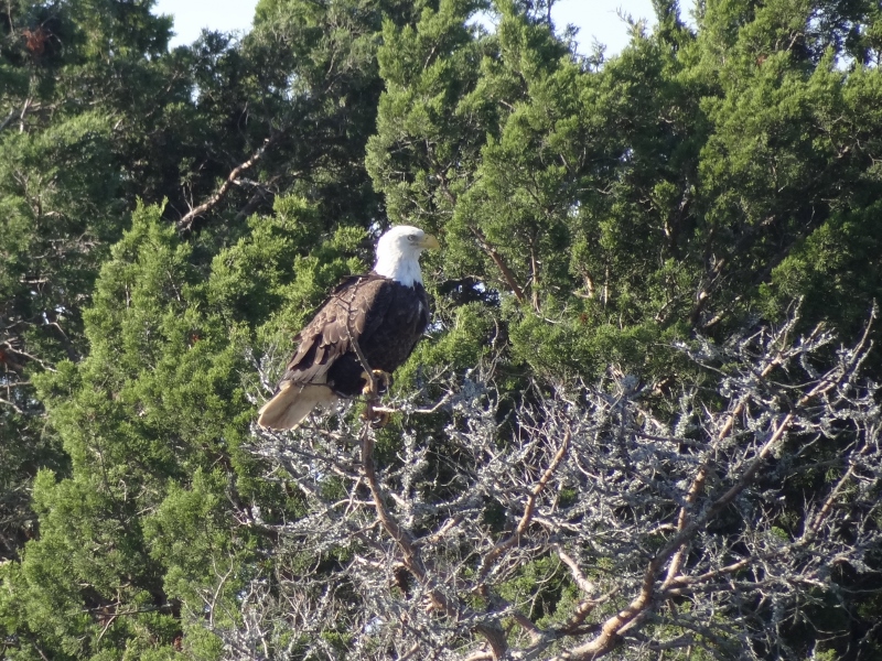
So many regal eagles sighted since August!
I’ve been thinking that postings of late are lacking in the proper cruising excitement that readers hope to find; and while I’m tempted to greatly embellish or just downright tell a tall tale, I can’t bring myself to do it. Please content yourselves with lots of photos and know that if anything remotely interesting happens, I will write about it!
We’ve started using Navionics on our iPad now. We’d been using Garmin Blue Charts as a backup to the Navionics we have on our old E120 chartplotter because it shows all the ActiveCaptain hazards, anchorages and marinas. It also has a sonar setting that shows depth contour lines and is generally more detailed and up-to-date than the Garmin charts. Garmin, while very pretty, is not known for updating often or well. On Ortolan, we had a touchscreen Garmin chartplotter with Sirius XM radio; one of the fancier pieces of equipment on that cat.
So the newer version of Navionics that runs on the iPad (but not on the old E120s at each helm) is the Captain’s new best friend. It’s got color, dots that show the shallower water (you define the depth) and shows you the deepest water path through the channel/ICW. Traveling through the southern half of South Carolina and all of Georgia requires luck, nerves of steel, accurate electronic charts, oh and a boat that only needs 3ft of depth! 🙂
We used to stop at Osprey Marina for diesel and extremely competitive (if not THE lowest) fuel prices; dockage was a good deal too. Over the years we watched Bucksport Marina come alive and become a bit more substantial; and then we stopped this past Spring to check them out. Easy to stop, friendly service and competitive fuel price. Twenty-five minutes and off we go, down the scenic Waccamaw with a favorable current.
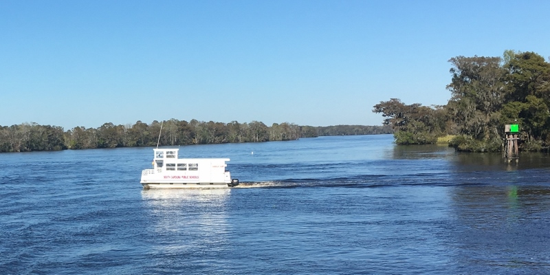
School ferry crossing! On the Waccamaw, south of Myrtle Beach
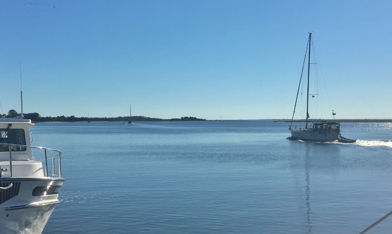
Our next travel day would include the Cape Romain Wildlife Refuge stretch that lies south of Georgetown as you travel toward Charleston.
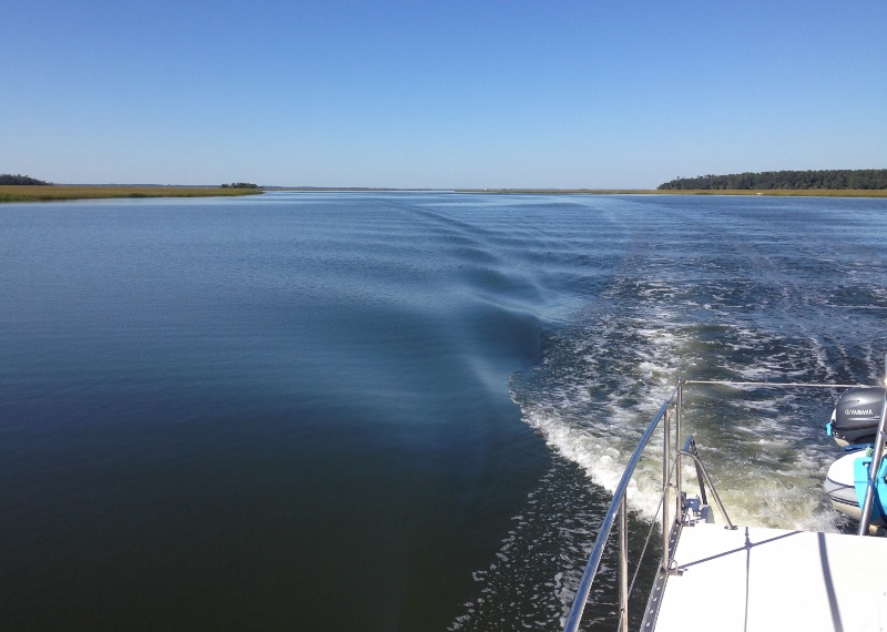
Love the early morning lighting
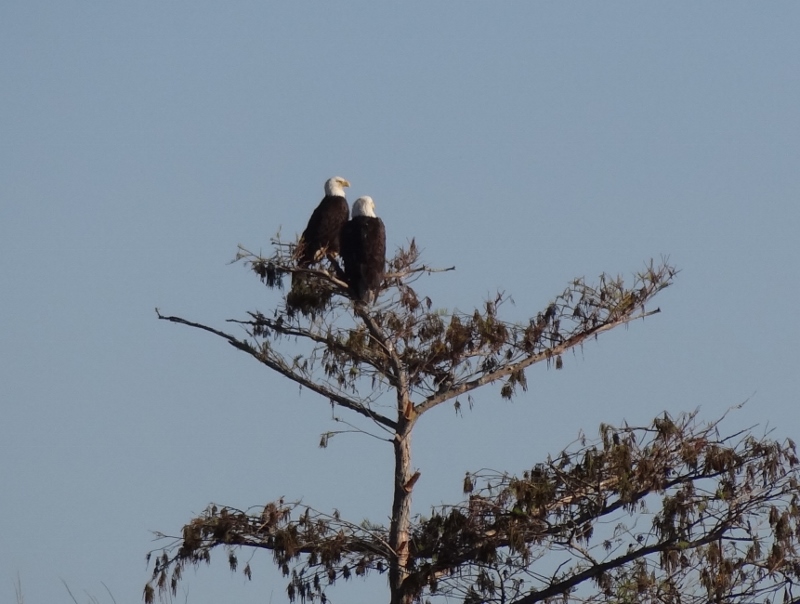
Cape Romain stretch of ICW- the happy couple hang out

Sort of a prairie look here

All in a day’s work along the ICW
As we approached the two guys below I could have gotten a better shot but the distance was too great, even with cropping, so just pretend he’s got a water jet shooting him up a few feet.
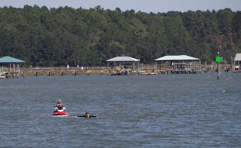
South of McClellanville- not in distress just trying to jet up out of the water
The night before going into the Ashley River Marina in Charleston, the anchorage in Dewees Creek was simply idyllic. Our first time using the creek; two thumbs up!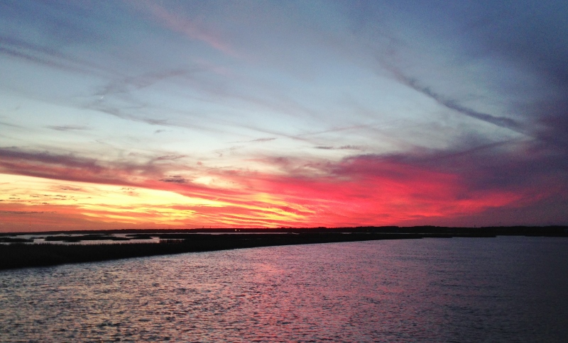
Last fall we pulled into Ashley and met Richard and Jan, owners of PDQ34 Soul Sauce. Lovely people who live nearby, with a long cruising history, more recently local cruising on their PDQ. We’d reserved a few nights at St John’s Yacht Harbor as they offer a two-hour courtesy car and lower dockage rates (being farther from town). Wanting to meet up with Soul Sauce, we let them know our plans. By fantastic coincidence, friends on m/v Kemo Sabe who own the slip opposite theirs, were leaving the day we planned to arrive and said we could rent their slip for a very reasonable amount. Hard to say no to that. Felt bad cancelling with SJYH though.
Not a coincidence though was that we each planned our arrival and departure around the time of slack current; this makes for much less drama and therefore no excitement. We waved to Kemo Sabe (pretty sure I’d read reviews they’d written in ActiveCaptain) as they headed off. Richard and Jan got more experience in the helping cast off and catch your lines department; not that they need it, but was nice they were there for the exchange.
“Kissing Cousins”
Does the design remind you of holly?
Tucking into a slip during windy/rainy times has pros and cons; the downside being it’s unpleasant to walk around in the rain but if very windy then I feel safer and can enjoy some hobby time. We prefer to travel on non-rainy, low wind at our backs days as we (mostly Russ) are exposed to the elements up on the flybridge, with sun protection but only minimal wind thanks to our low front wind screen. We move right along during nice weather and hunker down when we don’t like the conditions. Being able to do 80+ mile days is helpful when we want to move along.
After Charleston, a stretch of lovely days would enable us to enjoy traveling to Brunswick, GA. Deeper draft boats became scarce, but they should have stuck with us as we had higher tide through nearly all the shallow spots.
Where is everyone on this fine travel day?
Tried out another new-to-us anchorage and it’s a keeper. Morning offered up this pretty red glow that perhaps warned of lousy weather to come, but not today.
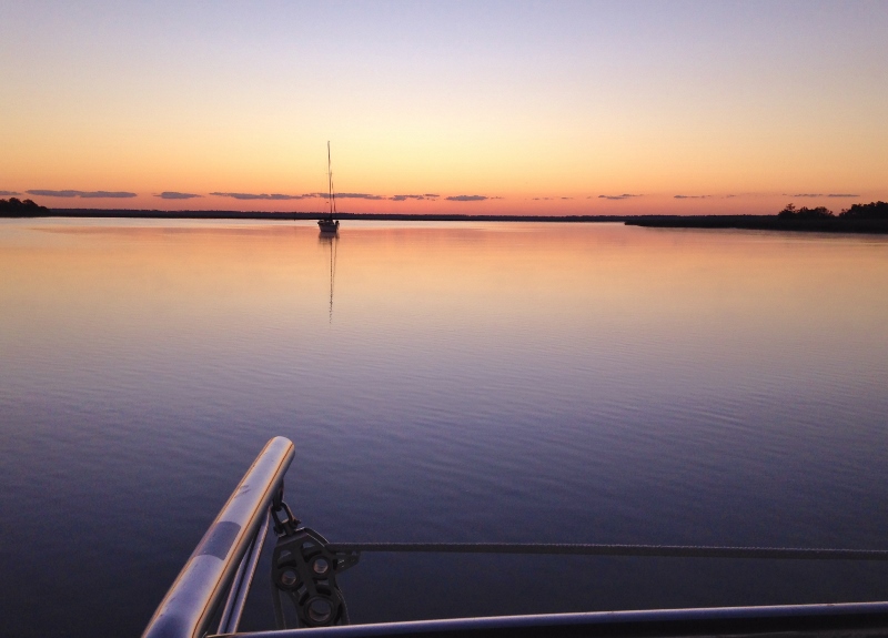
Another gorgeous day begins. Crescent River off the ICW.
Delayed leaving this peaceful spot until 8:30 so that the tide would be up a bit in the Little Mud River- another stretch where if you draw more than 4 ft you want some tide assist. We went through two hours after low tide and saw no less than 8 ft- but the moon cycle is providing at least a foot more water than typical.
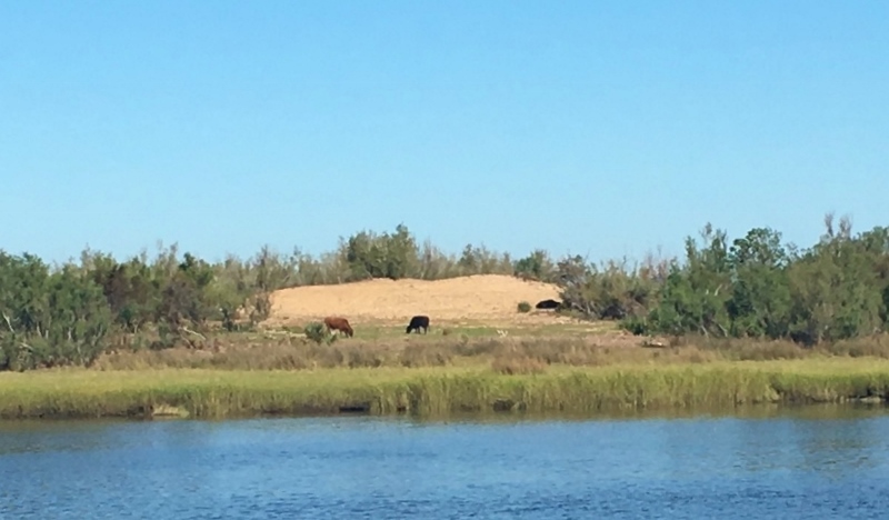
Cows on marsh-y island, south of Little Mud River
We’ve seen goats and horses along the ICW but cows are a first!
Brunswick Landing Marina (BLM) is very popular for re-fueling and as a former naval hurricane hole, is a perfect spot to leave your boat for extended periods of time or just make it your year-round home base. Slips were in short supply as many boats hadn’t headed off yet and I’m guessing a few had come up before Irma. But while our slip had no protection from southerly winds, most of the strong stuff expected would be from the West to North.
We got to meet the owners of Kemo Sabe, and they both are Buffalo, NY natives. 🙂 but not living in that frigid northland anymore!
Brunswick Landing Marina. Nordhavn Kemo Sabe is docked stern-in to our left.
And what did I tell you about distilleries and craft breweries? This will give downtown Brunswick a much-needed boost; plus a craft brewery will be opening across the street. What’s not to love? Oh right, no donuts. 😦
The Farmer and the Larder is changing course, but one of the owners is opening a restaurant across the street; we look forward to checking out Strong Roots in the spring.
Downtown was very quiet for a Saturday, but we learned from a shop owner that the BIG Florida/Georgia football game was this afternoon, so that’s where everyone was. Georgia won.
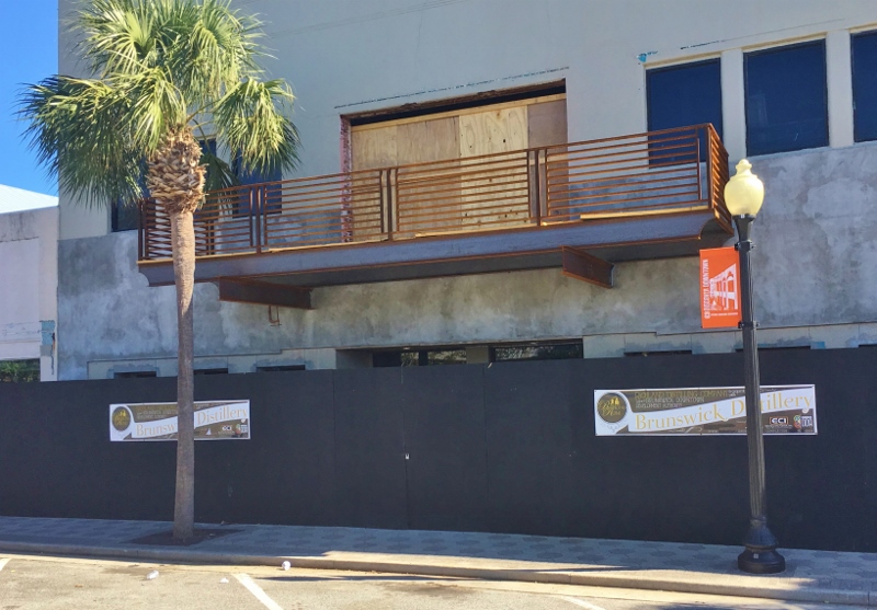
Here a distillery, there a distillery, EVERYWHERE a distillery…
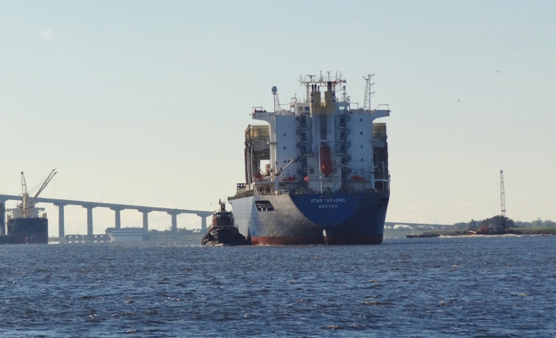
Looked like it was headed right for us at BLM; we’d be the first line of boats to get rammed!
But the loading dock south of us was the intended destination, whew.
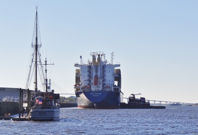
And in she goes
Tuesday and Wednesday nights would find us nine miles from Brunswick, at Jekyll Harbor Marina. Loaner bikes and a golf cart; everyone is happy. We needed to be stationary on Nov 1 to accomplish a long list of to-dos in changing our domicile from CT to FL. The “stay or go” decision hinged on Florida’s healthcare and those costs/subsidies weren’t available until Nov 1. Once we saw the numbers, it was full speed ahead to tackle the loonnngggg list, that we’d only begin to check-off on Nov 1.
Tuesday, after we arrived- that was Halloween but sure didn’t look or feel like it- got the golf cart for a shopping/grocery run then biked the southern part of the island in the afternoon.
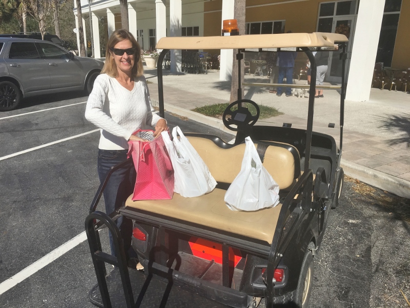
Love golf cart shopping!
Yes! A beach. First one in months.

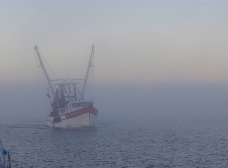
The ICW channel brings you close to shore- spooky when its foggy

Near southern tip of Jekyll. Northern tip Cumberland Island in distance
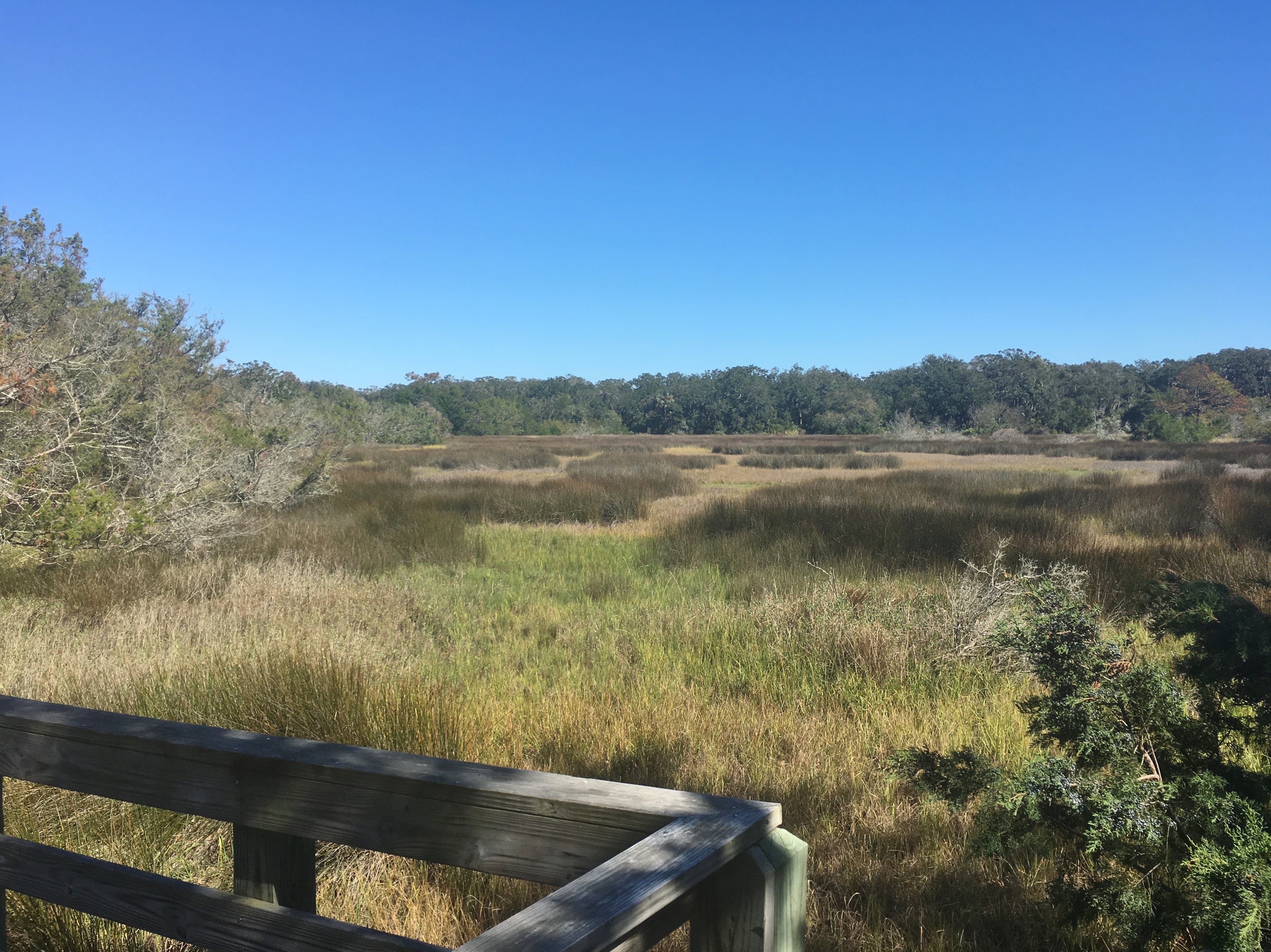
Spartina and Black Needlerush- looks like burnt fields
The squirrels left out the remains of daily snacking- gave us a never-before look at the inside of a pine cone that’s been stripped.
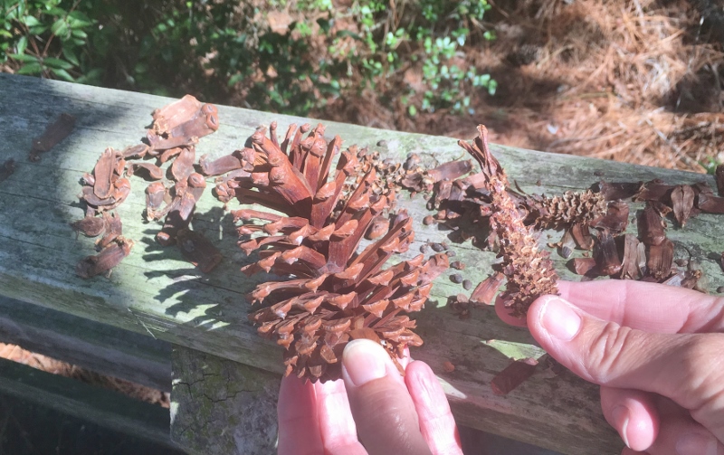
Squirrel snacking cones- before and after
This info panel contained several pieces of interesting historical information from the year I was born.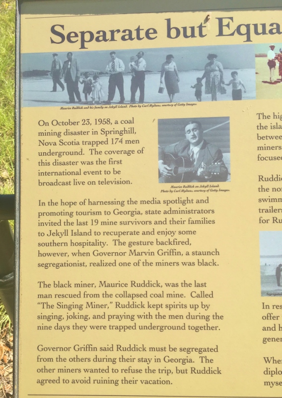
S/V Fleetwing, whose ActiveCaptain handle is Bob423, comes past the marina to anchor off to the right
Over the past few years we would focus on comments from Bob423 as they were precise and concise. Not that we usually had to worry but it’s good to be prepared. Then Russ discovered not only does Bob423 have a blog, he also produces a guidebook. So I’ve added a link to his blog from ours.
Normally, Bob423 is ahead of us and most snowbirds, but not this year. We are a week ahead of last year and Bob423 is a bit behind thanks to weather. So when Russ said that he’d be catching up to us today and anchoring off the marina, I joked that he’d come by at 4:23. What is the likelihood that we’d see him come past at 4:23? not sure, but doubt me not when I say that after I took the photo the wall clock said 4:23.

Jekyll Sunset
Thursday we would continue south and cross the FL/GA line: Anything Goes, It’z Just What We Do, Round Here- oh wait not that- the actual state line 🙂
Morning fog showed signs of lifting, but whether it did or not, we had to get going with a long day ahead. Next stop, Pine Island- north of St. Augustine.
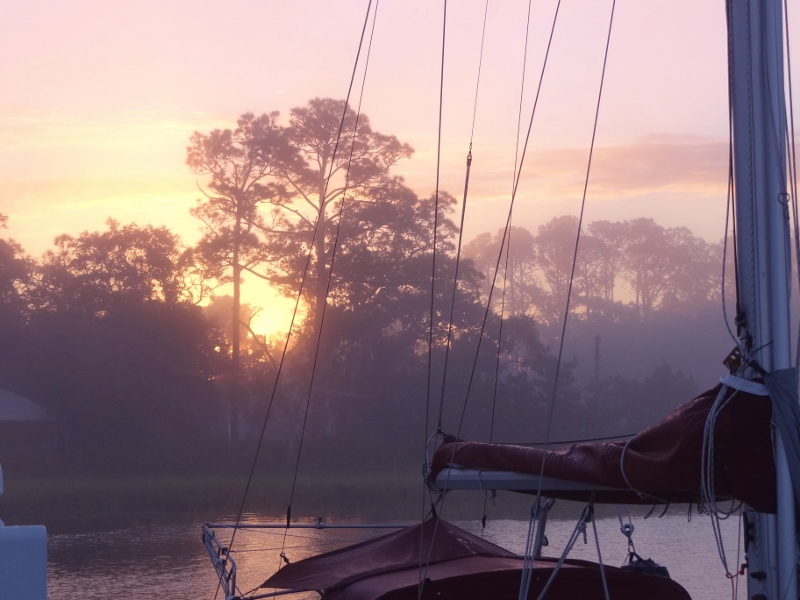
Good foggy misty morning Jekyll Island