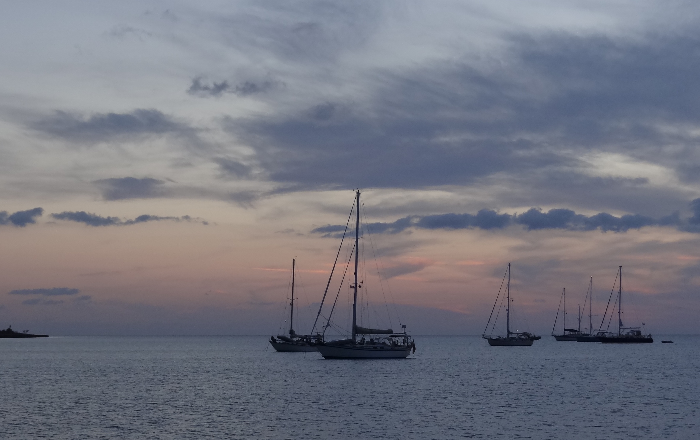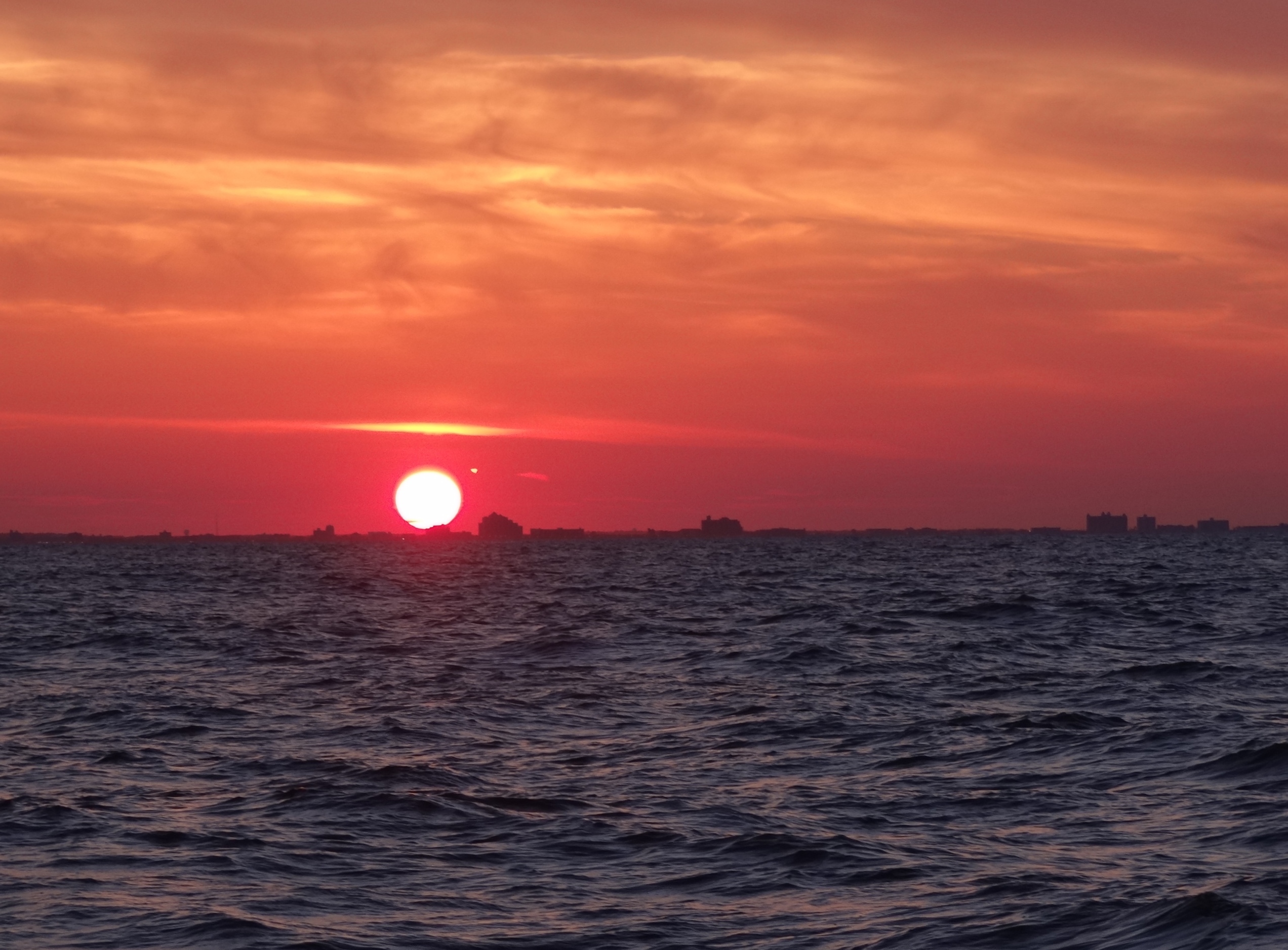
The sun sets along the Maryland shore as we approach the mouth of the Delaware
On the first day of travel my Captain said to me, “Honey we’ll have a following sea.” On the second day of travel my Captain said to me, “Ignore those swells, it’s just a following sea.” On the third day of travel my Captain said to me, “Ignore that thunderstorm, wind will squash the swells and we still have a following sea.” On the fourth day of travel my Captain said to me. “Ignore the pouring rain, no more T-storms, swells are all gone and we still have a following sea.” On the fifth day of travel my Captain said to me, “Five hours of sailing, no more raining, thunderstorms all gone, swells nonexistent and we still have a following sea!”
Kudos to you if you can sing that one. That about sums up our final five days; departing the Chesapeake just after 6am on Monday, arriving Sandy Hook, NJ at 6pm Tuesday and taking three days to land back in Deep River. In between we experienced calm, boring, exciting, tense, heart-pounding, happy, and exhilarating moments that made for a memorable end to our fourth cruising year.
The majority of the 241nm trip from Cape Charles to Sandy Hook was a motor-sail thanks to not quite enough wind too close behind us for us to sail at the required average speed to arrive before dark. We really wanted to arrive by 6:30pm to spend time with Makai. So except for a 4 ½ hr period Monday late afternoon, we either motor-sailed or motored using two engines. Sleeping was easy and while we didn’t do “watches” we both managed to get more sleep than usual. The boats during the night were well-behaved and we never spotted any commercial fishing trawlers. The glow that is Atlantic City appeared long before we ever got close. The best part of this trip north is the short night; dark was present between 9pm and 4:15am, barely enough time to get acclimated to it.
To pass the time I kept tracking of stuff in the water and here is what I counted during daylight hours: 4 dolphin sightings, 1 dead bird, 1 baby bottle, 11 balloons and 2 “others” (undetermined)
Several motor yachts passed us throughout the trip but not until New Jersey (closer to shore helps) did we see other sailing vessels heading north. Many leave from Cape May or Atlantic City and by 8pm several had joined those already anchored at Sandy Hook.
A couple of hours before reaching the Sandy Hook Channel, marine warnings came up for thunderstorms, “capable of producing winds over 30kts, hail and cloud to ground lightning.” Vessels should seek safe harbor.” Sure, we’ll just zoom right in. We’d been watching the approach on the chart plotter; in navigation mode the weather radar (colored blobs showing rain, etc) is overlaid so you can see it easily. The wind had died to 8kts so we dropped the main and began motoring using both engines. Could we get in and anchored in time? Probably not, but we’ll see how it goes.
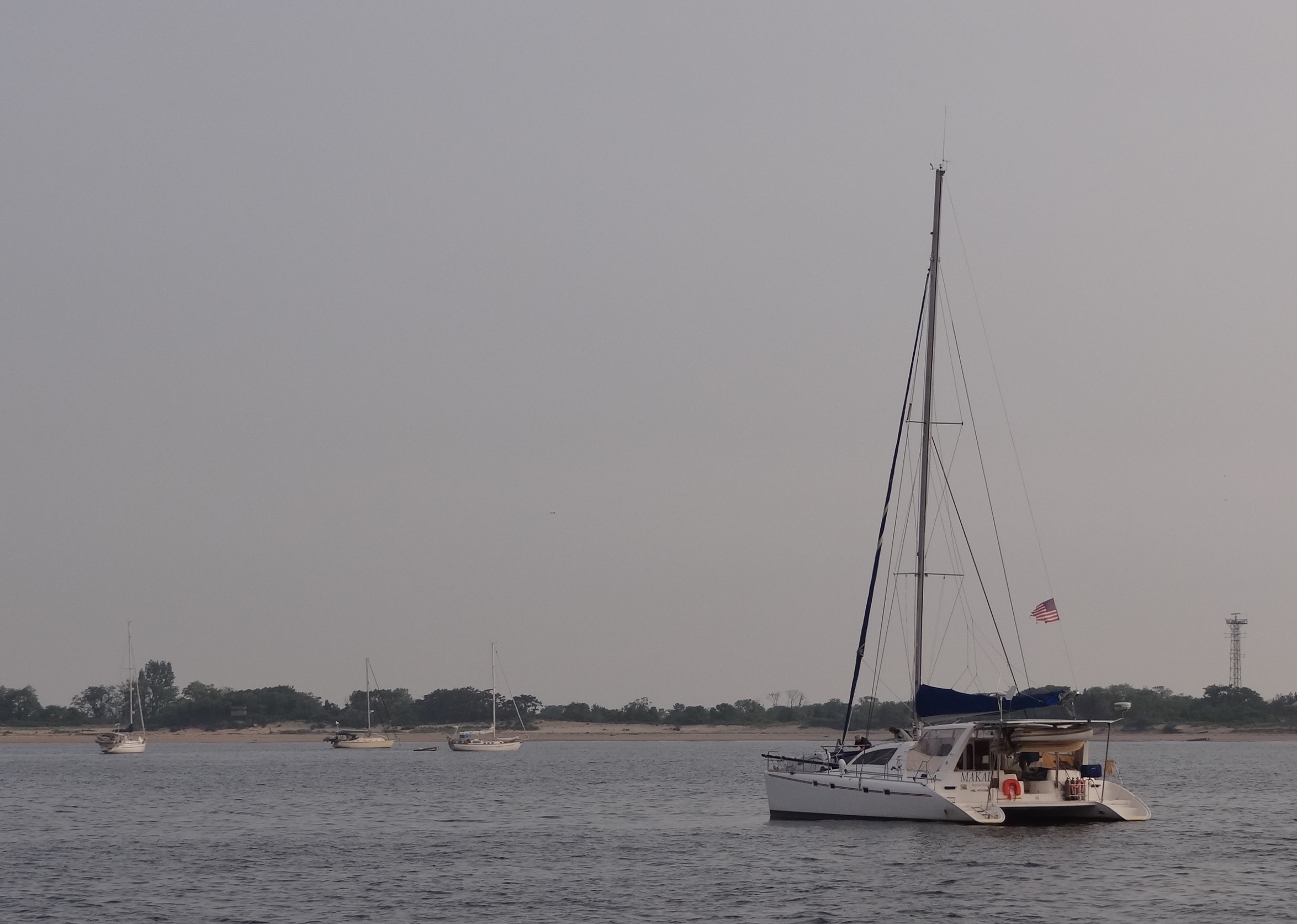
Who needs a report or delayed radar when you can see exactly what’s happening up ahead? By some miracle (me having used up every prayer and promise in my favor bank) the worst of what was nearby, passed just north of Sandy Hook. The wind kicked up to 24kts for a spell, shifted 180 degrees, the sky darkened but, sorry for the cliche, light shown at the end of the tunnel. By 6pm we’d dropped the hook next to s/v Makai who was anchored near the Coast Guard Station along with four others.
Once the light showers ended, Eric zoomed over to pick us up and get his long-awaited tour of Ortolan. Jackie prepared dinner for us and what a treat to enjoy someone else’s cooking! The protein was Mahi that Roy had caught off Hatteras; delicious. Cut into chunks and sautéed; along with the Mahi Jackie prepared sides of kale, sundried tomatoes and onion; steamed rice, caprese and slaw. Being on Makai felt so much like the Leopard 36 we chartered in BVIs, only it’s larger and easily accommodates 5 people and dog Topaz. Since it’s a charter version, each person/couple has their own cabin and bathroom. Our “meeting up with boat friends” luck was pretty crappy this year, but we are so happy to have met up with those we did. Much thanks Makai for being part of our cruising time.
Wednesday morning as Makai weighs anchor for the very short trip to Atlantic Highlands
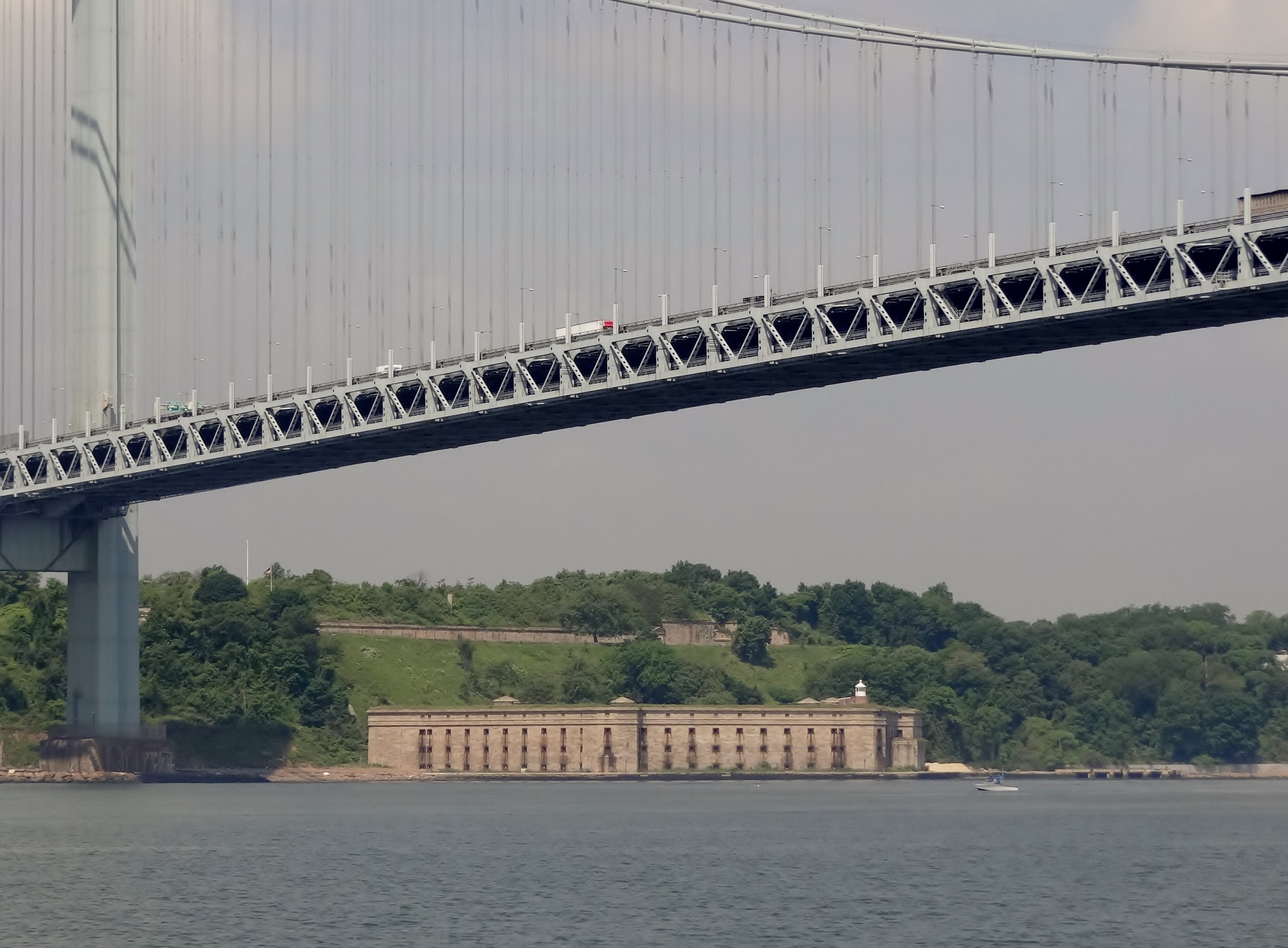
Fort Wadsworth sits below the Verrazano Bridge, guarding the entrance to the Upper Bay
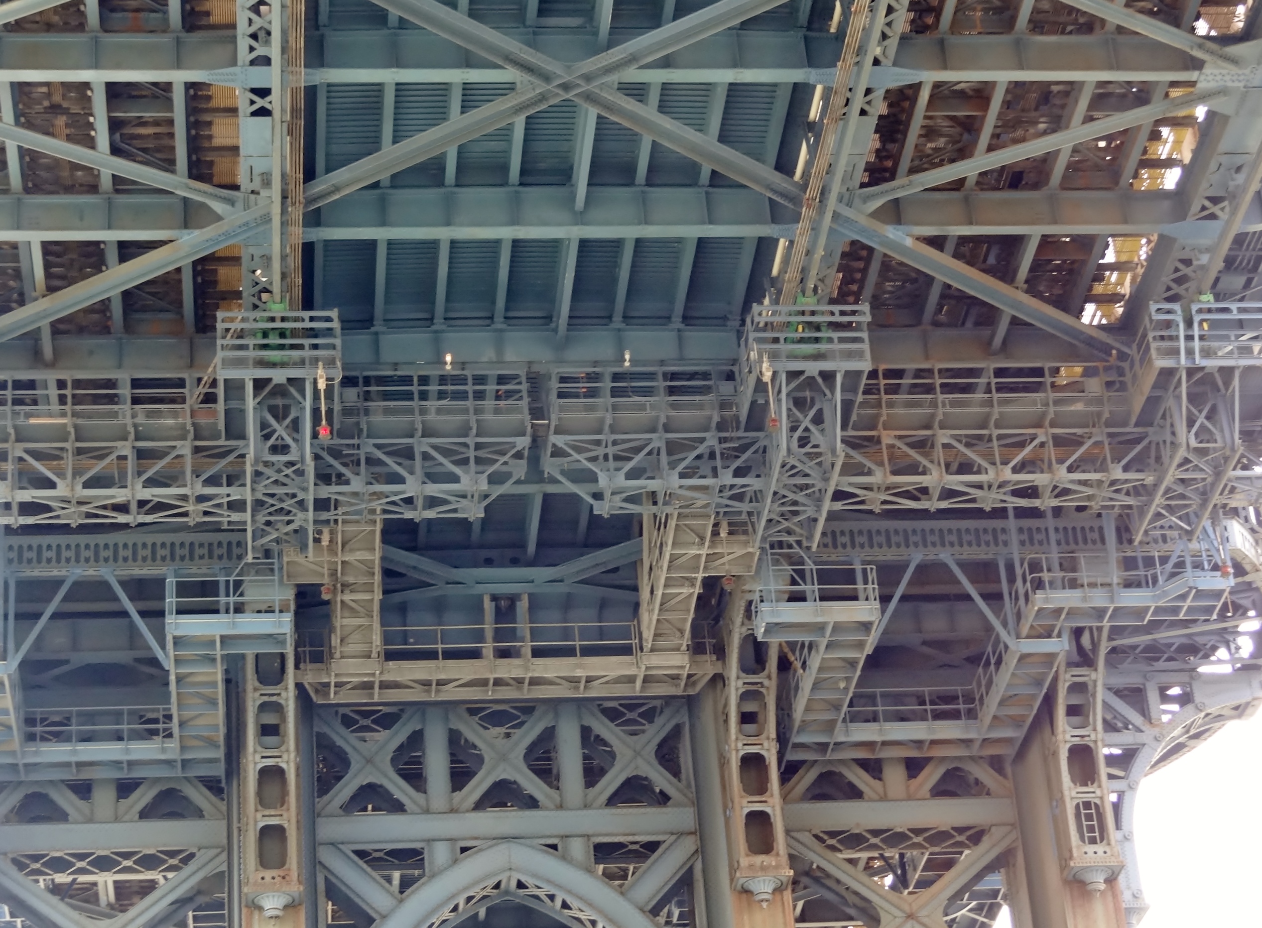
Looking up at the underside of the Manhattan Bridge

This carousel sits between the Brooklyn and Manhattan Bridges. Lots of kids waved as we passed

One World Trade Center fills in the skyline with the Brooklyn Bridge (or maybe it’s the Manhattan) across the East River. At 1,776 ft tall, it’s the tallest building in the Western Hemisphere
And for the Hell Gate report- max speed 10.4 kts because although we were there near maximum flood (current with us heading toward LIS) it wasn’t as strong as other times. A fun ride and since we’d have the current against us by the time we entered LIS, any help is appreciated.
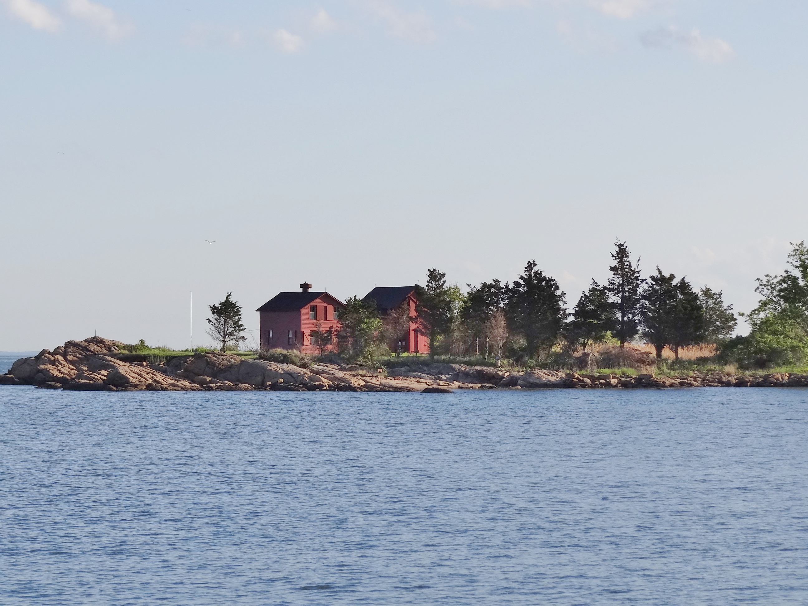
A very scenic cove at Short Beach (Branford/East Haven) made up for Bridgeport

Got a great view of the Thimble Islands (Branford/Guilford line) as we sailed near shore on Friday
I’d like to know how often any forecast for LIS weather is even close to accurate. When the rain stopped we decided to leave our Bridgeport anchorage and chose Short Beach as a perfect spot. The wind was to be enough to sail the few late afternoon hours, but we only managed 1 1/2 hours in a 3 1/2 hour trip. Increased north winds at night never happened either but our spot offered great protection as well as scenic beauty.
As you know, good things come to those who wait and boy was it good! Friday’s forecast from a couple of days ago was saying 15-20kts of NW winds; perfect direction and boy would we fly with that much wind. Seas would be low (near the north shore, because LIS runs east to west) and off our stern. That morning as we got up, Russ checked three sources that all said NW 5-10; no sailing in that teeny bit of hanky wind. Again, who needs to read about the weather when you can hear it. As we cranked the engines you could hear the wind pick up and we raised the main asap, headed out the small cove and sailed well for several hours in the Sound before the wind backed down, forcing us to jibe a few times. The benefit of not being pressed for time is you can tack or jibe to keep sailing, rather than douse the sails and begin motoring.
The lighthouses at the Old Saybrook breakwater welcomed us at noon and even the Old Lyme Draw (Amtrak bridge) opened promptly; perfect timing on our part, not anything to do with Mr Grumpy bridge tender.
By 2pm Ms Ortolan was attached to the mooring we’d call home for the coming month. So much to do in that time before leaving for a two month cruise to Maine.