May 31- June 2: NJ, NY & CT!

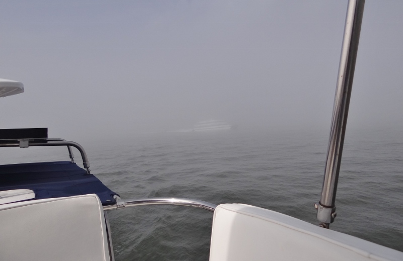
Foggy departure out Cape May inlet. Happy to have a lead vessel.

When you see an opening, take it. Squeeze through it any way you can and continue on. Wed, May 31 was predicted to be very low winds, not the best direction but not an issue. So what frequents  New Jersey on windless days? Answer: FOG, and plenty of it.

And when we thought it had departed on those little cat’s paws, back in it oozed, surrounding us like a cool, moist blanket. Even the wind picking up didn’t completely dispel the persistent fogginess.  For the most part, visibility was just good enough to safely see ahead as we sped along at 13kts.  The morning fog was so dense we kept to a slower 8kt pace for a couple of hours, running radar, two sets of eyes, happy to have AIS and listening carefully to any nearby VHF convo.

Rounded Sandy Hook with no issues and no fog. You may recall years ago we dealt with fog up the NJ coast, getting too close to the channel’s edge at Sandy Hook, and then bam! surprised beach fishermen and us, as we were closer in than we thought. I think we couldn’t see the large buoys and relied on the chartplotter, but the channel and buoys had been moved further away from the growing sandy beach so we found ourselves outside of the actual channel- but only briefly!

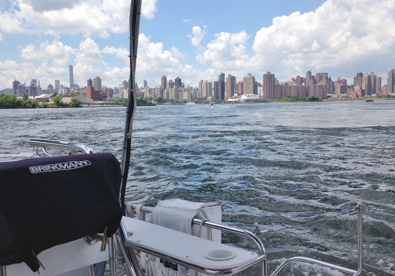
We tucked in for the night just behind the breakwater at Atlantic Highlands, with plans to transit through NYC, the East River and east through Long Island Sound as far as we could get, the next day- Thursday June 1.

Surprise! Morning fog crept in to greet us, then ebbed only to return. Nerves of steel, AIS, our trusty VHF and chartplotter got us through the harbor with ferries, container ships, tugs, small fishing boats and other pleasure craft all messing about as always.

We watched the process depicted below a couple of times; the first happened when before we upped anchor in the morning, and this time was a better view. Clams?

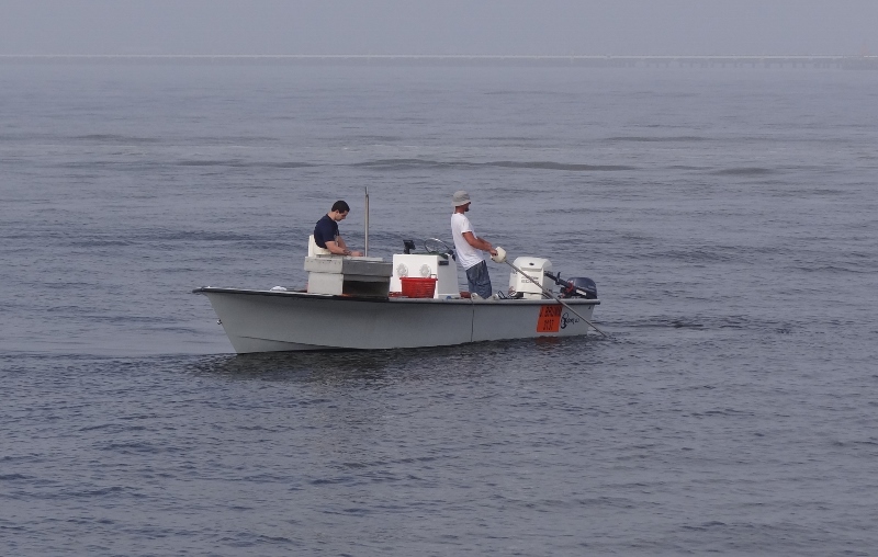
Drop in a big trap thing, pull and drag it, and then bring it up


SeaStreak- called to let us know she’d do a two whistle pass. Invisible until very close by

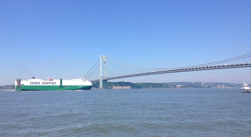
As we closed in on the Verrazano, the fog lifted for the day- ahhh.

Your consumer goods have arrived!


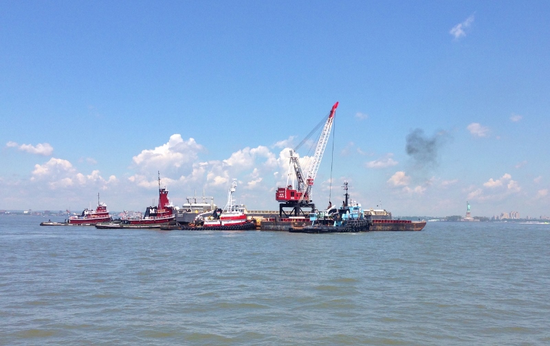
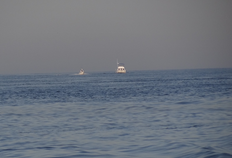
Joint effort? or Tug rendezvous?


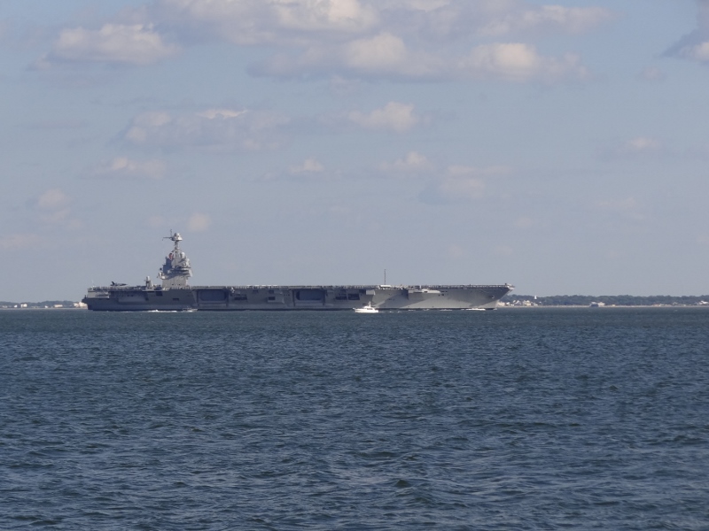
Always an honor and a pleasure


Turbulent water near Hell Gate. The current was with us- against would not be good


Plane makes a very steep ascent on take off from LaGuardia over Rikers Island

We enter into eastern Long Island Sound and decide to keep up our speed as conditions are calm and we want to get as close to Westbrook as possible tonight- ok how about Clinton 2 miles away?

I often check the AIS list to see at a glance who’s out there, but hadn’t looked in a while. Such a pleasant surprise when I looked and saw s/v Amistad headed into New Haven Harbor. The first time we ever saw her, she was being constructed at Mystic Seaport. Laid eyes on her a couple of times since then but never under way. I rushed up to tell Russ and insisted we divert for a photo. The shot below shows the path we were on and how we turned nearly 90 degrees to hunt her down.

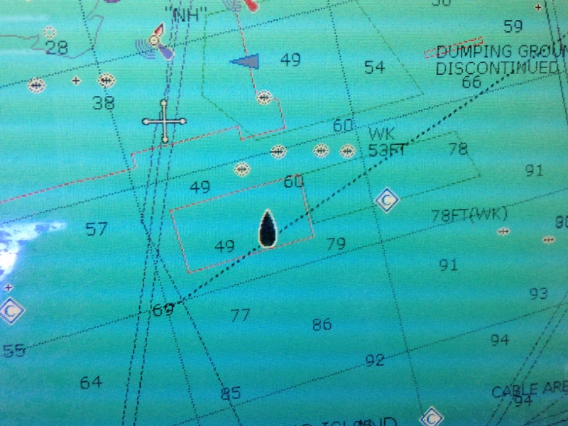
Changed course from the dotted line to check out the Amistad, the large triangle.

I took a slew of photos, but the sun was wrong. This was the best one.

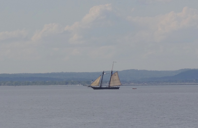
S/V Amistad heads into New Haven Harbor

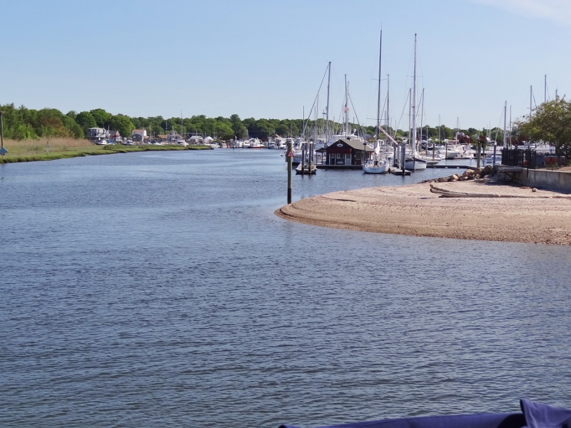
Friday morning we began the long 15 minute trip into what would be our summer home for two months; a blessed slip at Pilots Point Marina. Could I ask for more? I’d better not. But then again, we’d be reunited with Bonny our Mini Cooper, with friends to see, lobster to consume, appoints to keep and all the shopping we cared to do. Oh and those pesky boat projects too.

Mind that sandy point!


Offshore jumps get you home fast

Watching aircraft carrier head in to Norfolk, while anchored off Buckroe Beach

To rush or not to rush, that is the question. Weather be ideal to head offshore, or up the Bay; nay say he. Saturday 5/27 promised to be a 5 star low wind, calm seas day. What’s not to love? Such is the nomad life.

Hampton to Cape May was gonna be a few miles, more than we’d ever done in a day of daylight. The original plan to anchor at Lewes, DE got scratched and Russ said Cape May would only be another five miles; we could make that.

Thanks to winds blowing out of the west Friday and Friday night, we couldn’t anchor at Cape Charles but we left the marina and came around to anchor off Buckroe Beach where we’d have protection. This only saved four miles on Saturday plus the time to get off the dock with no help, since we’d be leaving at OH SO VERY DARK THIRTY!!

So how was the trip you ask? Ah, can you say, “accurate forecast?”  Calm Mother Ocean provided the slightest of gentle swells just so we’d know we were actually in the ocean. No wind wavelets to speak of. We zoomed along at top cruising speed, 3,100 rpms.

First light is before 5:30 am, which helps a lot.

The sun rises over Cape Charles- early bird photo at 5:54!

I’d prepped breakfast the night before by cutting up fruit and getting out cereal bowls and plates for the coffee cake. We raised the anchor as soon I was dressed and could see (put my contacts in)! Breakfast was consumed underway as we let the engines warm up enough and then Russ pushed the throttles forward.

To give you an idea of how wide the southern part of the Chesapeake Bay is, it was at least 15 nm (18 land miles) from our anchorage to the tip of Cape Charles. Once we rounded Cape Charles and passed all the small boats out fishing, the ocean was our oyster.

Chesapeake Bay Bridge- we are on the water- traffic is under us

At 7:10- finally in Mother Ocean- but look, who’s that PDQ? Miss Agnes– headed home to Ocean City MD

The only negative was the “chance of scattered rain and T-storms” near our destination. That too was accurate.  Slowing down to let it pass didn’t work but we did time our arrival to Canyon Club Resort/Marina well enough to not be docking in the rain. Our spot was a T-head, stern-to a 47ft Leopard power cat, named Gypsies Palace. Guess who they love? Huge Buffett fans.

Sunday looked like the only decent day to go into town, so we did. Shared the courtesy van ride with Debbie & Steve of Gypsies Palace. They are Loopers and brand new full timers from Florida as of April 1.


Fancy tide minders slide up and down in a groove in the piling at Canyon Cove, Cape May.  Clever.


Pool at Canyon Club- can you say, “our most expensive marina stay in the last 7 years”?

We stayed at the Canyon Club for two nights, but with rain coming there was no point in paying to be at a dock stuck on the boat, so we fueled up (at the dock) and anchored across the harbor in sight of the marina

This anchorage is sorta close to the Coast Guard station with plenty of room for  8 or more boats as long as some are like us and don’t mind being in 4ft at low tide. Being near the CG station doesn’t mean you should feel safer though. We turned the VHF on and heard the Canyon Club call for help that a boater at the fuel dock had fallen in and was likely injured. Whoever was on call at the station must not be from the area, nor was familiar with the marinas around the harbor- that’s all I’m saying. Shakin’ our heads at the standard but ludicrous questions when the Canyon Club is across the harbor, in sight of the CG station. All ended well thankfully.

Coast Guard Memorial Day tribute through the harbor and the Cape May Canal

Wednesday, May 31 we planned to head offshore up to Sandy Hook or Atlantic Highlands, another long-ish day but not like the last one.  Wondered how calm the trip would be and would we spot a whale like we did last year?