Decisions, Decisions

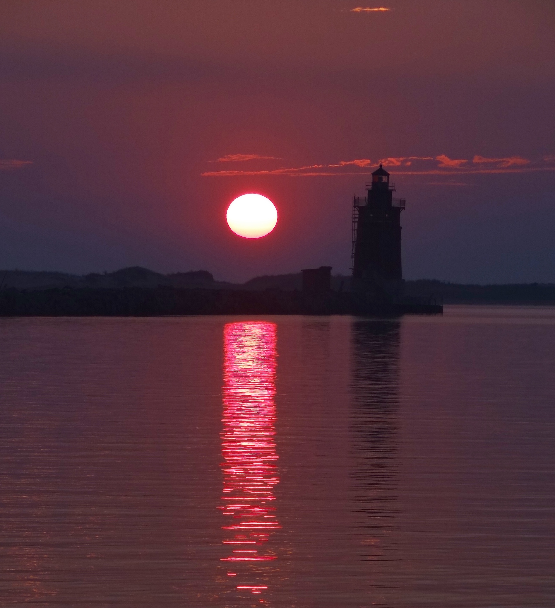
Sunrise at Breakwater Harbor

Sunrise at Breakwater Harbor

Where and when to get the sail repaired, how to manage the current up the river, where to spend time in the Chesapeake; with luck things would fall into place, with bad luck the weather would turn. I am the half-empty glass girl I suppose.

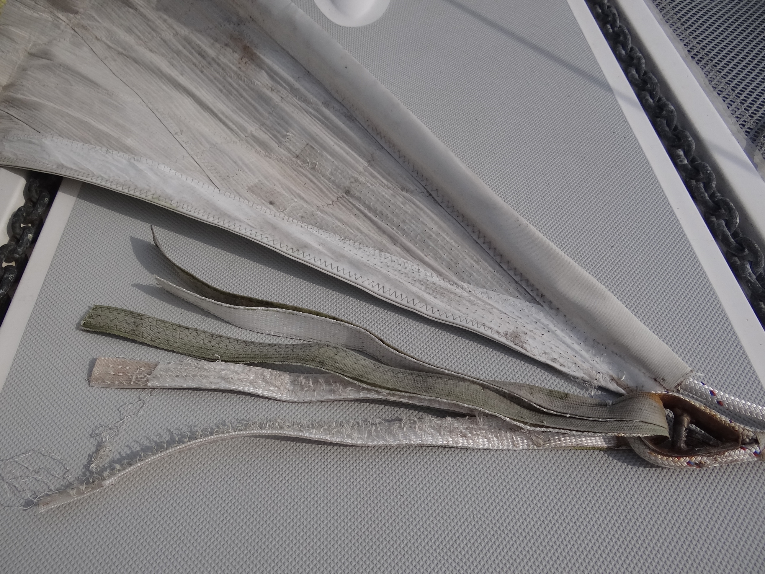
When these important strips popped off, the sail began to slide down

When these important strips popped off, the sail began to slide down

A couple of calls produced possible credible sail makers near St Michaels or Annapolis. The Annapolis Sailboat Show Oct 10-14 would make the area in and around Annapolis very busy and we weren’t sure where we’d find space. The powerboat show was this weekend and the place becomes one massive nautical fun and grog fest until both shows are over. We’d try for a weekday arrival and figure out how to get the sail to shore. Fickle weather goddesses could ruin our sand written plans at any time.

Friday was a short, 5 hour day. Pulled over toward a wide cove rather than fight the current. Indian summer weather is upon us (but can you say Indian Summer now? Sorry, but Native American Summer does NOT work). Morning fog and haziness kept the day’s high temp to 80 vs the 84 degrees forecast. Guess I could have left those cold weather meals behind 🙂 Saturday saw us spend 3 more hours up the Delaware, the current sweeping us along well enough to hit 7kts on one engine at 2400 rpm. The few tankers heading south were huge, but they keep in the channel and the rest of us stay outside it.

This dredge just scoops. Water is apprx 30ft there- "sand waves" according to our charts

This dredge just scoops. Water is apprx 30ft there- “sand waves” according to our charts

Around noon we entered the 14-mile long C&D Canal, a godsend for all boat traffic wanting or needing a northern route between Chesapeake Bay and the Delaware River. Wide enough for freighters, barges, pleasure boats and PWC (especially active on weekends) the canal is banked by hefty riprap (large stones) and spanned by six bridges all with oodles of clearance. Once a dream of cartographer Augustine Hermann who mapped the area in the 17th century, the canal idea popped up again in the 18th century, but not until the dawn of 1800 was the lobbying, interest and funds sufficient to get the lengthy process started. Benjamin Franklin’s efforts helped form the C&D Canal Company which began digging, only to fizzle out for lack of money.

In 1822, Delaware, Maryland and Pennsylvania raised enough money and along with Federal funds and stock subscriptions, the $2 million price tag was met; let the digging begin. More than 2,600 men hacked away with shovels and pickaxes for seven years. Can you picture the effort, the generally lousy working conditions and poor food quality? The canal opened to ship traffic in 1829; it was 10 ft deep and 66 ft wide. In 1919 the U.S. government bought the canal and made it part of the Intracoastal Waterway. Locks were removed and the canal was widened to 90 ft. Several expansions later the canal is presently at least 35 feet deep and 400 ft wide.

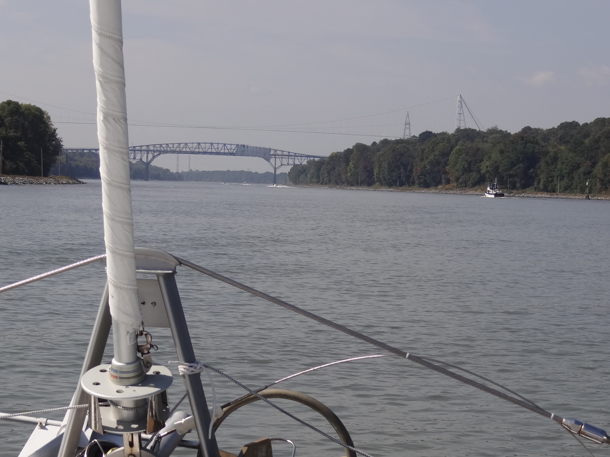
Heading west through the C&D

Heading west through the C&D

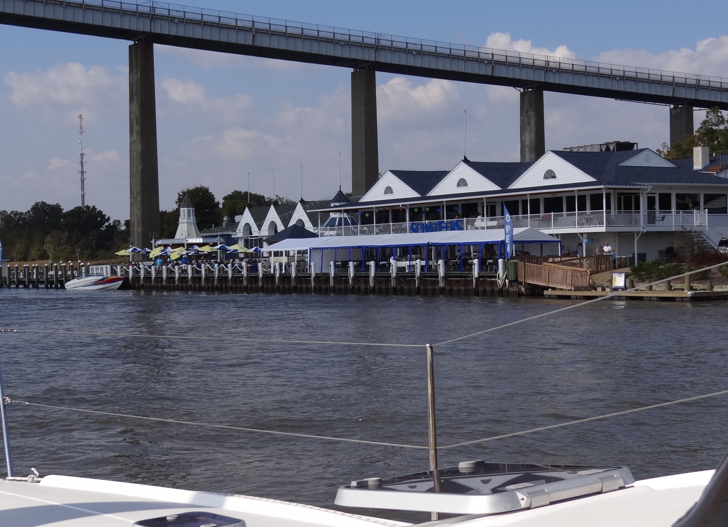
Canal-side dining at Chesapeake City

Canal-side dining at Chesapeake City

Winery on Elk Neck- note the vines on the left

Winery on Elk Neck- note the vines on the left

In 2010 we took this route and pretty much zoomed down the Chesapeake after spending a few nights at Delaware City Marina. This time, with our early schedule we plan to spend time exploring some of the many lovely creeks and towns along the shores of the Bay.

Where Does IT Happen? Cap’n Ron knows.

With each passing day we pinched ourselves to be sure that everything was really
going our way. We bid farewell to Port Washington along with three other sails,
motoring down the East River through New York harbor, the current sweeping us
along. No noticeable pleasure boat traffic and minimal commercial traffic- a
nice change from last year’s Saturday trip.

New York City skyline, Tower One in center and Brooklyn Bridge to left

New York City skyline, Tower One in center and Brooklyn Bridge to left

Don’t look now but we are starting to show our experience, or maybe we could call it confidence. 🙂  The paper charts remained MIA- oh those silly things that consume 75% of the table space; oh I did pull them out eventually for the trip down the lonnggg NJ coast. Gives me something to look at, plus I find the charts provide a better “big picture” than the chart plotter. We raised the main in the harbor; a walk in the park event today, a terrifying moment if this had been Year One.

West winds allowed for fine sailing through the lower bay, around Sandy Hook and along the New Jersey coast. Seas could not have been more than a foot (and I’m being generous here) thanks to low winds for the past couple of days. The Pride of Baltimore was sailing just ahead of us and made for a lovely view and of course the requisite photos.

The Pride of Baltimore apprx 3/4 mi to our port side and 1/4 mile ahead

The Pride of Baltimore apprx 3/4 mi to our port side and 1/4 mile ahead after rounding Sandy Hook

After a short time I noticed our apparent wind was hanging around 60 degrees with 8 to 13 kts true and some higher gusts. About 3 seconds later Russ predictably states that we should use the screecher, “the wind is gonna stay low.”  I agreed. A day earlier “gusts to 20kts” were in the forecast, but had been removed as of the morning. In went the jib, out came the screecher; our speed increased and we were closing in on The Pride.(you can bet she was motor-sailing)

No, no NOAA, when will we ever learn not to trust you, you miserable substitute for a forecasting entity. Sigh. This time we can’t blame NOAA entirely; we failed to pound that proverbial nail into the horse’s shoe and blew out our flip-flop. About an hour and a-half later we heard a loud POP sound and I raced out to see what I could see, but my wondering eyes proved useless as I looked up at the screecher from both sides. We could hear a flap-flap sound, reminiscent of the awful sound the sail made last November when we got caught in BIG wind that tore the sun protection material. Russ figures it out and we try to roll in the darn thing, which is not easy to do well as it doesn’t wind on a pole but on a halyard line. As soon as it was mostly wrapped we released the halyard and dropped the whole thing into the ocean.  In my dreams perhaps, but in reality we dropped it on deck, tied off the halyard and tied up the very bulky mass with a few dock lines. Naturally the wind was gusting during this time, but overall we were lucky that conditions were calm and Otto was doing his usual good job.  The Pride pulled farther ahead since we don’t go as fast with the jib and we were left wondering where she’d be in the morning.

Screecher down, jib out, The Pride pulls further ahead.

Screecher down, jib out, The Pride pulls further ahead.

The night was uneventful and we both got some sleep, motor-sailing with only the main in 8-12kts that had moved to SSW. Warm too; the low for the night was only 67. Ah, now I can relax a bit; how great to be done with my least favorite overnight so quickly- not that I like any of them mind you.

Sunrise off Cape May, NJ

Sunrise off Cape May, NJ

Crossed the Delaware with ease; the big ships not awake to terrorize us yet. By 8:30 Thursday morning, 24 hrs later, we were anchored in Breakwater Harbor at Cape Henlopen near Lewes, DE.  After a short nap we’d deal with that white pile on the tramps.

Stunning sunset at Breakwater Harbor

Stunning sunset at Breakwater Harbor