

New bridge construction with the old drawbridge in the background
During our 9 years of cruising, we have seen dozens of opening bridges replaced with 65′ high bridges – nice for all of us & especially sailboats. Particularly in the south, it is remarkable how fast they build replacement bridges. In as little as 2 years, they’ll build a new high-rise bridge complete with approaches as well as removing the old bridge (unless they keep part of it as a fishing pier).
 The Intracoastal Waterway (ICW) requires frequent dredging – historically under-funded. Fortunately, the last several years has seen a large surge in much needed dredging.
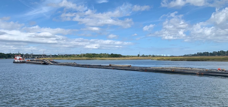 While dredging is great, there are times it is a challenge to get past the dredges … or in this case … their goods. This is a tug, a barge with pipeline AND hundreds of feet of trailing pipeline moving to their next job. This photo shows only 1/2 of the pipe – it was TWICE this long including 2 small work boats attempting to “steer” it around the bends of the river. Right after we stopped to let them go by, we heard on the VHF radio a police boat responding to “pull over” the tug as they were accused of hitting a boat docked at a marina a mile before … oops.
Almost more important than regular dredging is keeping channel markers & charts accurate & up-to-date. While all of the agencies involved usually do a good job, there are a few spots which are so frustrating. One particular half-mile stretch of the ICW in SC was just dredged at a huge cost. Not only has it already partially filled-in making passage at low tide difficult, there is an adjacent, parallel naturally-deep path with plenty of water – why not just move the channel markers to where there is naturally-deep water?
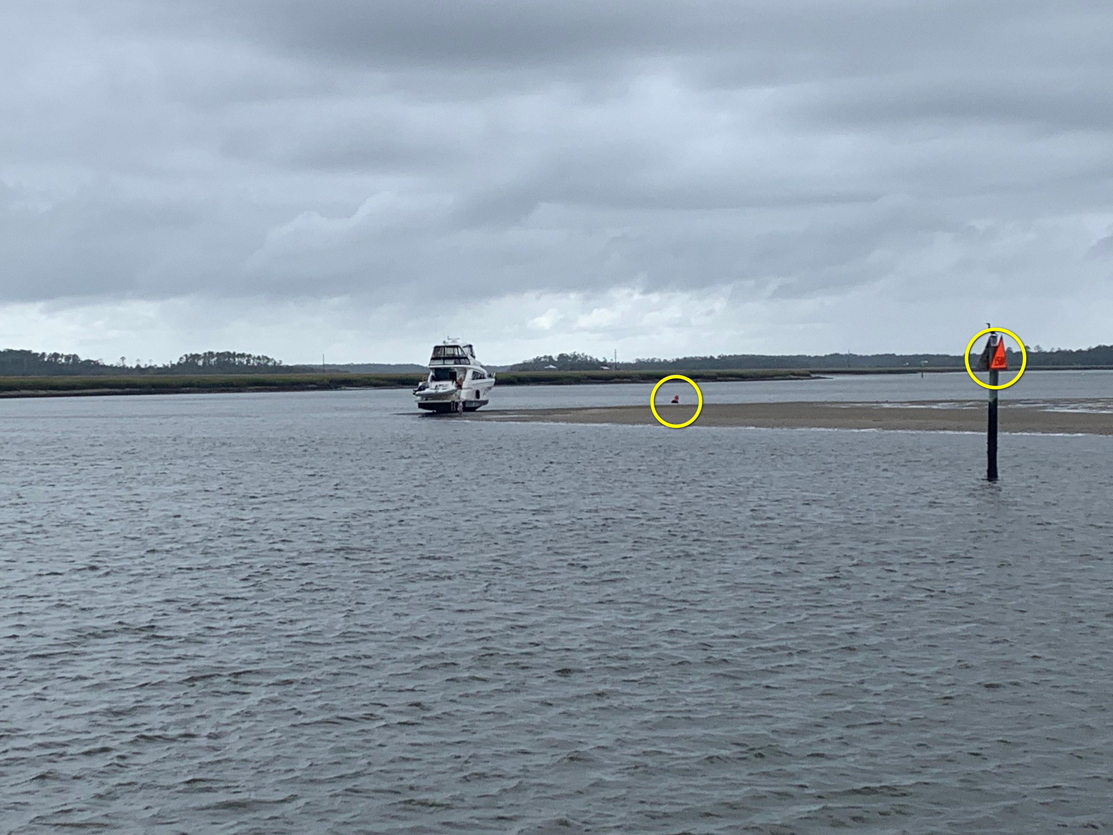 This is an another example of the need for proper placement of channel markers. This shoal on a curve has been growing for years, but if you simply follow the red channel markers (leave them on your starboard/right – circled in yellow) you can go aground as this boat did (he’s high & dry). On the other hand, this is a curve in the channel – you must follow the curve & take it wide. Still, this shoal protrudes much too far & needs to be dredged back and/or marked better.
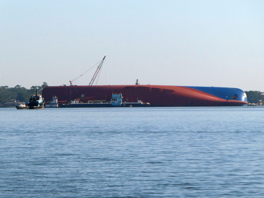 Speaking of expensive miscalculations, we cruised by the Golden Ray cargo ship which also grounded on the inside turn of a channel & capsized last September in St. Simons Sound, Brunswick, Georgia. They are still formulating plans to cut it apart, remove it along with the 4,000 automobiles contained within & all of the pollution – it may take up to 2 years & the blame-game, environmental damage & legal battles will likely go on for decades. Ironically, Georgia is in the midst of being the first state in the nation to pass strict anchoring regulations & nightly fees for cruisers because some politicians think we’re polluting their waters!

I don’t know where else to post/ask this question so sorry if it’s in the wrong place. I had hoped to talk to you guys in Beaufort and I would have discussed it there. Anyway, how far south in the Bahama’s have you traveled? In addition, do you think you could make the additional jumps from say …Georgetown to the Turks & Caicos and then to the DR and PR? Just curious what the PDQ can handle?
LikeLike
Nice write up, I enjoyed reading it.
Looks like you are making good progress south. Safe travels
LikeLike