
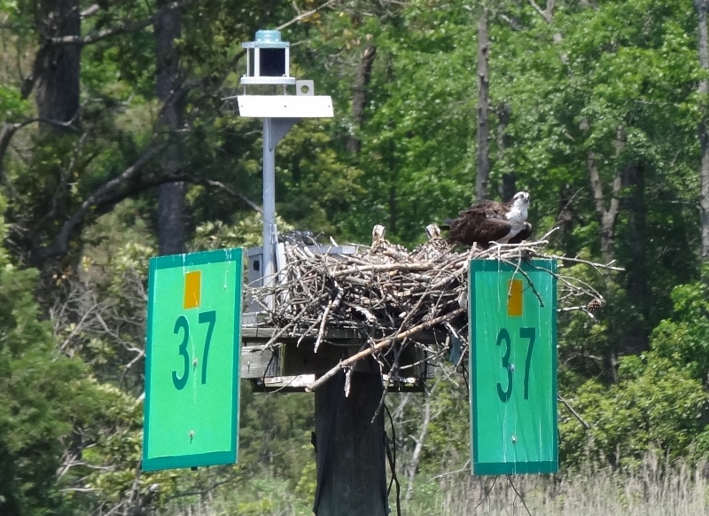
Mama and kids- nearly every marker houses an osprey family. Lucky shot to see the kids too!
In the blink of a pirate’s good eye we zoomed though Virginia. We did not intend to; rather some force beyond our control inspired Twins to make way toward a Saturday (two days early) arrival at Calvert Marina, Solomons, Maryland. Now what force could that be I wonder? Let’s call it my Voldemort. (get it?)
With Memorial Day weekend fast approaching we wondered if pleasure boats would be out in force or would most, as usual, be safely still tied to their docks.
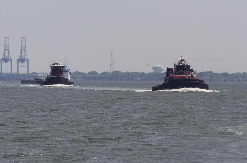
No sure if it was the time of day, the fact the day was Friday or simply a busy Friday before a long holiday weekend, but the tugs were out in force.
If this is a race we are in the lead!
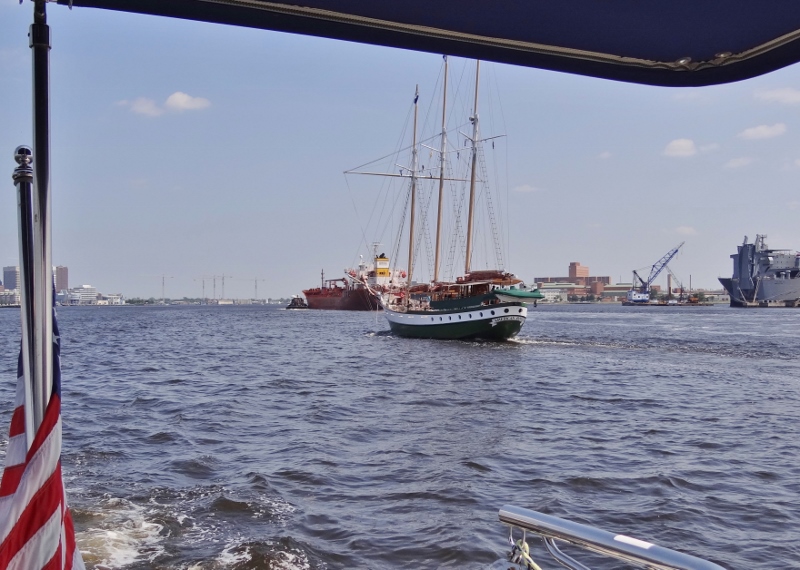
A very busy Friday just north of Mile Zero. Meeting up is much easier & quicker than passing
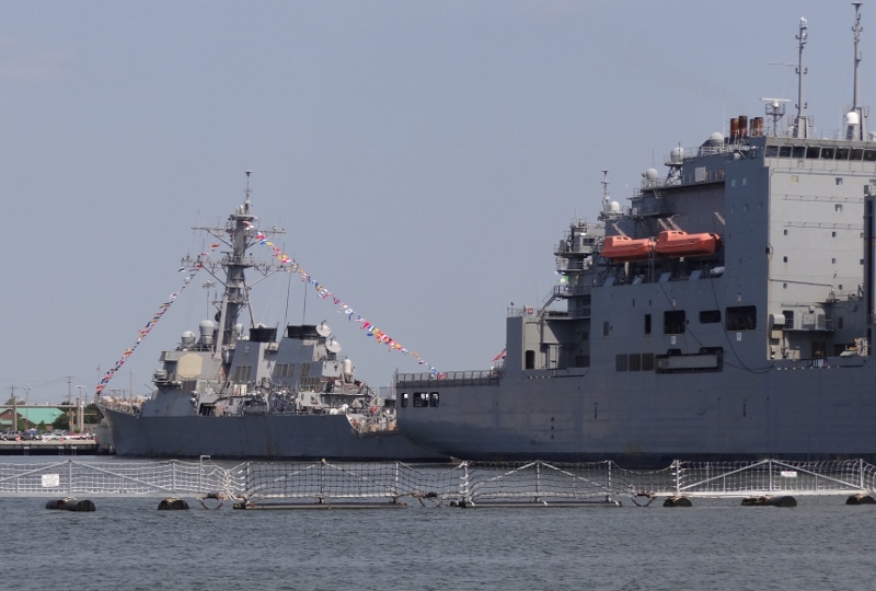
The warships were just hanging out and the only one we saw on the move was coming up the long and wide channel into Norfolk after we had already crossed and were heading up the Bay.
Ready for Memorial Day, or dedication perhaps.
To say that Chesapeake Bay offers innumerable anchorages, is not an exaggeration. We know a very few. I am generally the trip planner for where we’ll stop, mileage and duration (at slow speed 8kts and fast 13kts). When the AICW ends at Mile Zero in the Norfolk/Portsmouth area, the flip chart we use gets stashed away and I bring out the BIG chart kit that covers Chesapeake Bay and Delaware River. Using the big chart I calculate mileage and get some idea for where I should look for an anchorage. Then, I use my handy iPhone app for Garmin BlueCharts which includes all the ActiveCaptain info: anchorages, marinas, hazards, etc.
I am now at the “sit back and put my feet up” point because there will be many little green boxes for all the anchorages that people have used (locals too). You gotta read their words as well as the ratings they give for the 6 categories: Current Protection, Holding, Wind Protection, Wake Protection, Scenery Quality and Shopping Facilities. I like to see reviews that are more current, not from 3 or more years ago. Sometimes an anchorage is no longer viable and boy you’d like to know that ahead. Even with all that, until you are there, you still can’t get a fully accurate picture in your mind.
When the plan changed to move up to Solomons sooner, I’d already found a spot halfway between Mile 9 (Top Rack Marina- fuel stop) and Solomons. Looking for another location that fit our new plan, I noticed Claxton Creek circled on the chart; ah yes that was one I’d found for our trip down last October, but guess what- we didn’t use it. Reviews were very good and no mention of pot floats (no guarantee though). Yes it was a couple of miles in, but on the Bay that’s nothing.
The spot was wide, very few pot floats and we dropped anchor in 6.5ft. Nice. The best part showed up about an hour before sunset.
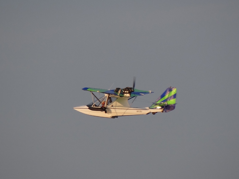
What a cool surprise- not mentioned in any review of Claxton Creek.
Watch out for that pot float!
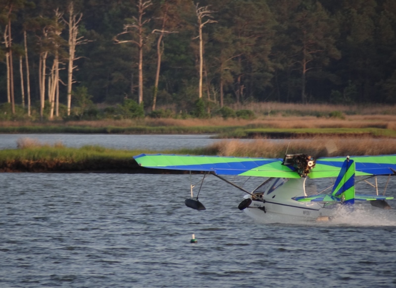
Talk about an anchorage with a view! We didn’t seem to be in the way; plenty of room for us small guys. Surprised to see two people aboard, but it’s permissible if one is the instructor. No flying after sunset.
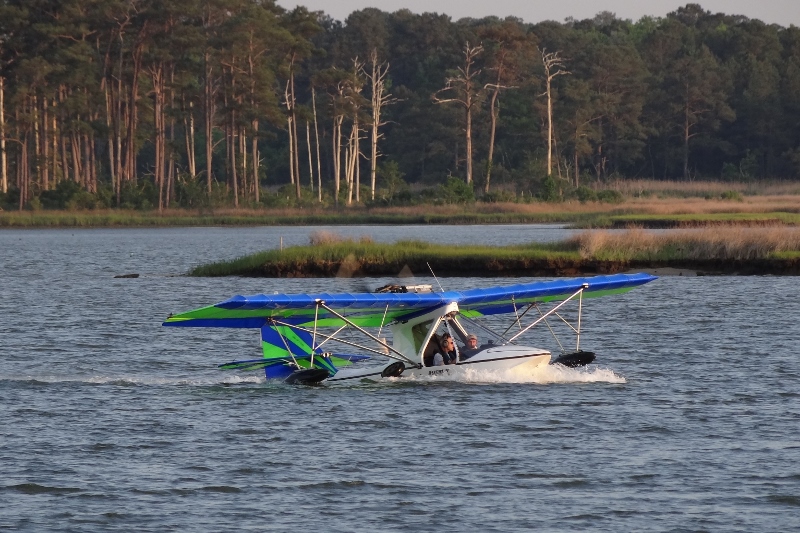
Two thumbs up from them to us and back!
Saturday we arrived at Calvert Marina in Solomons after a good trip with less wind and waves than Friday and lots more local boats but only one tried to run us down.
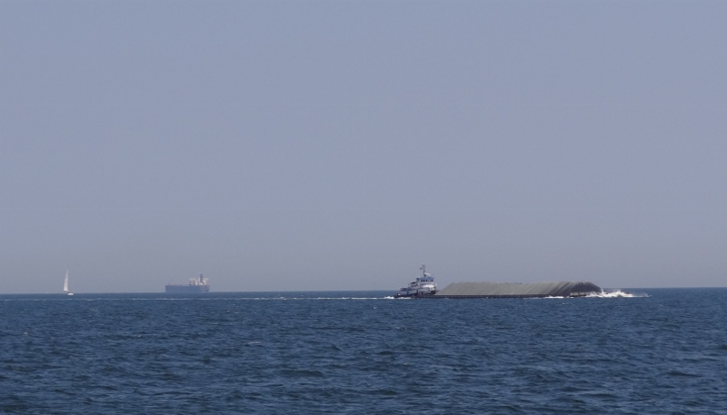
Sharing the Bay- ship in background nearly 1,000ft long with 37ft draft. Three miles away from us.
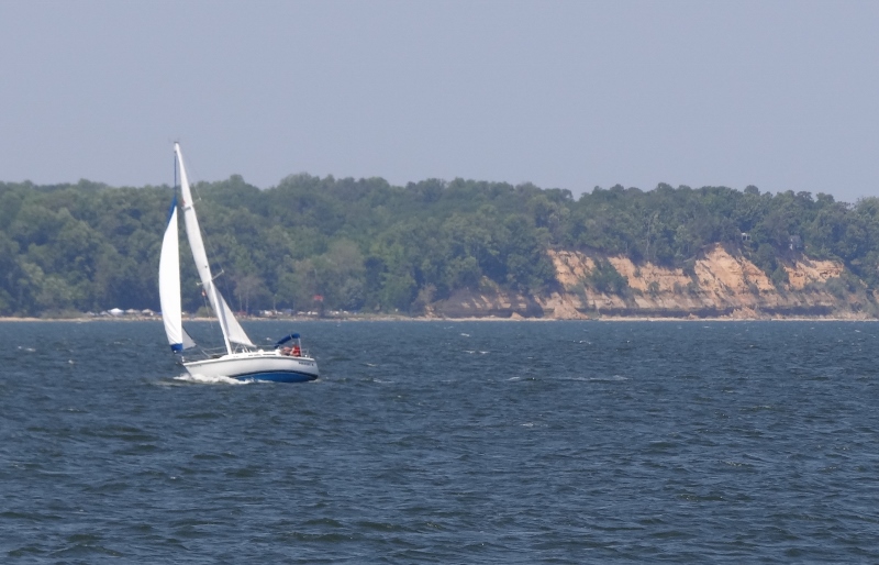
Heel that baby! The famous Calvert Cliffs in the background

Entering Solomons- on a busy Saturday no less. What we do to avoid you-know-what 🙂

I miss Solomons!
LikeLike
Oh just wait until the next post with more photos! Bet kids loved the museum and lighthouse. Adults too!
LikeLike