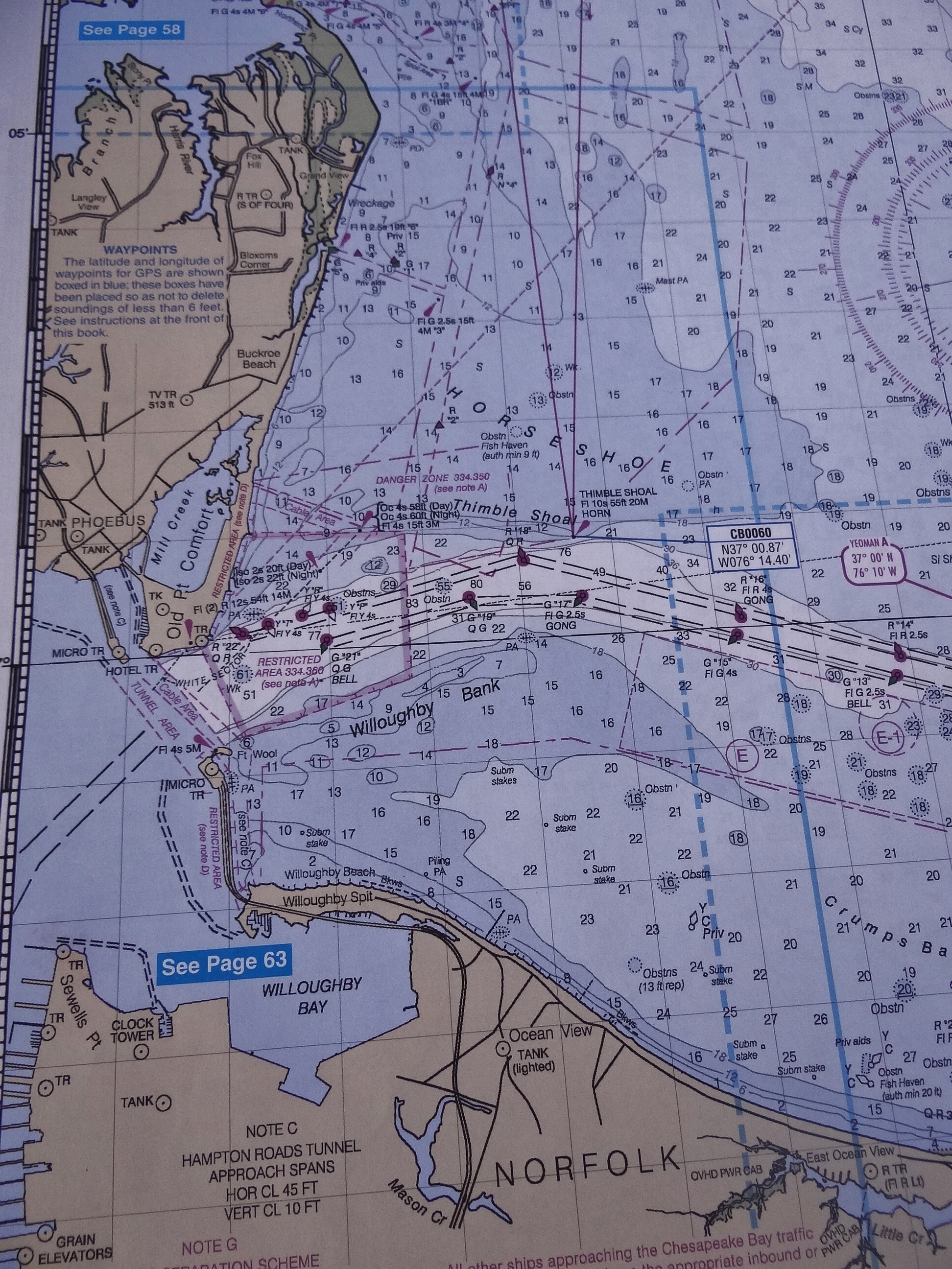
A portion of the chart showing the channel into Norfolk from the Chesapeake (to north)
We read a news blurb about the demise of the heavy paper charts that NOAA has been printing and selling for years. They state that by doing do, money will be saved. Then the article goes on to say that the charts sell for cost, around $20 each. So unless the article left out a few details, which is very possible, since when does break-even mean losing? Just because we all rely, although not solely, on electronic charts doesn’t mean paper isn’t wanted.
We have paper charts on board for nearly every area we go to, and others we talk with say they do too. Yes, many people go to places online or brick & mortar who will print the needed charts. I suppose that meets the immediate need, but what about history? All those aged charts that have found a second life as a framed piece on a wall. All those table-sized chart books with big-picture pages followed by a zoomed-in view, covering several hundred miles in each booklet. Just because many (most?) paper charts are outdated and this supposed money saved could be spent on extensive surveying, doesn’t mean the boating community doesn’t want those heavy paper, cumbersome charts that link us to days of old.
What next? No weather?
I know that most boaters have outdated charts and they do not update them. If you are diligent and spend the money your electronic charts can be as up-to-date as possible- and that’s a good thing. You should also have redundancy for when your primary electronics go down or get fried, perhaps in the form of charts on your iPad or laptop at least.
So all this being said, we like to supplement our electronic charts with paper for two reasons. One is that with our Garmin charts if you aren’t in the correct zoom level you will not see that small but important buoy or marker. And just to make things interesting, the correct zoom level is not the same all the time. The second reason I mentioned before and that is a paper chart can provide a good big-picture view of where you are and where you are going. When we leave the ICW, are sailing off-shore or in some larger body of water I always want to see the big picture and so does Russ as this helps him get his bearings.
Paper charts are like comfort food; not absolutely necessary just wonderful to have.
My take-away from NOAA’s announcement is that if we keep our paper NOAA charts they could be worth something some day in the future. If nothing else, we’ll have an assortment of wall hangings for our future little bungalow.