First let’s give you some Cat Island tidbits. Supposedly Cat is named after pirate Arthur Catt, or possibly after its large one-time population of feral cats. I’m going with the pirate guy version, not only because a pirate makes a better story, but then how do you explain Arthur’s Town, one of Cat’s few main settlements? Arthur’s Town is the childhood home of Sir Sidney Poitier and if you are lucky you might run across his daughter who calls this settlement her home. Or, as one boat told us, you might have tea with his aunt and just miss him by a day.
Cat Island is 50 miles long, 150 sq miles, shaped like a boot (a pirate boot right?) and the 2000 census counted 1,650 residents. It is as you now know, the Bahamian island with the tallest hill, Mt. Alvernia.
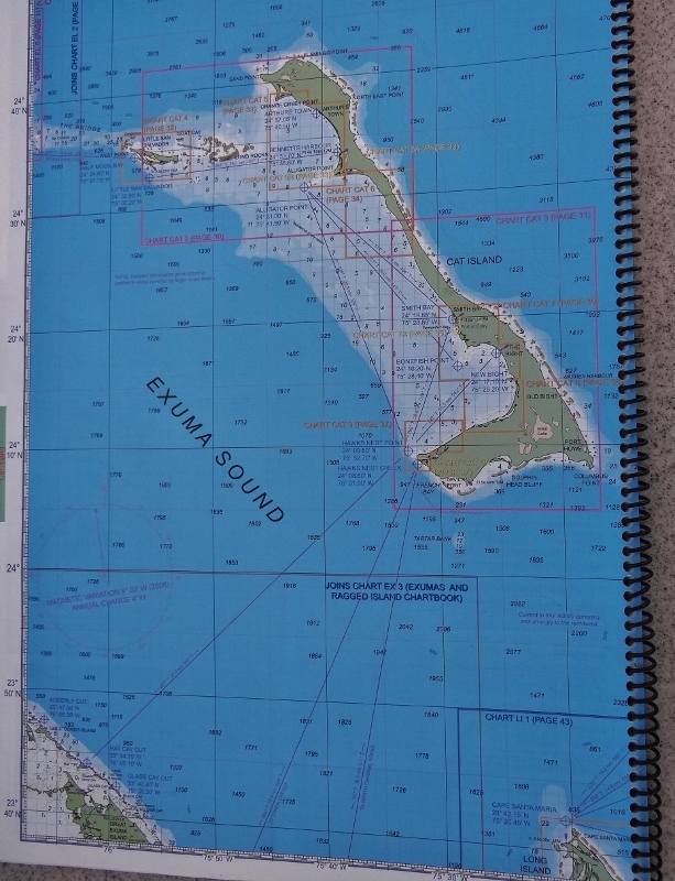
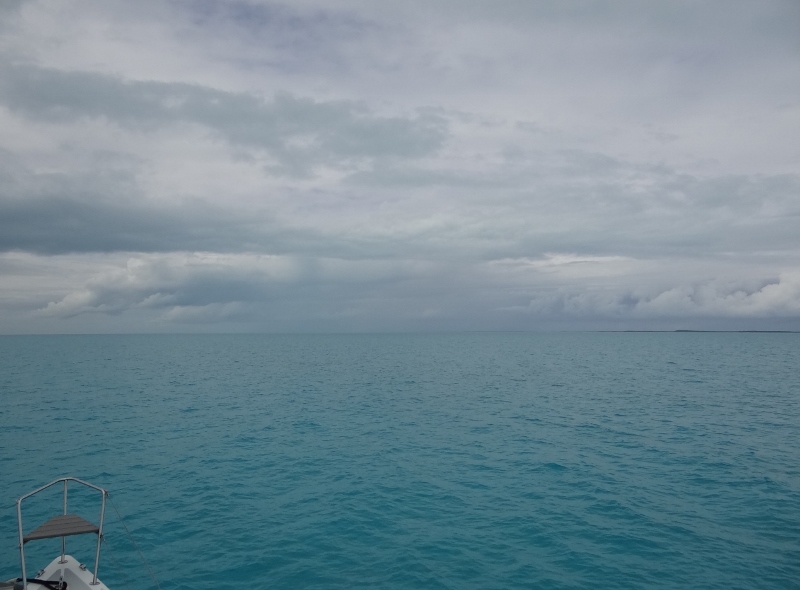
Cat Island sits east of the south-central Exumas. Can see the northern tip of Long Island in the bottom right-hand corner
After The Hermitage we walked back toward the shore road, turned right (north) to walk past the small cluster of “take-aways”, the Bahamian version of road-side take outs, only these are typically colorful and often sell beer and mixed drinks. Counted about 6 or 7; only 3 open. These tiny take-aways are next to the regatta stand so I imagine that during New Bight’s annual sailing regatta (one of the best because the harbor is large and unobstructed) business is brisk.
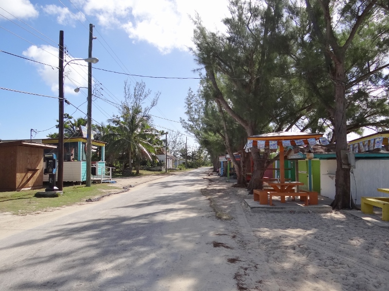
Along the beach-side road are a bunch of colorful take-aways- and a phone booth
Lula’s drew our attention and Lula herself was welcoming and made sure we came in to see what she offered. Impressive: cold drink, mixed drinks, beer, snacks and best of all baked goods. After a taste of her coconut pie (more like a tart with soft crust and a filling like Lorraine’s Mom uses for her bread), how could we not have it for our coconut-loving selves.
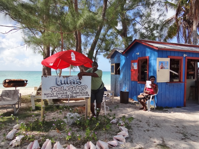
We sure were delighted to come across Lula’s
Along the way our coconut-spying eyes found a likely suspect on the ground; plenty of liquid and heavy. Visions of Bateau Ortolan coconut bread danced in our heads.
In the middle of the beach were large spigot thingys for three hefty hoses to attach to.
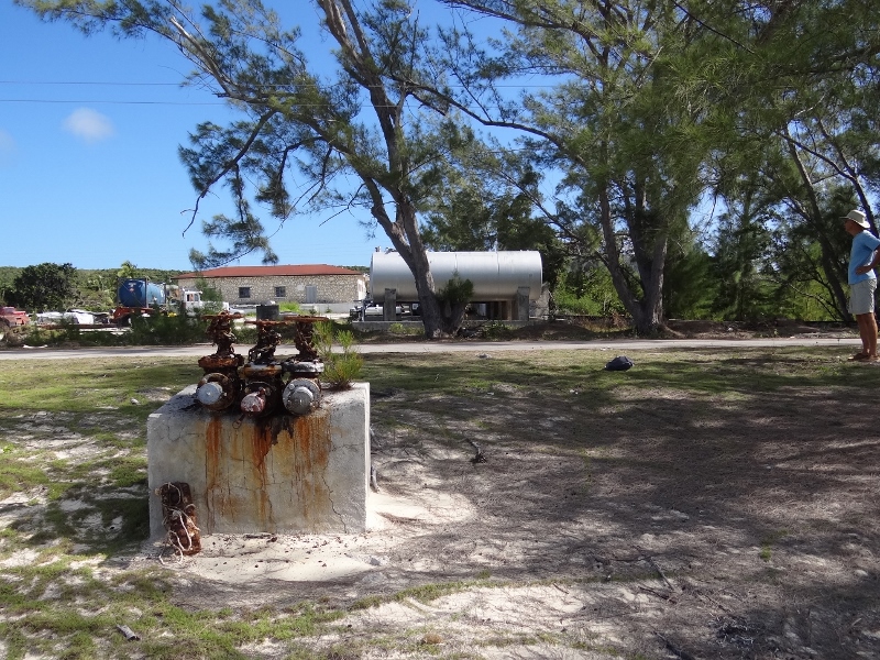
Fuel hose receptacle on the beach in New Bight
A few yards up was the road and across the road were large fuel tanks. Not every settlement receives fuel and not all that do have enough depth at a dock to accommodate a fuel freighter. Those settlements with shallower harbors use this method: the freighter anchors out (past where you see us anchored) and long, very long hoses are run to shore and hooked up to these faucets.
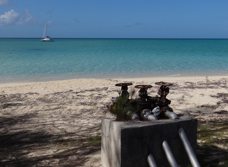
Fuel freighter anchors off the beach and runs in long hoses
The Church of the Holy Redeemer was along the way and in addition to the church itself, was a rectory building, what looked like a small carriage/garage, a storage structure and around back an outhouse (educated guess based on the seat inside).
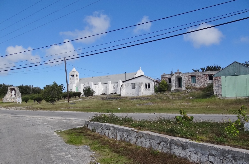
Father Jerome’s final church project
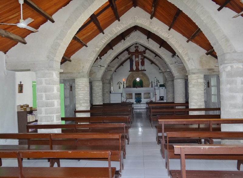
Beautiful interior with several small cut-outs in the side walls and Bapistry a half-level down
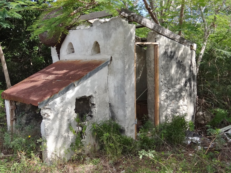
Outhouse (?) no longer in use- thankfully
As we climbed back aboard Ortolan, I heard a sound and then I got it- big groan- we’d (ok ME) left the propane switch on in the galley and the one hour warning voice was announcing “Propane left on, Warning, propane left on.” Darn. First time ever we’d left the boat and forgotten the switch.
Our afternoon foray involved landing at a beach closer to the market. Directions provided by an ActiveCaptain reviewer said to use the beach at the abandoned resort with the three ink buildings. A Twilight Zone setting complete with plastic chairs still inside, an outdoor bar with stools, curtains hanging and signs indicating Twin Palms Resort. Any minute the place could spring to life; the creepy feeling we were not alone sat heavy.
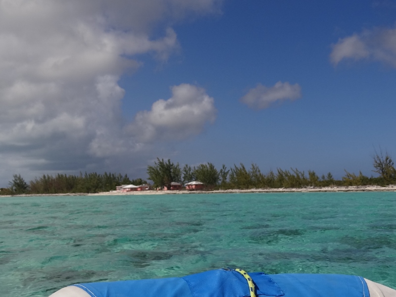
We head over to land Bunting at the abandoned resort
Our directions guided us to take the road with tiny wooden bridge across Musgrove Creek then turn left at the main road. At the creek we could see an arched entry that looked like- what else- another forsaken resort? A large sign at the main road told part of the story; those who wander by can create their own ending.
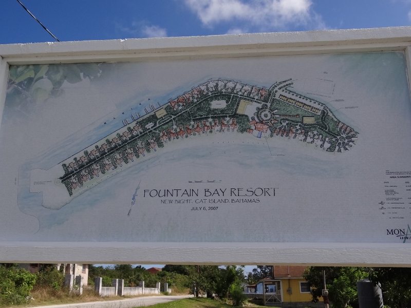
Looks impressive, but best we could see not much has happened since 2007
Perhaps more in New Bight than we’ve seen elsewhere- a close second being Long Island- are small concrete homes abandoned when a family member died which required that a new home be built.
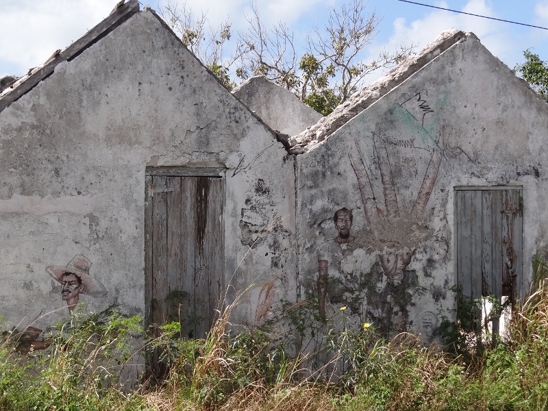
A rare specimen with wall art- kinda Mexican farmer looking to me
In sharp contrast to those was a walled home a bit further out of New Bight central that prompted the words, “Bahamian mansion”. Workers were on-site as were several hens and a rooster.
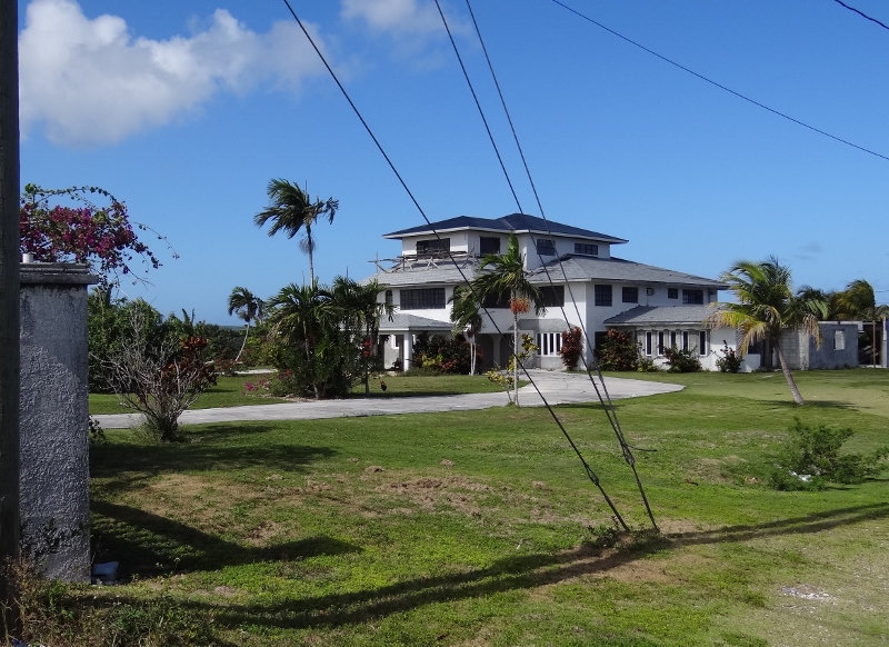
Not too many homes owned by locals look like this
The lawn looked like that low Bermuda grass stuff we’d been seeing around, which explains the lawnmower noticed earlier. Did you see it in the photo of Russ on the stone seats in the prior post?
The New Bight Market was as promised; clean and well-stocked. Good thing our supply of Bounty was ample; who would pay this price?
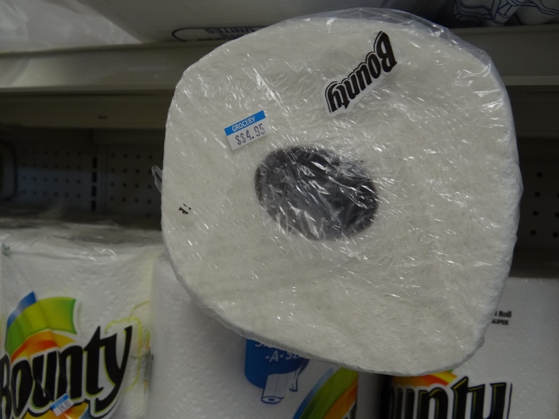
Curious to know who pays this price
Cheapy brands are available for around $2/roll in a pinch in most markets. When Exuma Market had an unheard of two-week-long sale on paper towels at $1/roll we scooped up six to use as shop towels around the boat since the 10 from CT ran out the week before. Paper towels, Scotts Boat and RV toilet paper, K-cups, various protein bars, cans of cashews, real maple syrup, contact lens solution and all our supplements are provisions we don’t leave FL without a 4-month supply. I’d like to put tonic water into that same category because only Schweppes is available here and our taste buds prefer Canada Dry, Polar or any store brand to Schweppes, but we couldn’t find room for more than 50 bottles – just kidding.

Spacious and well-stocked New Bight Market
Our weather today was sunny with a moderate breeze, wind out of the ESE and a high temp of 82F. Lovely. Saturday promised to be a great sailing-back-to-Exumas day. Always fuel conscious, we sure hoped so. We’d added about 20 gals of diesel in George Town before we left and didn’t plan to add more until Abacos.