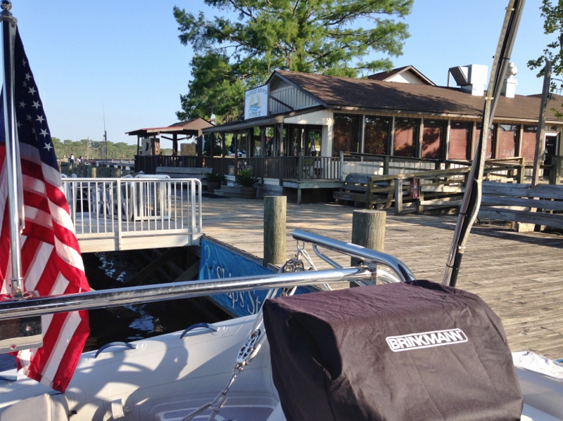
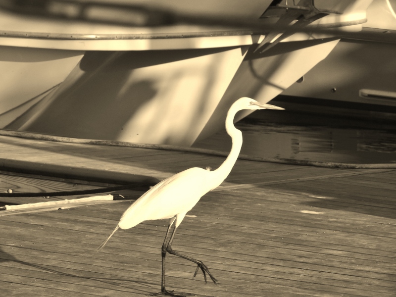
 When I downloaded my Sony camera every picture included at least one or more of the items in the title. I wanted to include donuts, but although a “d” is a flipped around “b”, one donut stop wasn’t enough to earn a title spot.
All along the way from Florida we’ve spotted curious dolphins, sometimes in places we didn’t expect. Been lovely as always to see these intelligent creatures. Many are youngsters with mom and dad showing them the ways of the life aquatic. I haven’t mentioned them, but I wanted you to know they are there!
Whenever I mention places in NC we like to stop at; and there’s quite a few, Russ often remarks, “I thought you didn’t like North Carolina?” Sigh. Yes, I still have not-so-fond memories of severe thunderstorms, very nearby tornadoes, hiding out from hurricane Sandy, going aground and fog, fog. But those are in the past- maybe the most recent event was 2013, and memories fade faster after age 50!
North Carolina has a great deal to offer boaters and cruisers and that’s just along the many miles of shoreline. Looks like this post might turn out longer than I first imagined!
First off a close encounter with a dredge. It would swing back and forth across the channel, doing a good job of allowing room for boats to pass by as they came along. We would be proceeding between the dredge and the red marker.
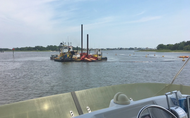
Dredging Phase 2 at Lockwoods Folly- room to pass? Just about.
Compare and contrast the dredging method above with the laborious dredge method below. Also note the smooth waters of the ICW versus the rougher Cape Fear River. We didn’t choose the best day to go up the Cape Fear River from Southport, NC to Carolina Beach, but the next two days looked worse and Britts is only open Friday through Sunday until Memorial Weekend. So there you have it.
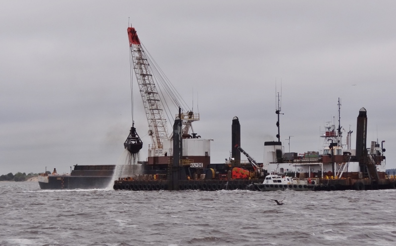
One scooper-full at a time dredging- Cape fear River
We reserved and paid for a mooring ball at Carolina Beach using Dockwa but not everyone does, so Randy comes out to collect your $20, chat and offer to take trash.
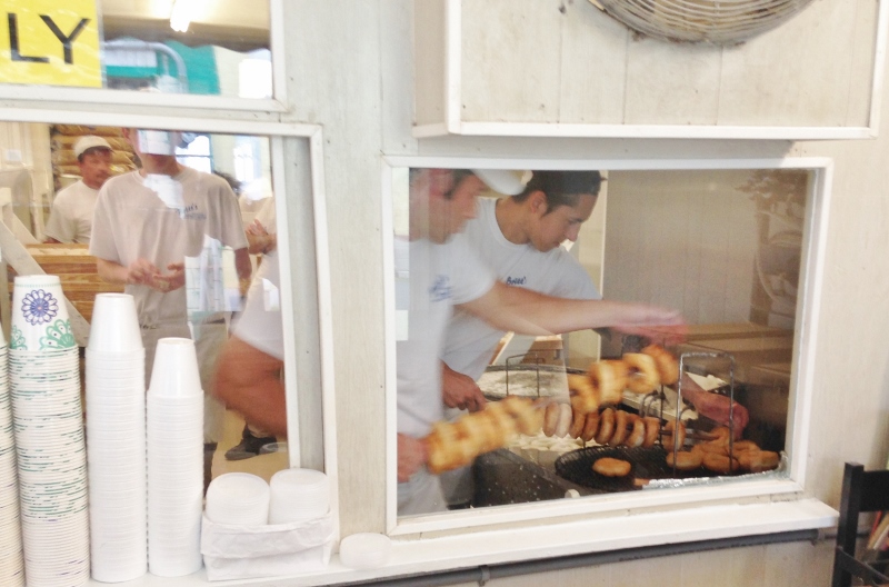
Britts!! Always fresh, hot and delicious!!
Others love them too!
8pm donut run by the Coasties. They were down at the “dead end” for just long enough to visit Britts.
Mothers’ Day was warm and mostly sunny, unlike the dreary rainy day before. We had to use the dinghy dock a stone’s throw from our mooring because the small boat/dinghy dock at the south “dead end” was completely dismantled. This makes for a longer walk down to Britts and the boardwalk shops but we needed the exercise.
A stop at Britts- surprise!- but hey, these have to last us an entire year because they aren’t open when we come by in October. We walked back on the beach with smiling faces, full bellies and “happy in the sand” toes.
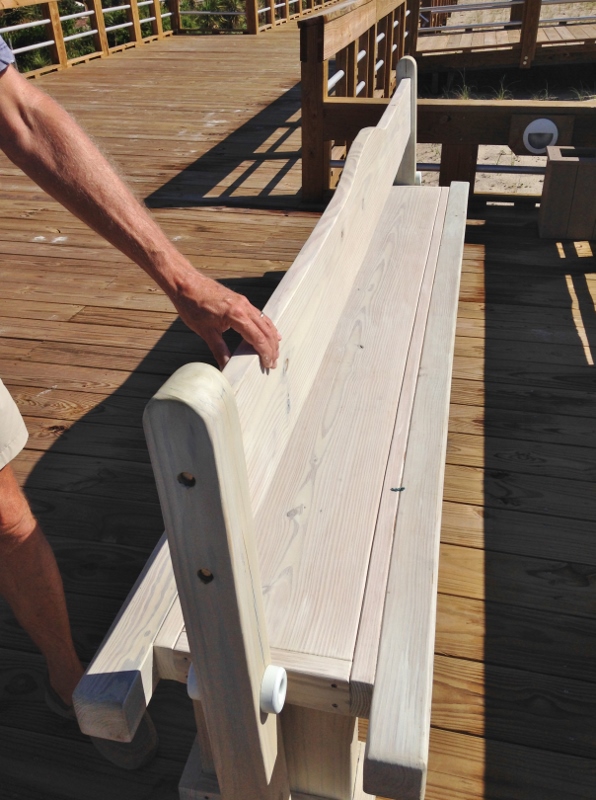
Clever benches- the back flips so you can sit facing either way! Beach view or boardwalk view.
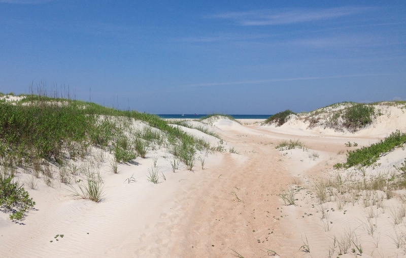
Monday brought an offshore day of 80 miles to Cape Lookout which is six miles past the Beaufort, NC inlet and a pristine paradise. Some compare the water and beaches to the Bahamas, but take it from one who knows; the beaches are wide and loaded with shells, the dunes picturesque, but the water no way.
Still, the Cape has a lot to offer and if you are there during the week, you can avoid the weekend craziness.
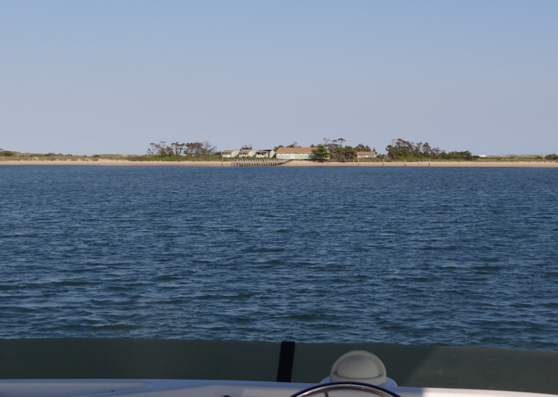
Anchored off the abandoned CG station at Cape Lookout
Cape Lookout- looking out to the ocean – small boats fishing and a red buoy
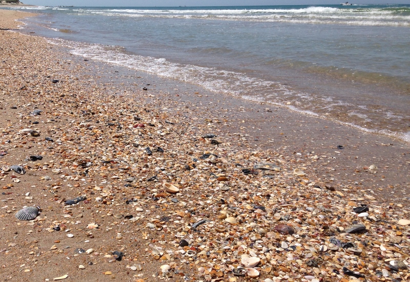
The ocean facing beach is long and loaded with shells and well-worn pieces
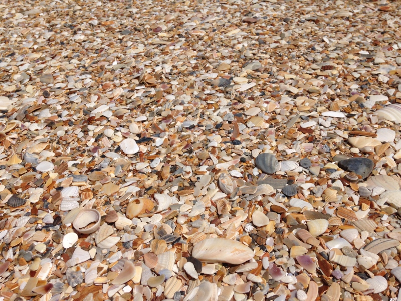
Just some of the millions on the beach at Cape Lookout

Cape Lookout Lighthouse
Over by the lighthouse which opens to visitors/climbers every May 16, is a ferry dock. The ferries bring people in from Beaufort using the inside route which gets regular dredging to keep it usable by the large pontoon ferries, small local boats and smaller shrimpers.

These two were just tooling around. Surprised to see they spent the night anchored at Cape Lookout

The creature from the Cape Lookout bight!!
Russ took an hour in the late afternoon to gently scrub the moss-y stuff off the bottoms and scrape away the few barnacles that had attached themselves. Maybe this place is more like the Bahamas than I thought!
I’m also certain I saw a huge loggerhead turtle as we headed back from the beach. They are fairly common in here but other than that one sighting we didn’t spot any others.

Small shrimper heads into the Cape from inside route. No collision- only looks that way

Sunset at Cape Lookout
I’m sure you have all heard the red sky saying, and if you are like me you may not know exactly what conditions are being predicted by the night or morning red. Read on and you too will be all the wiser:
Red sky at night, sailors delight. Red sky in morning, sailor’s warning’? In general in mid latitudes because the prevailing winds are westerlies, storms move in from the west. A red sky at night means that the setting sun is sending its light through a high concentration of dust particles. This usually indicates high pressure and stable air coming in from the west. Basically good weather will follow. A red sunrise can mean that a high pressure system (good weather) has already passed, thus indicating that a storm system (low pressure) may be moving to the east. A morning sky that is a deep, fiery red can indicate that there is high water content in the atmosphere. So, rain could be on its way.
Interesting uh?
Our next stop was close by, six miles back the way we came; head in the Beaufort inlet, catch the 10:30 Beaufort Bascule Bridge opening, hang a right and nose into a slip at Homer Smith’s Docks. You may recall this is the shrimp place. 🙂 Tony lends you his truck for errands and this baby was a new white Ford pickup; very comfy but as usual many of the bells & whistles left us baffled. We returned to find a new neighbor; Captain Bob: swordfish vessel.
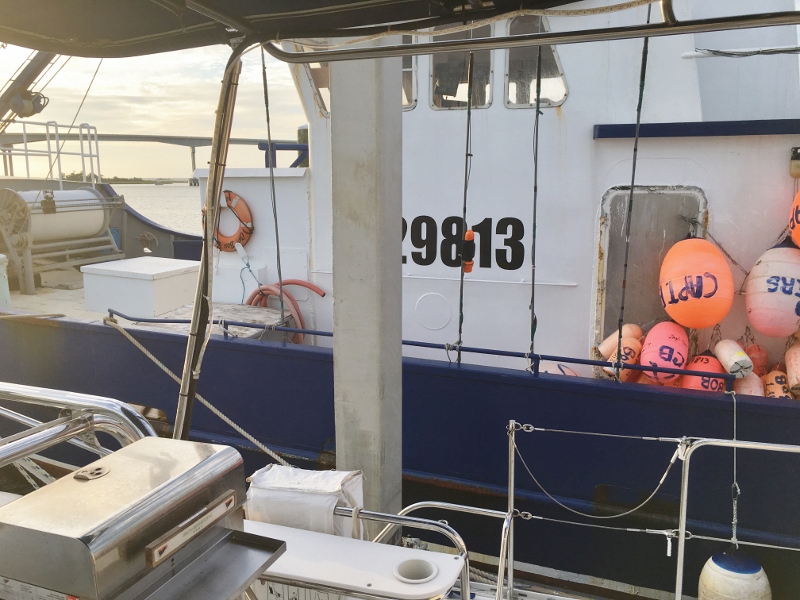
Captain Bob- a good neighbor

Swordfish at Homer Smiths- brought in by Captain Bob and crew.
Could we purchase any swordfish? Why sure! One of the guys pulled out a partial and cut us two thick fillets. Mahi had also come in, so we bought an entire four-pounder and watched an expert filet job. That and three pounds of cleaned shrimp all for much less than we’d pay anywhere else.
Traveling Soul recommended the bus tour of historic Beaufort and it was excellent Sunny and hot though, but most wanted to sit up top anyway.
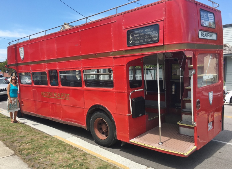
A touch of class. Double decker in Beaufort. Authentic bus from England, top removed for a better view
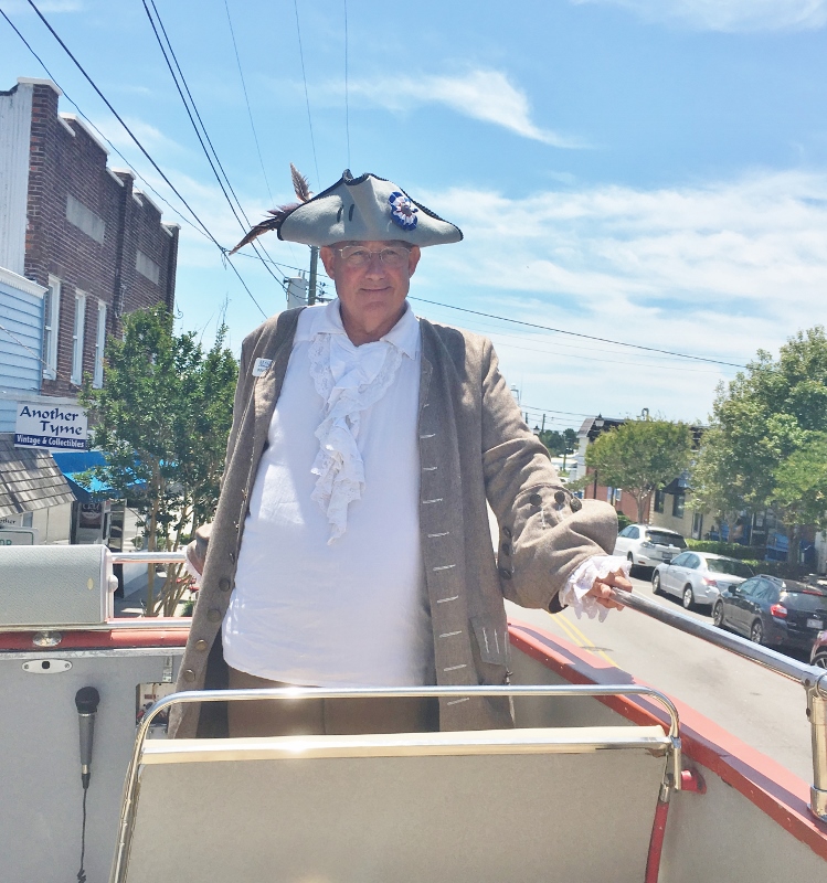
Douglas, our delightful tour guide. Originally a Maryland native, he moved south for a warmer climate
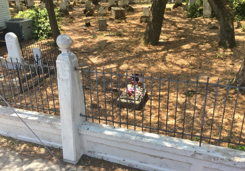
Grave of a young girl
Continuing north as we do this time of year, Belhaven would be our next stop. Anchor in the protected harbor, dinghy in to the public floating dinghy dock, walk one block and well what do you know? If it isn’t Spoon River.
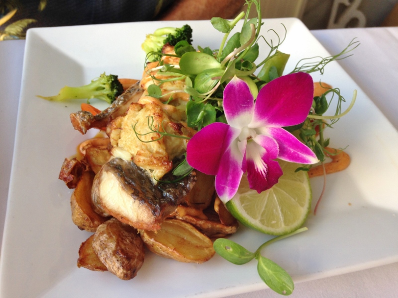
Russ chose pretty food- Red Drum. More lovely than my swordfish selection, but mine was delicious
The day we left Belhaven would be a great travel day, except for one event; a cold front was due to sweep by and that meant chilly winds out of the north.The tricky part was that we’d be crossing the Albemarle Sound; 15 miles of water shallow enough to get rough and choppy in just a moderate wind. Foolish nomads we are, we believed the forecast which had the front coming around 3pm. Our plan was to depart early and pick up speed in the Alligator River so as to be across the Sound in time. Twenty miles in the Alligator-Pungo Canal, twenty miles in the Alligator River, fifteen across the Sound. Plus 6-8 miles on either end; very doable assuming the front doesn’t come early. Ha.
I must say we could not have timed it better, had we wanted to do the last five miles of the Alligator River and the entire Albemarle Sound in strong northerly headwinds that gave us the roughest trip, pounding like no tomorrow. Spray flew up over the flybridge but Russ couldn’t retreat to the inside helm because then he couldn’t see the pot floats which lay scattered about. Miserable I tell you. And I was down below, much warmer and drier. I haven’t felt so happy to drop the hook as I did that day.
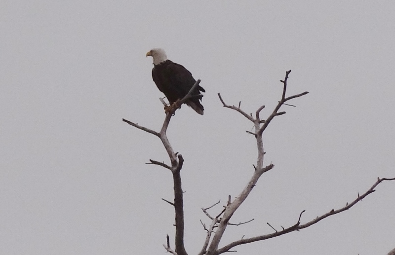
Near Coinjock, a bald eagle surveys his domain
Our final bird photo to round out North Carolina is one we’d been hoping to spot but couldn’t recall ever seeing in this area. We crossed Currituck Sound without a pounding repeat and crossed the line into Virginia by noon.