Yikes! Back in the U.S.

Fortunately there is good cellular data in most of the Bahamas.  Unfortunately we have been keeping up with the news of the COVID-19 virus.  We had been planning on spending about 2 more weeks before heading back, but weren’t sure how much we’d enjoy ourselves checking the news every hour, so we headed straight back.  While in a way it made sense to just stay there in a tropical paradise away from people … it’s not that straightforward for many reasons.

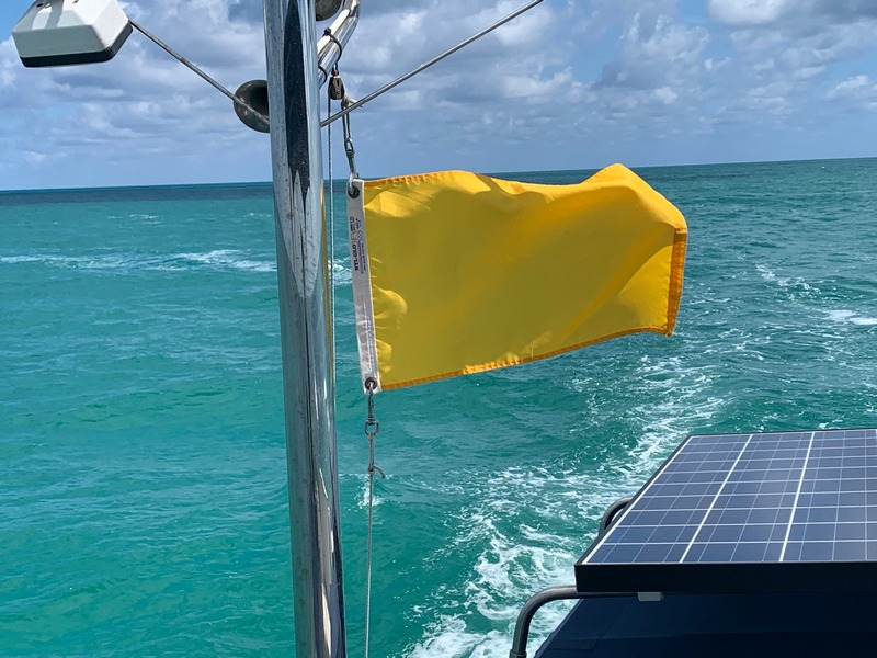
Flying a yellow quarantine flag has been required when entering a new country for over a hundred years – seemed like a cute old custom until today.

How long would we need to stay?  The Bahamas enforce strict immigration law & may not necessarily extend your visa.  Hurricane season begins in only a few months & our existing insurance would be void.  It may get bad there too – thousands of tourists from around the world are on their way out, but may have first infected many Bahamians.  Medical resources are extremely limited with only one real hospital (in Nassau) for the entire country.  Many of the smaller islands have only a one-room clinic with a part-time nurse.

These were our thoughts over a week ago.  Of course, the situation has become worse since then. The U.S. State Department is telling all U.S. residents to return now, or be prepared to stay away for a long duration.  What if we tried to cross back to the U.S. in a few weeks & instead of easily clearing back in via a phone app, we are ordered to appear at some pier for a health screening and/or mandatory quarantine on shore? This, or worse, is possible if the Bahamas becomes yet other country with a large number of cases.

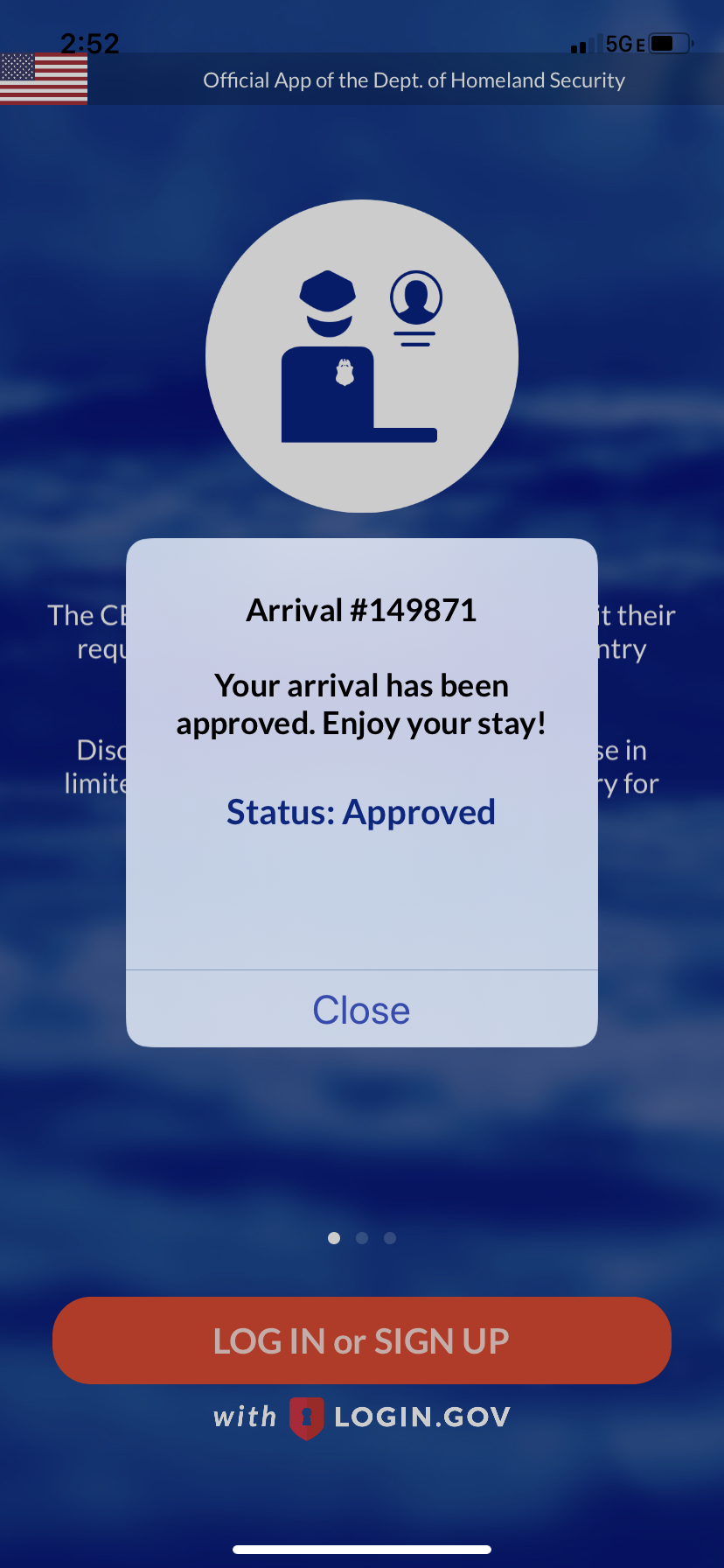
A relief! U.S. Customs allowed us to re-enter using only their phone app – very easy.

The Bahamas government is now taking this very seriously, so it may not be easy for cruisers who decide to stay.  Being able to stay and/or being able to re-enter the U.S., obtaining food & fuel may become serious concerns.  From our decision time to arriving in the Miami area was only 3 days.

As we crossed the gulf steam, we were surprised at the number of boats who appeared to have just left Florida heading the other way.  They are probably thinking … what’s the worst that could happen??

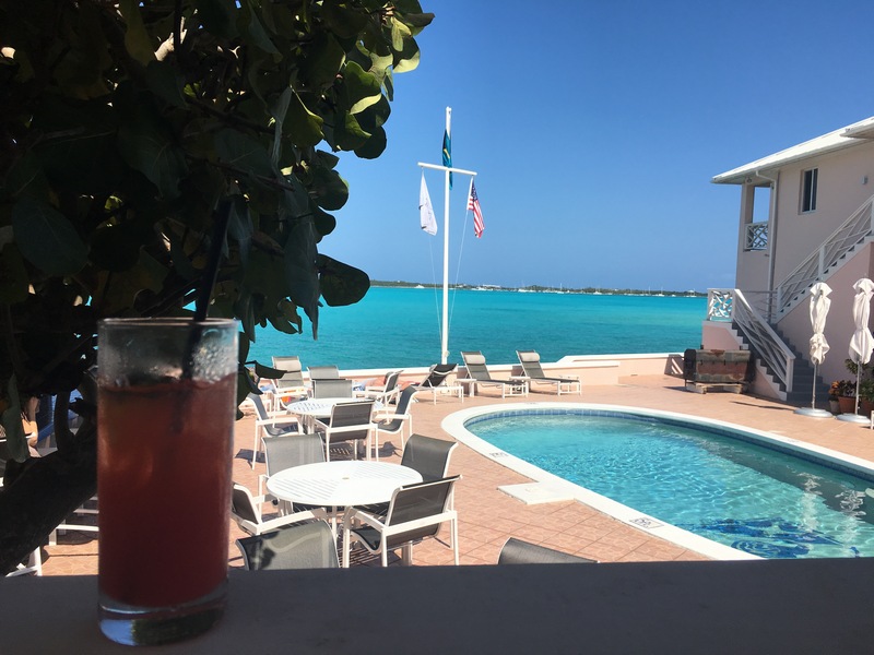
We found the last slip at a small marina in Marathon, Florida within walking distance to a Publix Supermarket.  We had seen photos of the crazy supermarket scenes from around the country, so were were expecting long lines to get in, people wearing masks, large signs with cautionary messages, etc.  Nope – these are the Keys baby – 1/2 way to crazy Key West.  While extremely busy & some shelves bare, the atmosphere was fairly casual & one guy I spotted was even barefoot.  Our cupboards were mostly bare after 3 months in the Bahamas, so we’ve made 2 cautious, but large runs to stock up, not knowing where our next easy stop will be. We can’t believe it, but some marinas are shutting down & will turn away any arriving boats.

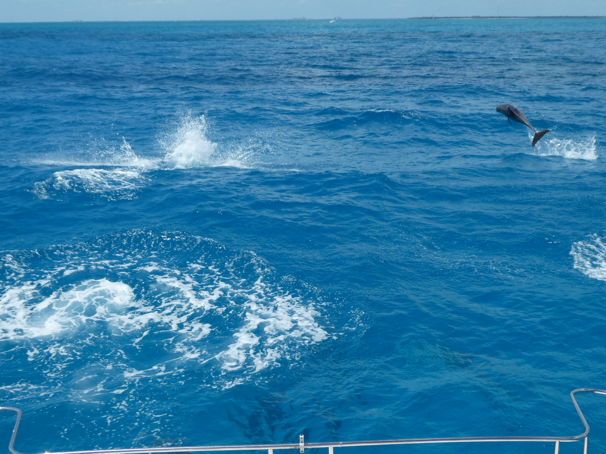
At least the dolphins off Miami welcomed us back! While we’ve had dolphins swim with us dozens of times, this was the first with dolphins leaping up several feet into the air! Easy to enjoy – hard to photograph!

We have also now scrapped our original Florida plans.  As we were married on Sarasota Bay on a Krogen trawler on May 5th 30 years ago, I had the crazy idea to return in our own boat to celebrate. Oh well, maybe for our 31st wedding anniversary next year.

Be safe everyone!!


Twin Sisters Has Left the Harbour

George Town Harbour that is … hard to believe we’ve been here 2 months! The weather, as usual, has dictated our schedule & activities.  Every week or so there is a cold front which offers one perfect, low wind day, followed by several high wind days, followed by moderate winds.

You can see the weather coming in.
The first (of many) dragging boats during our stay. At least this one was in ideal conditions – daylight, low winds and didn’t hit or get tangled with another boat. That’s me by the stern just after we pulled it off the rocky shore (it only gently hit, so only scratched paint on it’s rudder).

While most boats are anchored out in the large 1 mile by 8 mile harbor, we spend much of the time in a protected area called Red Shanks behind Crab Cay.  There are 6 different “holes” – areas with 2 or 3 sided wind protection.  Some are fairly deep with rooms for up to 20 boats – this one spot is fairly shallow & barely room for one boat – us!  High hills to our north & east cut the wind down by half.  Our anchoring app to the right gives you a visual idea of the wind’s “clocking” with each cold front – the little anchor symbol in the middle is our anchor – the colored lines show our boat’s track as the wind takes us around during about a week’s stay.


This little beach in Red Shanks used to be where cruisers hung out most nights, jokingly called the “Red Shanks Yacht and Tennis Club”. Someone had a great idea to gather one night – just like in the old days. All of those things high up on the rocky bank are dozens of old conch shells cruisers used to paint their boat names on & leave on display.
Military? helicopter exercises on adjacent Crab Cay – no markings, tail numbers or IDs?? Better not to ask …

While waiting for winds to die down, there are always various projects to keep us busy.  I’m making a watermaker repair replacing the feed pump.  Here’s Lori’s latest creation!


We always make the best of the good weather days!  We get our shopping & errands out-of-the-way to have some fun!

As part of the George Town Cruisers Regatta, there is a softball game between the cruisers and Bahamians. We had never attended before so it was fun, although the Bahamians were so late we only saw part of the actual game.
A feast courtesy of Cort and Max – Max caught the lobsters and fish that morning.
This is the view the tourists see from the Peace and Plenty Hotel looking out at the 300+ boats anchored out in the harbor.

Overall it was a great season! Lots of time with old cruising & land friends, along with a some new friends. While we had planned on staying a bit longer, there is a long stretch of windy weather ahead so we need to head about 50 miles north up the Exuma chain, which allows us to cross over from the east side (basically open ocean) to the west side (the “bank side”) of the chain which has protection from the most common east winds. Over the next 2 weeks we’ll slowly continue up another 50 miles stopping at favorite spots such as Black Point, Staniel Cay, the Exuma Land & Sea Park, then Highbourne Cay.

This is our first stop heading back north up the Exuma chain.  This sunset picture shows a peaceful scene, however 1′ – 2′ waves rocked us silly for a few hours until the front switched the wind around.  By midnight the wind clocked around to shore side giving us some relief.  The faux castle is actually just someone’s house, although we haven’t seen anyone around in a few years.

What wind?

This is our protected, beachside anchorage we moved to the next morning, since the wind was forecast to be blowing 25 – 35 knots for the next 4 – 5 days.  Our move, however, was not without a bit of drama.  As we passed by 2 sailboats, they started yelling & pointing, then air horn blowing, again & again.  Finally we motored over closer & were told we couldn’t re-anchor because that’s “their spot” they were planning to move to later in the morning! “Their spot” was a large corner for the anchorage with plenty of room for several boats. We weren’t even necessarily anchoring there anyway – we were simply making our way past them.  Later on the beach he told me that the day before “everyone” had pre-planned their anchoring spots, including where they might be moving to when the wind changed, so they were pissed that we (& another powercat before us) had just moved on our own?!?  Anchoring situations can be stressful, but this was a first!!